
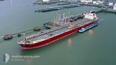
FLAGSHIP TULIP
Oil Products Tanker
Current Trip
| Time Travelled | 2 days |
|---|---|
| Remaining Time | --- |
| Distance Travelled | 122.08 nm |
| Remaining Distance | --- |
| AVG Speed | 10.3 Noeuds |
| MAX Speed | 14.5 Noeuds |
| AVG Wind | 13.8 knots |
| MAX Wind | 31.7 knots |
| MIN Temp | 6.3°C / 43.34°F |
| MAX Temp | 17.3°C / 63.14°F |
| Tirant d eau | 8.5 m |
| Position reçue | 2 d depuis |
Current Position
| Longitude | --- |
|---|---|
| Latitude | --- |
| Etat | Under way using engine |
| Vitesse | 12.6 Noeuds |
| Parcours | 263.2° |
| Zone | Sea of Marmara |
| Station | T-AIS |
| Position reçue | 2 d depuis |
Info
Information
The current position of FLAGSHIP TULIP is in Sea of Marmara with coordinates 40.77041° / 27.70440° as reported on 2026-01-06 11:35 by AIS to our vessel tracker app. The vessel's current speed is 12.6 Noeuds and is heading at the port of CANAKKALE. The estimated time of arrival as calculated by MyShipTracking vessel tracking app is 2026-01-06 18:00 LT
The vessel FLAGSHIP TULIP (IMO: 9594896, MMSI: 538006441) is a Oil Products Tanker that was built in 2013 ( 13 Age ). It's sailing under the flag of [MH] Marshall Is.
In this page you can find informations about the vessels current position, last detected port calls, and current voyage information. If the vessels is not in coverage by AIS you will find the latest position.
The current position of FLAGSHIP TULIP is detected by our AIS receivers and we are not responsible for the reliability of the data. The last position was recorded while the vessel was in Coverage by the Ais receivers of our vessel tracking app.
The current draught of FLAGSHIP TULIP as reported by AIS is 8.5 meters
Weather
| Temperature | 4.4°C / 39.92°F |
|---|---|
| Wind Speed | 15 knots |
| Direction | 344° NNW |
| Pressure | 1011 hPa |
| Humidity | 37.2 % |
| Cloud Coverage | 100 % |
Featured Company
Last Port Calls
| Port | Arrival | Departure | Time In Port |
|---|---|---|---|
| 2026-01-06 08:38 | 2026-01-06 09:49 | 1 h | |
| 2026-01-01 08:20 | 2026-01-04 01:00 | 2 d | |
| 2025-12-14 10:10 | 2025-12-22 14:27 | 8 d | |
| 2025-12-11 09:37 | 2025-12-11 18:57 | 9 h | |
| 2025-11-12 01:28 | 2025-11-13 14:45 | 1 d | |
| 2025-11-08 22:54 | 2025-11-09 23:57 | 1 d |
Last Trips
| Origin | Departure | Destination | Arrival | Distance | |
|---|---|---|---|---|---|
| 2026-01-04 01:00 | 2026-01-06 08:38 | 286.44 nm | |||
| 2025-12-22 14:27 | 2026-01-01 08:20 | 823.64 nm | |||
| 2025-11-13 14:45 | 2025-12-14 10:10 | 6438.52 nm | |||
| 2025-11-13 14:45 | 2025-12-11 09:37 | 5598.40 nm | |||
| 2025-11-09 23:57 | 2025-11-12 01:28 | 7.27 nm | |||
| 2025-10-22 11:38 | 2025-11-08 22:54 | 3382.93 nm |
Events
| Heure | Evenement | Détails | Position/ Destination | Info |
|---|---|---|---|---|
| 2026-01-08 14:43 | Arret | 3.64 nm, North East of ICDAS |
40.50500 / 27.18500
TRCKZ
|
Vitesse: Parcours: -1° |
| 2026-01-08 09:26 | Démarrage | 4.3 nm, North of ICDAS |
40.52333 / 27.16341
TRCKZ
|
Vitesse: 4.1 kn Parcours: 30° |
| 2026-01-06 15:07 | Arret | 3.24 nm, North of ICDAS |
40.50667 / 27.15500
TRCKZ
|
Vitesse: Parcours: -1° |
| 2026-01-06 11:41 | Etat Changé | Default Under way using engine |
40.76814 / 27.67895
TRCKZ
|
Vitesse: 12.6 kn Parcours: 263.2° |
| 2026-01-06 11:35 | Hors de la zone couverte |
40.77041 / 27.70440
Sea of Marmara
TRCKZ
|
Vitesse: 12.6 kn Parcours: 263.2° |
|
| 2026-01-06 08:00 | Changement d'ETA | 2026/01/06 15:00 2026/01/06 05:30 |
40.90983 / 28.78135
TRCKZ
|
Vitesse: 13.9 kn Parcours: 261° |
| 2026-01-06 07:54 | Changement de destination | TRCKZ TRIST |
40.91338 / 28.81253
TRCKZ
|
Vitesse: 13.9 kn Parcours: 261° |
| 2026-01-06 06:49 | PORT DE DEPART |
|
41.00337 / 28.99586
TRIST
|
Vitesse: 11.6 kn Parcours: 185° |
| 2026-01-06 05:38 | Port d'arrivée |
|
41.20330 / 29.11204
[TR] ISTANBUL
|
Vitesse: 8.7 kn Parcours: 210.8° |
| 2026-01-06 05:25 | Changement de zone | Turkish part of the Sea of Marmara Turkish part of the Black Sea |
41.23184 / 29.13071
Sea of Marmara
TRIST
|
Vitesse: 9.7 kn Parcours: 190.6° |