

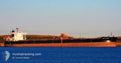
EMERALD HORIZON
Cargo

Current Trip
PHE AU
| Time Travelled | 20 days |
|---|---|
| Remaining Time | --- |
| Distance Travelled | 3828.90 nm |
| Remaining Distance | --- |
| AVG Speed | 10 Noeuds |
| MAX Speed | 14.7 Noeuds |
| AVG Wind | 14.9 knots |
| MAX Wind | 38.6 knots |
| MIN Temp | -6.1°C / 21.02°F |
| MAX Temp | 30.8°C / 87.44°F |
| Tirant d eau | 8.7 m |
| Position reçue | 4 m depuis |
Current Position
| Longitude | --- |
|---|---|
| Latitude | --- |
| Etat | At anchor |
| Vitesse | 0.1 Noeuds |
| Parcours | 250° |
| Zone | Indian Ocean |
| Station | T-AIS |
| Position reçue | 4 m depuis |
Information
The current position of EMERALD HORIZON is in Indian Ocean with coordinates -19.84206° / 118.55329° as reported on 2025-02-24 02:30 by AIS to our vessel tracker app. The vessel's current speed is 0.1 Noeuds
The vessel EMERALD HORIZON (IMO: 9638862, MMSI: 431941000) is a Cargo It's sailing under the flag of [JP] Japan.
In this page you can find informations about the vessels current position, last detected port calls, and current voyage information. If the vessels is not in coverage by AIS you will find the latest position.
The current position of EMERALD HORIZON is detected by our AIS receivers and we are not responsible for the reliability of the data. The last position was recorded while the vessel was in Coverage by the Ais receivers of our vessel tracking app.
The current draught of EMERALD HORIZON as reported by AIS is 8.7 meters
Weather
| Temperature | 30.2°C / 86.36°F |
|---|---|
| Wind Speed | 12 knots |
| Direction | 250° WSW |
| Pressure | 1011.9 hPa |
| Humidity | 79.6 % |
| Cloud Coverage | 28 % |


Featured Company
Last Port Calls
| Port | Arrival | Departure | Time In Port |
|---|---|---|---|
| 2025-02-01 14:49 | 2025-02-03 11:09 | 1 d | |
| 2025-01-15 20:30 | 2025-01-17 12:25 | 1 d | |
| 2024-12-22 20:53 | 2024-12-25 08:32 | 2 d | |
| 2024-12-05 14:39 | 2024-12-07 00:24 | 1 d |
Most Visited Ports (Last year)
| Port | Arrivals | |
|---|---|---|
| 8 | ||
| 5 | ||
| 2 | ||
| 2 | ||
| 1 |
Last Trips
| Origin | Departure | Destination | Arrival | Distance | |
|---|---|---|---|---|---|
| 2025-01-17 12:25 | 2025-02-01 14:49 | 3845.87 nm | |||
| 2024-12-25 08:32 | 2025-01-15 20:30 | 3911.62 nm | |||
| 2024-12-07 00:24 | 2024-12-22 20:53 | 3914.64 nm | |||
| 2024-11-12 07:36 | 2024-12-05 14:39 | 3925.18 nm |
Events
| Heure | Evenement | Détails | Position/ Destination | Info |
|---|---|---|---|---|
| 2025-02-24 02:18 | Etat Changé | At anchor Default |
-19.84191 / 118.55339
PHE AU
|
Vitesse: Parcours: 246° |
| 2025-02-24 02:09 | Etat Changé | Default At anchor |
-19.84193 / 118.55338
PHE AU
|
Vitesse: Parcours: 248° |
| 2025-02-24 01:54 | Etat Changé | At anchor Default |
-19.84173 / 118.55330
PHE AU
|
Vitesse: 0.1 kn Parcours: 236° |
| 2025-02-24 01:48 | Etat Changé | Default At anchor |
-19.84160 / 118.55317
PHE AU
|
Vitesse: 0.1 kn Parcours: 234° |
| 2025-02-24 01:15 | Etat Changé | At anchor Default |
-19.84090 / 118.55264
PHE AU
|
Vitesse: 0.3 kn Parcours: 227° |
| 2025-02-24 01:02 | Etat Changé | Default At anchor |
-19.84142 / 118.55307
PHE AU
|
Vitesse: 0.1 kn Parcours: 239° |
| 2025-02-24 00:48 | Etat Changé | At anchor Default |
-19.84130 / 118.55307
PHE AU
|
Vitesse: 0.1 kn Parcours: 248° |
| 2025-02-24 00:39 | Etat Changé | Default At anchor |
-19.84178 / 118.55330
PHE AU
|
Vitesse: 0.1 kn Parcours: 249° |
| 2025-02-24 00:18 | Etat Changé | At anchor Default |
-19.84161 / 118.55326
PHE AU
|
Vitesse: 0.2 kn Parcours: 245° |
| 2025-02-24 00:09 | Etat Changé | Default At anchor |
-19.84172 / 118.55323
PHE AU
|
Vitesse: 0.2 kn Parcours: 250° |