

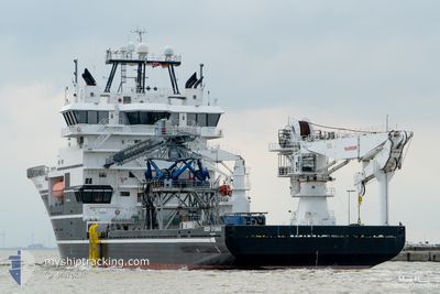
DEEP CYGNUS
Offshore Supply Ship

Current Trip
| Time Travelled | 15 days |
|---|---|
| Remaining Time | --- |
| Distance Travelled | 1004.39 nm |
| Remaining Distance | --- |
| AVG Speed | 11.7 Noeuds |
| MAX Speed | 19.1 Noeuds |
| AVG Wind | 8.1 knots |
| MAX Wind | 22 knots |
| MIN Temp | -5.1°C / 22.82°F |
| MAX Temp | 8.7°C / 47.66°F |
| Tirant d eau | 5.6 m |
| Position reçue | 13 h, 17 m depuis |
Current Position
| Longitude | --- |
|---|---|
| Latitude | --- |
| Etat | Under way using engine |
| Vitesse | 11.8 Noeuds |
| Parcours | 324.7° |
| Zone | Inner Seas off the West Coast of Scotland |
| Station | T-AIS |
| Position reçue | 13 h, 17 m depuis |
Information
The current position of DEEP CYGNUS is in Inner Seas off the West Coast of Scotland with coordinates 54.84914° / -5.33782° as reported on 2025-03-29 05:33 by AIS to our vessel tracker app. The vessel's current speed is 11.8 Noeuds and is heading at the port of ABERDEEN. The estimated time of arrival as calculated by MyShipTracking vessel tracking app is 2025-03-31 08:00 LT
The vessel DEEP CYGNUS (IMO: 9479541, MMSI: 257205000) is a Offshore Supply Ship that was built in 2009 ( 16 Age ). It's sailing under the flag of [NO] Norway.
In this page you can find informations about the vessels current position, last detected port calls, and current voyage information. If the vessels is not in coverage by AIS you will find the latest position.
The current position of DEEP CYGNUS is detected by our AIS receivers and we are not responsible for the reliability of the data. The last position was recorded while the vessel was in Coverage by the Ais receivers of our vessel tracking app.
The current draught of DEEP CYGNUS as reported by AIS is 5.6 meters
Weather
| Temperature | 6.4°C / 43.52°F |
|---|---|
| Wind Speed | 13 knots |
| Direction | 238° WSW |
| Pressure | 1017 hPa |
| Humidity | 81.1 % |
| Cloud Coverage | 94 % |


Featured Company
Last Port Calls
| Port | Arrival | Departure | Time In Port |
|---|---|---|---|
| 2025-03-11 04:53 | 2025-03-13 22:38 | 2 d | |
| 2025-03-06 06:51 | 2025-03-06 11:53 | 5 h | |
| 2025-03-06 06:39 | 2025-03-06 06:48 | 8 m | |
| 2025-02-23 12:08 | 2025-02-24 21:25 | 1 d | |
| 2025-02-05 12:26 | 2025-02-05 19:36 | 7 h | |
| 2025-01-31 00:11 | 2025-01-31 00:38 | 27 m | |
| 2025-01-22 10:44 | 2025-01-22 18:34 | 7 h | |
| 2025-01-10 02:06 |
Most Visited Ports (Last year)
| Port | Arrivals | |
|---|---|---|
| 11 | ||
| 4 | ||
| 4 | ||
| 4 | ||
| 2 | ||
| 2 |
Last Trips
| Origin | Departure | Destination | Arrival | Distance | |
|---|---|---|---|---|---|
| 2025-03-06 11:53 | 2025-03-11 05:53 | 1049.48 nm | |||
| 2025-03-06 06:48 | 2025-03-06 06:51 | 0.77 nm | |||
| 2025-02-24 16:25 | 2025-03-06 06:39 | 2670.03 nm | |||
| 2025-02-05 14:36 | 2025-02-23 07:08 | 87.45 nm | |||
| 2025-01-30 19:38 | 2025-02-05 07:26 | 25.44 nm | |||
| 2025-01-22 13:34 | 2025-01-30 19:11 | 13.56 nm | |||
| 2025-01-09 21:06 | 2025-01-22 05:44 | 36.51 nm |
Events
| Heure | Evenement | Détails | Position/ Destination | Info |
|---|---|---|---|---|
| 2025-03-29 05:33 | Hors de la zone couverte |
54.84914 / -5.33782
Inner Seas off the West Coast of Scotland
GBABD
|
Vitesse: 11.8 kn Parcours: 324.7° |
|
| 2025-03-29 04:21 | Tirant d'eau modifié | 5.6 5.9 |
54.66225 / -5.05562
GBABD
|
Vitesse: 13.2 kn Parcours: 314.8° |
| 2025-03-29 04:21 | Changement de destination | GBABD ORMONDE OWF |
54.66225 / -5.05562
GBABD
|
Vitesse: 13.2 kn Parcours: 314.8° |
| 2025-03-29 04:21 | Changement d'ETA | 2025/03/31 08:00 2025/03/20 17:00 |
54.66225 / -5.05562
GBABD
|
Vitesse: 13.2 kn Parcours: 314.8° |
| 2025-03-29 03:56 | Detecté en mer | United Kingdom part of the Inner Seas off the West Coast of Scotland |
54.59550 / -4.94893
Inner Seas off the West Coast of Scotland
|
Vitesse: 14.6 kn Parcours: 309.8° |
| 2025-03-29 03:56 | Dans la zone couverte |
54.59550 / -4.94893
Inner Seas off the West Coast of Scotland
|
Vitesse: 14.6 kn Parcours: 309.8° |
|
| 2025-03-27 07:48 | Hors de la zone couverte |
53.96630 / -3.30162
Irish Sea and St. George's Channel
|
Vitesse: 13.5 kn Parcours: 120.5° |
|
| 2025-03-27 07:37 | Dans la zone couverte |
53.99450 / -3.35095
Irish Sea and St. George's Channel
|
Vitesse: 13.2 kn Parcours: 142.4° |
|
| 2025-03-26 09:42 | Hors de la zone couverte |
54.08461 / -3.43612
Irish Sea and St. George's Channel
|
Vitesse: 0.1 kn Parcours: 67.6° |
|
| 2025-03-26 07:06 | Dans la zone couverte |
54.08409 / -3.43661
Irish Sea and St. George's Channel
|
Vitesse: Parcours: 224.6° |