
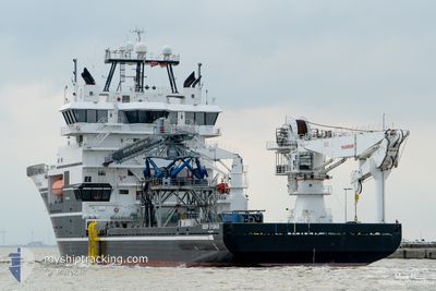
DEEP CYGNUS
Offshore Supply Ship
Current Trip
KP29 SURVEY
| Time Travelled | 1 day |
|---|---|
| Remaining Time | --- |
| Distance Travelled | 23.94 nm |
| Remaining Distance | --- |
| AVG Speed | 7.7 Knots |
| MAX Speed | 10.6 Knots |
| AVG Wind | 4.8 knots |
| MAX Wind | 9 knots |
| MIN Temp | 5.5°C / 41.9°F |
| MAX Temp | 7.7°C / 45.86°F |
| Dybgang | 5.8 m |
| Position Modtaget | 13 h, 24 m siden |
Current Position
| Longitude | --- |
|---|---|
| Latitude | --- |
| Status | Restricted manoeuverability |
| Fart | |
| Kurs | 98° |
| Område | North Atlantic Ocean |
| Station | T-AIS |
| Position Modtaget | 13 h, 24 m siden |
Info
Information
The current position of DEEP CYGNUS is in North Atlantic Ocean with coordinates 40.44450° / -73.59107° as reported on 2026-01-09 09:33 by AIS to our vessel tracker app. The vessel's current speed is 0 Knots
The vessel DEEP CYGNUS (IMO: 9479541, MMSI: 257205000) is a Offshore Supply Ship that was built in 2009 ( 17 år gamle ). It's sailing under the flag of [NO] Norway.
In this page you can find informations about the vessels current position, last detected port calls, and current voyage information. If the vessels is not in coverage by AIS you will find the latest position.
The current position of DEEP CYGNUS is detected by our AIS receivers and we are not responsible for the reliability of the data. The last position was recorded while the vessel was in Coverage by the Ais receivers of our vessel tracking app.
The current draught of DEEP CYGNUS as reported by AIS is 5.8 meters
Weather
| Temperature | 7.5°C / 45.5°F |
|---|---|
| Wind Speed | 9 knots |
| Direction | 175° S |
| Pressure | 1026 hPa |
| Humidity | 79 % |
| Cloud Coverage | 20 % |
Featured Company
Last Port Calls
| Port | Arrival | Departure | Time In Port |
|---|---|---|---|
| 2025-12-17 10:45 | 2026-01-08 12:43 | 22 d | |
| 2025-12-10 06:34 | 2025-12-10 19:54 | 13 h | |
| 2025-11-22 18:33 | 2025-11-28 21:43 | 6 d | |
| 2025-11-08 18:33 | 2025-11-13 14:39 | 4 d | |
| 2025-11-02 12:51 | 2025-11-06 18:47 | 4 d | |
| 2025-11-01 07:55 |
Most Visited Ports (Last year)
| Port | Arrivals | |
|---|---|---|
| 16 | ||
| 4 | ||
| 2 | ||
| 2 | ||
| 2 | ||
| 2 |
Last Trips
| Origin | Departure | Destination | Arrival | Distance | |
|---|---|---|---|---|---|
| 2025-12-10 19:54 | 2025-12-17 10:45 | 86.74 nm | |||
| 2025-11-28 21:43 | 2025-12-10 06:34 | 81.35 nm | |||
| 2025-11-13 14:39 | 2025-11-22 18:33 | 85.51 nm | |||
| 2025-11-06 18:47 | 2025-11-08 18:33 | 31.99 nm | |||
| 2025-11-01 07:55 | 2025-11-02 12:51 | 31.20 nm |
Events
| Tid | Hændelsen | Detaljer | Position / Dest | Info |
|---|---|---|---|---|
| 2026-01-09 09:33 | Udenfor Dækning |
40.44450 / -73.59107
North Atlantic Ocean
|
Fart: Kurs: 7.8° |
|
| 2026-01-09 09:10 | Indenfor Dækning |
40.44453 / -73.59183
North Atlantic Ocean
|
Fart: 0.2 kn Kurs: 102.4° |
|
| 2026-01-09 08:00 | Udenfor Dækning |
40.44490 / -73.59331
North Atlantic Ocean
|
Fart: 0.2 kn Kurs: 31° |
|
| 2026-01-09 08:00 | Indenfor Dækning |
40.44490 / -73.59331
North Atlantic Ocean
|
Fart: 0.2 kn Kurs: 31° |
|
| 2026-01-09 06:06 | Udenfor Dækning |
40.44497 / -73.59399
North Atlantic Ocean
|
Fart: 1.6 kn Kurs: 83.9° |
|
| 2026-01-09 04:30 | START Sejllads | 9.12 nm, East of FORT HANCOCK |
40.48517 / -73.81054
KP29 SURVEY
|
Fart: 3.9 kn Kurs: 116° |
| 2026-01-08 18:53 | Status er ændret | Restricted manoeuverability Under way using engine |
40.48941 / -73.88737
KP29 SURVEY
|
Fart: 0.2 kn Kurs: 92° |
| 2026-01-08 18:48 | STOP Sejllads | 5.71 nm, East of FORT HANCOCK |
40.48965 / -73.88750
KP29 SURVEY
|
Fart: 0.1 kn Kurs: 31° |
| 2026-01-08 17:43 | Afsejlet fra sidste havn |
|
40.57573 / -74.03529
KP29 SURVEY
|
Fart: 9.8 kn Kurs: 172° |
| 2026-01-08 17:20 | START Sejllads |
40.62886 / -74.06549
[US] NEW YORK
|
Fart: 3.3 kn Kurs: 128° |