

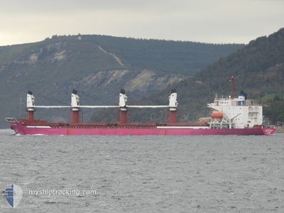
BR GLORY
Bulk Carrier

Current Trip
RO SUL
| Time Travelled | 22 days |
|---|---|
| Remaining Time | --- |
| Distance Travelled | 1608.51 nm |
| Remaining Distance | --- |
| AVG Speed | 8.9 Noeuds |
| MAX Speed | 11.1 Noeuds |
| AVG Wind | 10.5 knots |
| MAX Wind | 25 knots |
| MIN Temp | 2.9°C / 37.22°F |
| MAX Temp | 20.7°C / 69.26°F |
| Tirant d eau | 5.5 m |
| Position reçue | 3 m depuis |
Current Position
| Longitude | --- |
|---|---|
| Latitude | --- |
| Etat | At anchor |
| Vitesse | |
| Parcours | 4° |
| Zone | Sea of Marmara |
| Station | T-AIS |
| Position reçue | 3 m depuis |
Information
The current position of BR GLORY is in Sea of Marmara with coordinates 40.94478° / 28.85545° as reported on 2025-03-27 18:50 by AIS to our vessel tracker app. The vessel's current speed is 0 Noeuds
The vessel BR GLORY (IMO: 8907577, MMSI: 341902000) is a Bulk Carrier that was built in 1990 ( 35 Age ). It's sailing under the flag of [KN] St Kitts Nevis.
In this page you can find informations about the vessels current position, last detected port calls, and current voyage information. If the vessels is not in coverage by AIS you will find the latest position.
The current position of BR GLORY is detected by our AIS receivers and we are not responsible for the reliability of the data. The last position was recorded while the vessel was in Coverage by the Ais receivers of our vessel tracking app.
The current draught of BR GLORY as reported by AIS is 5.5 meters
Weather
| Temperature | 14.5°C / 58.1°F |
|---|---|
| Wind Speed | 13 knots |
| Direction | 23° NNE |
| Pressure | 1007.4 hPa |
| Humidity | 59.1 % |
| Cloud Coverage | 100 % |


Featured Company
Last Port Calls
| Port | Arrival | Departure | Time In Port |
|---|---|---|---|
| 2025-02-28 08:11 | 2025-03-05 00:17 | 4 d | |
| 2025-02-13 22:15 | 2025-02-18 04:29 | 4 d | |
| 2025-02-06 09:23 | 2025-02-06 19:12 | 9 h | |
| 2025-02-03 05:05 | 2025-02-04 02:00 | 20 h | |
| 2025-01-07 12:28 | 2025-01-15 18:58 | 8 d | |
| 2025-01-03 09:00 |
Most Visited Ports (Last year)
| Port | Arrivals | |
|---|---|---|
| 3 | ||
| 2 | ||
| 2 | ||
| 1 | ||
| 1 | ||
| 1 |
Last Trips
| Origin | Departure | Destination | Arrival | Distance | |
|---|---|---|---|---|---|
| 2025-02-18 04:29 | 2025-02-28 08:11 | 731.77 nm | |||
| 2025-02-04 02:00 | 2025-02-13 22:15 | 1580.59 nm | |||
| 2025-02-04 02:00 | 2025-02-06 09:23 | 297.25 nm | |||
| 2025-01-15 18:58 | 2025-02-03 05:05 | 3470.53 nm | |||
| 2025-01-03 09:00 | 2025-01-07 12:28 | 926.18 nm |
Events
| Heure | Evenement | Détails | Position/ Destination | Info |
|---|---|---|---|---|
| 2025-03-27 09:26 | Etat Changé | At anchor Default |
40.94663 / 28.85807
RO SUL
|
Vitesse: Parcours: 289° |
| 2025-03-27 09:20 | Etat Changé | Default At anchor |
40.94658 / 28.85813
RO SUL
|
Vitesse: Parcours: 289° |
| 2025-03-27 03:17 | Etat Changé | At anchor Default |
40.94697 / 28.85832
RO SUL
|
Vitesse: Parcours: 270° |
| 2025-03-27 03:08 | Etat Changé | Default At anchor |
40.94697 / 28.85837
RO SUL
|
Vitesse: Parcours: 270° |
| 2025-03-27 00:47 | Etat Changé | At anchor Default |
40.94738 / 28.85823
RO SUL
|
Vitesse: Parcours: 245° |
| 2025-03-27 00:41 | Etat Changé | Default At anchor |
40.94742 / 28.85818
RO SUL
|
Vitesse: Parcours: 245° |
| 2025-03-26 23:38 | Etat Changé | At anchor Default |
40.94730 / 28.85828
RO SUL
|
Vitesse: Parcours: 249° |
| 2025-03-26 23:29 | Etat Changé | Default At anchor |
40.94738 / 28.85830
RO SUL
|
Vitesse: Parcours: 249° |
| 2025-03-26 23:17 | Etat Changé | At anchor Default |
40.94733 / 28.85833
RO SUL
|
Vitesse: Parcours: 251° |
| 2025-03-26 23:11 | Etat Changé | Default At anchor |
40.94736 / 28.85827
RO SUL
|
Vitesse: Parcours: 251° |