
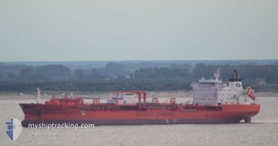
BOW CARDINAL
Oil/Chemical Tanker
Current Trip
VOPAK DP 1
| Time Travelled | 3 days |
|---|---|
| Remaining Time | --- |
| Distance Travelled | 749.18 nm |
| Remaining Distance | --- |
| AVG Speed | 10.9 Noeuds |
| MAX Speed | 16.2 Noeuds |
| AVG Wind | 8.2 knots |
| MAX Wind | 24.6 knots |
| MIN Temp | 19.5°C / 67.1°F |
| MAX Temp | 33°C / 91.4°F |
| Tirant d eau | 9.8 m |
| Position reçue | 20 h, 44 m depuis |
Current Position
| Longitude | -89.97690° |
|---|---|
| Latitude | 29.86923° |
| Etat | Under way using engine |
| Vitesse | 13.2 Noeuds |
| Parcours | 189° |
| Zone | Gulf of Mexico |
| Station | T-AIS |
| Position reçue | 20 h, 44 m depuis |
Info
Information
The current position of BOW CARDINAL is in Gulf of Mexico with coordinates 29.86923° / -89.97690° as reported on 2024-05-16 22:14 by AIS to our vessel tracker app. The vessel's current speed is 13.2 Noeuds
The vessel BOW CARDINAL (IMO: 9114244, MMSI: 538009779) is a Oil/Chemical Tanker that was built in 1997 ( 27 Age ). It's sailing under the flag of [MH] Marshall Is.
In this page you can find informations about the vessels current position, last detected port calls, and current voyage information. If the vessels is not in coverage by AIS you will find the latest position.
The current position of BOW CARDINAL is detected by our AIS receivers and we are not responsible for the reliability of the data. The last position was recorded while the vessel was in Coverage by the Ais receivers of our vessel tracking app.
The current draught of BOW CARDINAL as reported by AIS is 9.8 meters
Weather
| Temperature | 26.3°C / 79.34°F |
|---|---|
| Wind Speed | 16 knots |
| Direction | 181° S |
| Pressure | 1009.3 hPa |
| Humidity | 91.3 % |
| Cloud Coverage | 10 % |
Featured Company
Last Port Calls
| Port | Arrival | Departure | Time In Port |
|---|---|---|---|
| 2024-05-12 22:22 | 2024-05-13 23:30 | 1 d | |
| 2024-05-10 13:02 | 2024-05-11 19:06 | 1 d | |
| 2024-05-07 02:07 | 2024-05-08 14:25 | 1 d | |
| 2024-05-01 05:40 | 2024-05-03 23:54 | 2 d | |
| 2024-04-29 02:42 | 2024-04-29 22:38 | 19 h | |
| 2024-04-23 18:50 | 2024-04-27 03:32 | 3 d | |
| 2024-04-16 07:08 | 2024-04-21 10:09 | 5 d | |
| 2024-04-11 11:12 | 2024-04-13 14:57 | 2 d | |
| 2024-03-18 07:35 | 2024-03-19 11:32 | 1 d | |
| 2024-03-13 10:34 | 2024-03-18 06:47 | 4 d |
Most Visited Ports (Last year)
| Port | Arrivals | |
|---|---|---|
| 18 | ||
| 6 | ||
| 4 | ||
| 3 | ||
| 3 | ||
| 2 |
Last Trips
| Origin | Departure | Destination | Arrival | Distance | |
|---|---|---|---|---|---|
| 2024-05-11 14:06 | 2024-05-12 17:22 | 85.26 nm | |||
| 2024-05-08 09:25 | 2024-05-10 08:02 | 92.19 nm | |||
| 2024-05-03 18:54 | 2024-05-06 21:07 | 53.62 nm | |||
| 2024-04-29 17:38 | 2024-05-01 00:40 | 52.86 nm | |||
| 2024-04-26 22:32 | 2024-04-28 21:42 | 250.32 nm | |||
| 2024-04-21 05:09 | 2024-04-23 13:50 | 71.16 nm | |||
| 2024-04-13 09:57 | 2024-04-16 02:08 | 68.50 nm | |||
| 2024-03-19 12:32 | 2024-04-11 06:12 | 5251.65 nm | |||
| 2024-03-18 07:47 | 2024-03-18 08:35 | 1.70 nm | |||
| 2024-03-12 06:47 | 2024-03-13 11:34 | 172.25 nm |
Events
| Heure | Evenement | Détails | Position/ Destination | Info |
|---|---|---|---|---|
| 2024-05-16 22:22 | Etat Changé | Default Under way using engine |
29.84200 / -89.98629
VOPAK DP 1
|
Vitesse: 13.2 kn Parcours: 189° |
| 2024-05-16 22:14 | Hors de la zone couverte |
29.86923 / -89.97690
Gulf of Mexico
|
Vitesse: 13.2 kn Parcours: 189° |
|
| 2024-05-16 22:09 | Etat Changé | Under way using engine Default |
29.88259 / -89.96420
VOPAK DP 1
|
Vitesse: 15.9 kn Parcours: 301° |
| 2024-05-16 21:42 | Etat Changé | Default Under way using engine |
29.91651 / -89.91941
VOPAK DP 1
|
Vitesse: 11.9 kn Parcours: 91.9° |
| 2024-05-16 21:19 | Etat Changé | Under way using engine Default |
29.94652 / -90.01132
VOPAK DP 1
|
Vitesse: 13.3 kn Parcours: 122° |
| 2024-05-16 21:18 | Etat Changé | Default Under way using engine |
29.94807 / -90.01381
VOPAK DP 1
|
Vitesse: 13.2 kn Parcours: 121.2° |
| 2024-05-16 21:18 | Etat Changé | Under way using engine Default |
29.94887 / -90.01525
VOPAK DP 1
|
Vitesse: 11.7 kn Parcours: 110° |
| 2024-05-16 21:11 | Etat Changé | Default Under way using engine |
29.95801 / -90.04092
VOPAK DP 1
|
Vitesse: 14.2 kn Parcours: 348.2° |
| 2024-05-16 21:00 | Etat Changé | Under way using engine Default |
29.93681 / -90.05693
VOPAK DP 1
|
Vitesse: 14.4 kn Parcours: 25° |
| 2024-05-16 21:00 | Dans la zone couverte |
29.93913 / -90.05712
Gulf of Mexico
|
Vitesse: 13.6 kn Parcours: 354.2° |