

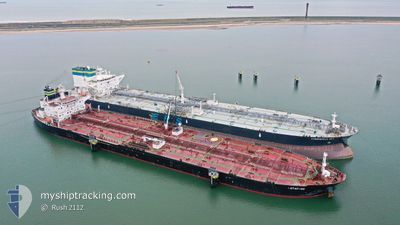
BOTAFOGO
Crude Oil Tanker

Current Trip
| Time Travelled | 14 days |
|---|---|
| Remaining Time | --- |
| Distance Travelled | 3527.43 nm |
| Remaining Distance | --- |
| AVG Speed | 10.8 Noeuds |
| MAX Speed | 15.8 Noeuds |
| AVG Wind | 16.3 knots |
| MAX Wind | 30 knots |
| MIN Temp | 4.9°C / 40.82°F |
| MAX Temp | 29.6°C / 85.28°F |
| Tirant d eau | 14.8 m |
| Position reçue | 13 h, 19 m depuis |
Current Position
| Longitude | --- |
|---|---|
| Latitude | --- |
| Etat | Under way using engine |
| Vitesse | 12.5 Noeuds |
| Parcours | 302.7° |
| Zone | Mediterranean Sea - Eastern Basin |
| Station | T-AIS |
| Position reçue | 13 h, 19 m depuis |
Information
The current position of BOTAFOGO is in Mediterranean Sea - Eastern Basin with coordinates 32.44499° / 27.29035° as reported on 2025-03-27 07:44 by AIS to our vessel tracker app. The vessel's current speed is 12.5 Noeuds and is heading at the port of GDANSK. The estimated time of arrival as calculated by MyShipTracking vessel tracking app is 2025-04-10 08:00 LT
The vessel BOTAFOGO (IMO: 9395329, MMSI: 249575000) is a Crude Oil Tanker that was built in 2010 ( 15 Age ). It's sailing under the flag of [MT] Malta.
In this page you can find informations about the vessels current position, last detected port calls, and current voyage information. If the vessels is not in coverage by AIS you will find the latest position.
The current position of BOTAFOGO is detected by our AIS receivers and we are not responsible for the reliability of the data. The last position was recorded while the vessel was in Coverage by the Ais receivers of our vessel tracking app.
The current draught of BOTAFOGO as reported by AIS is 14.8 meters
Weather
| Temperature | 16.9°C / 62.42°F |
|---|---|
| Wind Speed | 25 knots |
| Direction | 292° WNW |
| Pressure | 1005.6 hPa |
| Humidity | 91.2 % |
| Cloud Coverage | 100 % |


Featured Company
Most Visited Ports (Last year)
| Port | Arrivals | |
|---|---|---|
| 3 | ||
| 2 | ||
| 2 | ||
| 1 | ||
| 1 | ||
| 1 |
Events
| Heure | Evenement | Détails | Position/ Destination | Info |
|---|---|---|---|---|
| 2025-03-27 07:49 | Etat Changé | Default Under way using engine |
32.45324 / 27.27543
PLGDN
|
Vitesse: 12.5 kn Parcours: 302.7° |
| 2025-03-27 07:44 | Hors de la zone couverte |
32.44499 / 27.29035
Mediterranean Sea - Eastern Basin
PLGDN
|
Vitesse: 12.5 kn Parcours: 302.7° |
|
| 2025-03-27 06:06 | Etat Changé | Under way using engine Default |
32.25697 / 27.62537
PLGDN
|
Vitesse: 12.6 kn Parcours: 302° |
| 2025-03-27 05:21 | Etat Changé | Default Under way using engine |
32.17066 / 27.78723
PLGDN
|
Vitesse: 13.2 kn Parcours: 303.2° |
| 2025-03-27 02:54 | Etat Changé | Under way using engine Default |
31.87320 / 28.30459
PLGDN
|
Vitesse: 12.3 kn Parcours: 305° |
| 2025-03-27 02:50 | Etat Changé | Default Under way using engine |
31.86490 / 28.31845
PLGDN
|
Vitesse: 12.3 kn Parcours: 305.2° |
| 2025-03-27 02:43 | Etat Changé | Under way using engine Default |
31.85204 / 28.34003
PLGDN
|
Vitesse: 12.3 kn Parcours: 305° |
| 2025-03-27 02:41 | Etat Changé | Default Under way using engine |
31.84773 / 28.34723
PLGDN
|
Vitesse: 12.3 kn Parcours: 304.7° |
| 2025-03-27 02:20 | Etat Changé | Under way using engine Default |
31.80587 / 28.41632
PLGDN
|
Vitesse: 12.3 kn Parcours: 306° |
| 2025-03-27 02:18 | Etat Changé | Default Under way using engine |
31.80078 / 28.42442
PLGDN
|
Vitesse: 12.3 kn Parcours: 305.6° |