
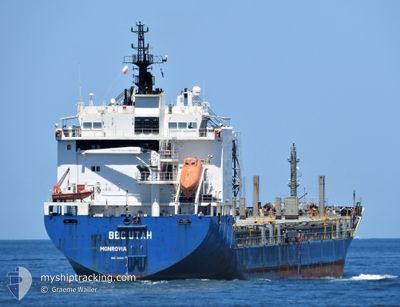
BBC UTAH
General Cargo
Current Trip
| Time Travelled | 3 days |
|---|---|
| Remaining Time | 1 day |
| Distance Travelled | 952.40 nm |
| Remaining Distance | 414.16 nm |
| AVG Speed | 12.1 Noeuds |
| MAX Speed | 15.1 Noeuds |
| AVG Wind | 6.8 knots |
| MAX Wind | 16.9 knots |
| MIN Temp | 16°C / 60.8°F |
| MAX Temp | 21.6°C / 70.88°F |
| Tirant d eau | 5.8 m |
| Position reçue | 6 h, 41 m depuis |
Current Position
| Longitude | 12.27231° |
|---|---|
| Latitude | 37.01641° |
| Etat | Under way using engine |
| Vitesse | 12.3 Noeuds |
| Parcours | 289.6° |
| Zone | Mediterranean Sea - Eastern Basin |
| Station | T-AIS |
| Position reçue | 6 h, 41 m depuis |
Info
Information
The current position of BBC UTAH is in Mediterranean Sea - Eastern Basin with coordinates 37.01641° / 12.27231° as reported on 2024-05-02 07:36 by AIS to our vessel tracker app. The vessel's current speed is 12.3 Noeuds and is heading at the port of PALMA DE MALLORCA. The estimated time of arrival as calculated by MyShipTracking vessel tracking app is 2024-05-03 23:51 LT
The vessel BBC UTAH (IMO: 9468114, MMSI: 636092811) is a General Cargo that was built in 2011 ( 13 Age ). It's sailing under the flag of [LR] Liberia.
In this page you can find informations about the vessels current position, last detected port calls, and current voyage information. If the vessels is not in coverage by AIS you will find the latest position.
The current position of BBC UTAH is detected by our AIS receivers and we are not responsible for the reliability of the data. The last position was recorded while the vessel was in Coverage by the Ais receivers of our vessel tracking app.
The current draught of BBC UTAH as reported by AIS is 5.8 meters
Weather
| Temperature | 17°C / 62.6°F |
|---|---|
| Wind Speed | 14 knots |
| Direction | 288° WNW |
| Pressure | 1016.5 hPa |
| Humidity | 76.4 % |
| Cloud Coverage | 99 % |
Featured Company
Last Port Calls
| Port | Arrival | Departure | Time In Port |
|---|---|---|---|
| 2024-04-23 10:54 | 2024-04-29 13:35 | 6 d | |
| 2024-04-15 13:04 | 2024-04-19 14:30 | 4 d | |
| 2024-03-29 10:55 | 2024-04-10 12:58 | 12 d | |
| 2024-03-16 08:02 | 2024-03-25 18:07 | 9 d |
Most Visited Ports (Last year)
| Port | Arrivals | |
|---|---|---|
| 2 | ||
| 2 | ||
| 2 | ||
| 2 | ||
| 2 | ||
| 2 |
Events
| Heure | Evenement | Détails | Position/ Destination | Info |
|---|---|---|---|---|
| 2024-05-02 07:45 | Etat Changé | Default Under way using engine |
37.02500 / 12.23833
ES PMI
|
Vitesse: 12.3 kn Parcours: 289.6° |
| 2024-05-02 07:36 | Hors de la zone couverte |
37.01641 / 12.27231
Mediterranean Sea - Eastern Basin
ES PMI
|
Vitesse: 12.3 kn Parcours: 289.6° |
|
| 2024-05-02 07:11 | Tirant d'eau modifié | 5.8 5 |
36.98571 / 12.37492
ES PMI
|
Vitesse: 12.6 kn Parcours: 290.8° |
| 2024-05-02 07:08 | Etat Changé | Under way using engine Default |
36.98135 / 12.38920
ES PMI
|
Vitesse: 12 kn Parcours: 289° |
| 2024-05-02 07:08 | Dans la zone couverte |
36.98135 / 12.38920
Mediterranean Sea - Eastern Basin
ES PMI
|
Vitesse: 12.6 kn Parcours: 291° |
|
| 2024-05-02 03:21 | Etat Changé | Default Under way using engine |
36.74448 / 13.37570
ES PMI
|
Vitesse: 13 kn Parcours: 286.7° |
| 2024-05-02 03:17 | Hors de la zone couverte |
36.73987 / 13.39507
Mediterranean Sea - Eastern Basin
ES PMI
|
Vitesse: 13 kn Parcours: 286.7° |
|
| 2024-05-02 03:03 | Etat Changé | Under way using engine Default |
36.72564 / 13.45695
ES PMI
|
Vitesse: 12 kn Parcours: 284° |
| 2024-05-02 02:53 | Etat Changé | Default Under way using engine |
36.71679 / 13.49806
ES PMI
|
Vitesse: 13 kn Parcours: 285.4° |
| 2024-05-02 02:51 | Etat Changé | Under way using engine Default |
36.71413 / 13.51032
ES PMI
|
Vitesse: 13 kn Parcours: 285° |