
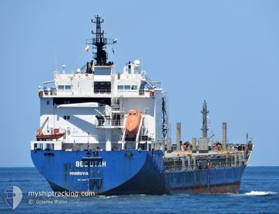
BBC UTAH
General Cargo
Current Trip
| Time Travelled | 19 h, 49 mins |
|---|---|
| Remaining Time | --- |
| Distance Travelled | 263.35 nm |
| Remaining Distance | --- |
| AVG Speed | 13.6 Knop |
| MAX Speed | 16.1 Knop |
| AVG Wind | 20.7 knots |
| MAX Wind | 36.5 knots |
| MIN Temp | 9.4°C / 48.92°F |
| MAX Temp | 15°C / 59°F |
| Djupgående | 5.1 m |
| Position mottagen | Nu |
Current Position
| Longitud | 24.98480° |
|---|---|
| Latitude | 38.61579° |
| Status | Under way using engine |
| Fart | 13.2 Knop |
| Kurs | 203.1° |
| Område | Aegean Sea |
| Station | T-AIS |
| Position mottagen | Nu |
Info
Information
The current position of BBC UTAH is in Aegean Sea with coordinates 38.61579° / 24.98480° as reported on 2024-04-20 10:18 by AIS to our vessel tracker app. The vessel's current speed is 13.2 Knop and is heading at the port of PORTO NOGARO. The estimated time of arrival as calculated by MyShipTracking vessel tracking app is 2024-04-23 10:00 LT
The vessel BBC UTAH (IMO: 9468114, MMSI: 636092811) is a General Cargo that was built in 2011 ( 13 År gammal ). It's sailing under the flag of [LR] Liberia.
In this page you can find informations about the vessels current position, last detected port calls, and current voyage information. If the vessels is not in coverage by AIS you will find the latest position.
The current position of BBC UTAH is detected by our AIS receivers and we are not responsible for the reliability of the data. The last position was recorded while the vessel was in Coverage by the Ais receivers of our vessel tracking app.
The current draught of BBC UTAH as reported by AIS is 5.1 meters
Weather
| Temperature | 13.3°C / 55.94°F |
|---|---|
| Wind Speed | 28 knots |
| Direction | 355° N |
| Pressure | 1007.6 hPa |
| Humidity | 75.4 % |
| Cloud Coverage | 88 % |
Featured Company
Last Port Calls
| Port | Arrival | Departure | Time In Port |
|---|---|---|---|
| 2024-04-15 13:04 | 2024-04-19 14:30 | 4 d | |
| 2024-03-29 10:55 | 2024-04-10 12:58 | 12 d | |
| 2024-03-16 08:02 | 2024-03-25 18:07 | 9 d | |
| 2024-02-20 20:08 | 2024-02-29 11:57 | 8 d | |
| 2024-02-15 17:40 | 2024-02-17 00:59 | 1 d | |
| 2024-02-12 11:53 | 2024-02-13 18:05 | 1 d | |
| 2024-02-12 07:08 | 2024-02-12 08:15 | 1 h | |
| 2024-02-11 19:16 | 2024-02-11 21:02 | 1 h | |
| 2024-02-04 11:46 | 2024-02-08 04:46 | 3 d |
Most Visited Ports (Last year)
| Port | Arrivals | |
|---|---|---|
| 2 | ||
| 2 | ||
| 2 | ||
| 2 | ||
| 2 | ||
| 2 |
Last Trips
| Origin | Departure | Destination | Arrival | Distance | |
|---|---|---|---|---|---|
| 2024-04-10 15:58 | 2024-04-15 16:04 | 248.69 nm | |||
| 2024-03-25 19:07 | 2024-03-29 13:55 | 1153.27 nm | |||
| 2024-02-29 12:57 | 2024-03-16 09:02 | 3250.68 nm | |||
| 2024-02-17 01:59 | 2024-02-20 21:08 | 1075.39 nm | |||
| 2024-02-13 19:05 | 2024-02-15 18:40 | 439.81 nm | |||
| 2024-02-12 09:15 | 2024-02-12 12:53 | 36.56 nm | |||
| 2024-02-11 22:02 | 2024-02-12 08:08 | 51.12 nm | |||
| 2024-02-08 05:46 | 2024-02-11 20:16 | 896.55 nm | |||
| 2024-01-27 16:46 | 2024-02-04 12:46 | 967.70 nm |
Events
| Tid | Event | Detaljer | Position / Dest | Information |
|---|---|---|---|---|
| 2024-04-20 07:58 | Status ändrad | Under way using engine Default |
39.08907 / 25.26516
IT PNG
|
Fart: 13.7 kn Kurs: 206° |
| 2024-04-20 07:24 | Status ändrad | Default Under way using engine |
39.20500 / 25.33667
IT PNG
|
Fart: 13.7 kn Kurs: 206.3° |
| 2024-04-20 03:50 | Byter havsområde | Greek part of the Aegean Sea Turkish part of the Aegean Sea |
39.90185 / 25.83542
Aegean Sea
IT PNG
|
Fart: 14.2 kn Kurs: 224.6° |
| 2024-04-20 03:50 | Status ändrad | Under way using engine Default |
39.90185 / 25.83542
IT PNG
|
Fart: 14 kn Kurs: 223° |
| 2024-04-20 03:45 | Status ändrad | Default Under way using engine |
39.91667 / 25.85333
IT PNG
|
Fart: 14.4 kn Kurs: 224.4° |
| 2024-04-20 03:28 | Status ändrad | Under way using engine Default |
39.96499 / 25.91759
IT PNG
|
Fart: 14.7 kn Kurs: 244° |
| 2024-04-20 03:09 | Status ändrad | Default Under way using engine |
40.00944 / 26.00073
IT PNG
|
Fart: 15.2 kn Kurs: 262.6° |
| 2024-04-20 03:04 | Byter havsområde | Turkish part of the Aegean Sea Turkish part of the Sea of Marmara |
40.01213 / 26.02530
Aegean Sea
IT PNG
|
Fart: 15.2 kn Kurs: 262.6° |
| 2024-04-20 03:04 | Status ändrad | Under way using engine Default |
40.01213 / 26.02530
IT PNG
|
Fart: 15.4 kn Kurs: 260° |
| 2024-04-20 02:16 | Status ändrad | Default Under way using engine |
40.05488 / 26.26876
IT PNG
|
Fart: 16.2 kn Kurs: 236.7° |