
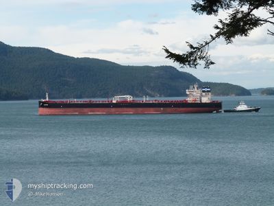
AIGEORGIS
Tanker
Current Trip
| Time Travelled | 17 days |
|---|---|
| Remaining Time | 9 days |
| Distance Travelled | 3227.69 nm |
| Remaining Distance | 3175.49 nm |
| AVG Speed | 11.1 Noeuds |
| MAX Speed | 13.4 Noeuds |
| AVG Wind | 8.7 knots |
| MAX Wind | 27 knots |
| MIN Temp | 6.4°C / 43.52°F |
| MAX Temp | 19.5°C / 67.1°F |
| Tirant d eau | 12.3 m |
| Position reçue | 2 d depuis |
Current Position
| Longitude | --- |
|---|---|
| Latitude | --- |
| Etat | Under way using engine |
| Vitesse | 11.3 Noeuds |
| Parcours | 267.9° |
| Zone | Strait of Gibraltar |
| Station | T-AIS |
| Position reçue | 2 d depuis |
Info
Information
The current position of AIGEORGIS is in Strait of Gibraltar with coordinates 35.95725° / -5.70792° as reported on 2025-01-13 20:03 by AIS to our vessel tracker app. The vessel's current speed is 11.3 Noeuds and is heading at the port of NEW YORK. The estimated time of arrival as calculated by MyShipTracking vessel tracking app is 2025-01-25 15:09 LT
The vessel AIGEORGIS (IMO: 9891660, MMSI: 538009248) is a Tanker It's sailing under the flag of [MH] Marshall Is.
In this page you can find informations about the vessels current position, last detected port calls, and current voyage information. If the vessels is not in coverage by AIS you will find the latest position.
The current position of AIGEORGIS is detected by our AIS receivers and we are not responsible for the reliability of the data. The last position was recorded while the vessel was in Coverage by the Ais receivers of our vessel tracking app.
The current draught of AIGEORGIS as reported by AIS is 12.3 meters
Weather
| Temperature | 17.7°C / 63.86°F |
|---|---|
| Wind Speed | 16 knots |
| Direction | 208° SSW |
| Pressure | 1026.2 hPa |
| Humidity | 67.8 % |
| Cloud Coverage | 100 % |
Featured Company
Most Visited Ports (Last year)
| Port | Arrivals | |
|---|---|---|
| 3 | ||
| 2 | ||
| 2 | ||
| 2 | ||
| 2 | ||
| 1 |
Events
| Heure | Evenement | Détails | Position/ Destination | Info |
|---|---|---|---|---|
| 2025-01-13 20:11 | Etat Changé | Default Under way using engine |
35.95735 / -5.73750
USNYC
|
Vitesse: 11.3 kn Parcours: 267.9° |
| 2025-01-13 20:03 | Hors de la zone couverte |
35.95725 / -5.70792
Strait of Gibraltar
USNYC
|
Vitesse: 11.3 kn Parcours: 267.9° |
|
| 2025-01-13 18:25 | Changement de zone | Spanish part of the Strait of Gibraltar Gibraltarian part of the Strait of Gibraltar |
36.02937 / -5.35069
Strait of Gibraltar
USNYC
|
Vitesse: 10.8 kn Parcours: 248.3° |
| 2025-01-13 18:22 | Changement de zone | Gibraltarian part of the Strait of Gibraltar Gibraltarian part of the Alboran Sea |
36.03252 / -5.33954
Strait of Gibraltar
USNYC
|
Vitesse: 10.8 kn Parcours: 251.9° |
| 2025-01-13 16:37 | Changement de zone | Gibraltarian part of the Alboran Sea Spanish part of the Alboran Sea |
36.09643 / -4.94892
Alboran Sea
USNYC
|
Vitesse: 11.3 kn Parcours: 254.8° |
| 2025-01-13 14:59 | Etat Changé | Under way using engine Default |
36.13436 / -4.59223
USNYC
|
Vitesse: 10 kn Parcours: 260° |
| 2025-01-13 14:35 | Etat Changé | Default Under way using engine |
36.14496 / -4.50711
USNYC
|
Vitesse: 10.2 kn Parcours: 262.3° |
| 2025-01-13 14:20 | Etat Changé | Under way using engine Default |
36.15007 / -4.45723
USNYC
|
Vitesse: 10.4 kn Parcours: 264° |
| 2025-01-13 13:40 | Etat Changé | Default Under way using engine |
36.16665 / -4.30616
USNYC
|
Vitesse: 11.7 kn Parcours: 262° |
| 2025-01-13 13:24 | Etat Changé | Under way using engine Default |
36.17345 / -4.24112
USNYC
|
Vitesse: 12.2 kn Parcours: 262° |