
AIGEORGIS
Tanker
Current Trip
USFPO
| Time Travelled | 4 days |
|---|---|
| Remaining Time | --- |
| Distance Travelled | 379.53 nm |
| Remaining Distance | --- |
| AVG Speed | 10.6 Knop |
| MAX Speed | 15.1 Knop |
| AVG Wind | 12.5 knots |
| MAX Wind | 19 knots |
| MIN Temp | 24.8°C / 76.64°F |
| MAX Temp | 30.5°C / 86.9°F |
| Djupgående | 11.9 m |
| Position mottagen | 4 d sen |
Current Position
| Longitud | -95.25443° |
|---|---|
| Latitude | 28.90400° |
| Status | Under way using engine |
| Fart | 7.9 Knop |
| Kurs | 103.1° |
| Område | Gulf of Mexico |
| Station | T-AIS |
| Position mottagen | 4 d sen |
Info
Information
The current position of AIGEORGIS is in Gulf of Mexico with coordinates 28.90400° / -95.25443° as reported on 2024-05-09 04:14 by AIS to our vessel tracker app. The vessel's current speed is 7.9 Knop
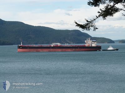
The vessel AIGEORGIS (IMO: 9891660, MMSI: 538009248) is a Tanker It's sailing under the flag of [MH] Marshall Is.
In this page you can find informations about the vessels current position, last detected port calls, and current voyage information. If the vessels is not in coverage by AIS you will find the latest position.
The current position of AIGEORGIS is detected by our AIS receivers and we are not responsible for the reliability of the data. The last position was recorded while the vessel was in Coverage by the Ais receivers of our vessel tracking app.
The current draught of AIGEORGIS as reported by AIS is 11.9 meters
Weather
| Temperature | 25.9°C / 78.62°F |
|---|---|
| Wind Speed | 17 knots |
| Direction | 147° SSE |
| Pressure | 1006.8 hPa |
| Humidity | 93.3 % |
| Cloud Coverage | 31 % |
Featured Company
Last Port Calls
| Port | Arrival | Departure | Time In Port |
|---|---|---|---|
| 2024-05-07 12:26 | 2024-05-09 03:50 | 1 d | |
| 2024-04-27 01:03 | 2024-04-29 12:36 | 2 d | |
| 2024-04-06 16:43 | 2024-04-07 21:58 | 1 d | |
| 2024-03-30 23:11 | 2024-03-31 20:38 | 21 h | |
| 2024-03-08 22:12 |
Most Visited Ports (Last year)
| Port | Arrivals | |
|---|---|---|
| 3 | ||
| 2 | ||
| 2 | ||
| 1 | ||
| 1 | ||
| 1 |
Last Trips
| Origin | Departure | Destination | Arrival | Distance | |
|---|---|---|---|---|---|
| 2024-04-29 07:36 | 2024-05-07 07:26 | 172.02 nm | |||
| 2024-04-07 17:58 | 2024-04-26 20:03 | 3626.35 nm | |||
| 2024-03-31 16:38 | 2024-04-06 12:43 | 298.15 nm | |||
| 2024-03-08 16:12 | 2024-03-30 19:11 | 2709.15 nm |
Events
| Tid | Event | Detaljer | Position / Dest | Information |
|---|---|---|---|---|
| 2024-05-12 12:46 | STARTAR förflyttning | 4.27 nm, West of CORPUS CHRISTI |
27.81647 / -97.46325
USFPO
|
Fart: 4.8 kn Kurs: 90° |
| 2024-05-10 16:42 | STOPPAR förflyttning | 4.68 nm, West of CORPUS CHRISTI |
27.81725 / -97.47093
USFPO
|
Fart: 0.1 kn Kurs: 102° |
| 2024-05-10 11:31 | STARTAR förflyttning | 11.48 nm, East of PORT ARANSAS |
27.84301 / -96.85131
USFPO
|
Fart: 3.5 kn Kurs: 290° |
| 2024-05-09 14:02 | STOPPAR förflyttning | 11.24 nm, East of PORT ARANSAS |
27.83813 / -96.85594
USFPO
|
Fart: 0.3 kn Kurs: 26° |
| 2024-05-09 04:22 | Status ändrad | Default Under way using engine |
28.88745 / -95.23570
USFPO
|
Fart: 7.9 kn Kurs: 103.1° |
| 2024-05-09 04:14 | UTANFÖR täckningsområde |
28.90400 / -95.25443
Gulf of Mexico
|
Fart: 7.9 kn Kurs: 103.1° |
|
| 2024-05-09 04:11 | Status ändrad | Under way using engine Default |
28.90427 / -95.26012
USFPO
|
Fart: 7.8 kn Kurs: 106° |
| 2024-05-09 04:06 | I täckningsområde |
28.90400 / -95.25443
Gulf of Mexico
|
Fart: 7.9 kn Kurs: 103.1° |
|
| 2024-05-09 03:50 | AVGÅTT HAMN |
|
28.94153 / -95.30269
USFPO
|
Fart: 5.3 kn Kurs: 79° |
| 2024-05-09 03:43 | STARTAR förflyttning |
28.94157 / -95.31557
[US] FREEPORT (TX)
|
Fart: 3.7 kn Kurs: 89° |