
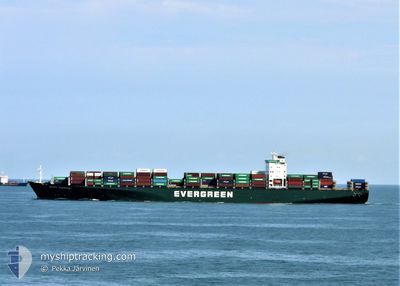
EVER SUPERB
Container Ship
Current Trip
| Trip Time | 10 h, 37 mins |
|---|---|
| Trip Distance | 180.46 nm |
| AVG Speed | 16.5 Knoten |
| MAX Speed | 20.3 Knoten |
| Tiefgang | 12.7 m |
| AVG Wind | 5.8 knots |
| MAX Wind | 13.8 knots |
| MIN Temp | 10.5°C / 50.9°F |
| MAX Temp | 17.1°C / 62.78°F |
| Position erhalten | 2 m alt |
Current Position
| Länge | -123.07503° |
|---|---|
| Breite | 49.28928° |
| Zustand | Moored |
| Geschwindigkeit | |
| Kurs | 108° |
| Gebiet | The Coastal Waters of Southeast Alaska and British Columbia |
| Station | T-AIS |
| Position erhalten | 2 m alt |
Info
Information
Die aktuelle Position von EVER SUPERB befindet sich in The Coastal Waters of Southeast Alaska and British Columbia mit den Koordinaten 49.28928° / -123.07503°, wie von AIS am 2024-06-03 14:23 an unsere Schiffsverfolgungs-App. Die aktuelle Geschwindigkeit des Schiffes betragt 0 Knoten und befindet sich derzeit im Port von VANCOUVER .
Das Schiff EVER SUPERB (IMO: 9300427, MMSI: 563077800) ist Container Ship das wurde im Jahr 2006 ( 18 Jahre alt ) gebaut. Es segelt unter der Flagge [SG] Singapore.
Auf dieser Seite finden Sie Informationen zur aktuellen Position des Schiffes, zu den zuletzt erkannten Hafenanlaufen und zu aktuellen Reiseinformationen. Wenn die Schiffe nicht von AIS abgedeckt werden, finden Sie die neueste Position.
Die aktuelle Position von EVER SUPERB wird von unseren AIS-Empfangern erkannt und wir sind nicht fur die Zuverlassigkeit der Daten verantwortlich. Die letzte Position wurde von den Ais-Empfangern unserer Schiffsverfolgungs-App aufgezeichnet, wahrend sich das Schiff in Deckung befand.
Der aktuelle Entwurf von EVER SUPERB, wie von AIS gemeldet, betragt 12.7 meter
Weather
| Temperature | 9.6°C / 49.28°F |
|---|---|
| Wind Speed | 5 knots |
| Direction | 277° W |
| Pressure | 998.4 hPa |
| Humidity | 97.6 % |
| Cloud Coverage | 100 % |
Featured Company
Last Port Calls
| Port | Arrival | Departure | Time In Port |
|---|---|---|---|
| 2024-06-02 05:52 | |||
| 2024-05-29 13:05 | 2024-06-01 19:15 | 3 d | |
| 2024-05-14 16:48 | 2024-05-15 05:16 | 12 h | |
| 2024-05-10 23:02 | 2024-05-11 19:52 | 20 h | |
| 2024-05-08 04:54 | 2024-05-09 19:50 | 1 d | |
| 2024-05-03 18:50 | 2024-05-04 06:51 | 12 h | |
| 2024-05-01 11:09 | 2024-05-02 14:40 | 1 d | |
| 2024-04-14 04:20 | 2024-04-16 00:54 | 1 d | |
| 2024-04-09 15:02 | 2024-04-12 04:04 | 2 d |
Last Trips
| Origin | Departure | Destination | Arrival | Distance | |
|---|---|---|---|---|---|
| 2024-06-01 19:15 | 2024-06-02 05:52 | 180.46 nm | |||
| 2024-05-15 05:16 | 2024-05-29 13:05 | 5392.65 nm | |||
| 2024-05-11 19:52 | 2024-05-14 16:48 | 923.97 nm | |||
| 2024-05-09 19:50 | 2024-05-10 23:02 | 350.94 nm | |||
| 2024-05-04 06:51 | 2024-05-08 04:54 | 1185.83 nm | |||
| 2024-05-02 14:40 | 2024-05-03 18:50 | 373.32 nm | |||
| 2024-04-16 00:54 | 2024-05-01 11:09 | 4348.94 nm | |||
| 2024-04-12 04:04 | 2024-04-14 04:20 | 184.44 nm | |||
| 2024-03-25 11:00 | 2024-04-09 15:02 | 5869.20 nm |
Events
| Zeit | Ereignis | Details | Position / Ziel | Information |
|---|---|---|---|---|
| 2024-06-02 13:43 | geänderter Status | Moored Under way using engine |
49.28928 / -123.07505
[CA] VANCOUVER
|
Geschwindigkeit: Kurs: 108° |
| 2024-06-02 13:32 | STOP Bewegung |
49.28967 / -123.07532
[CA] VANCOUVER
|
Geschwindigkeit: 0.3 kn Kurs: 109° |
|
| 2024-06-02 12:52 | ZIELHAFEN |
|
49.31738 / -123.14608
[CA] VANCOUVER
|
Geschwindigkeit: 9.2 kn Kurs: 113° |
| 2024-06-02 11:16 | Ändere Seegebiet | Canadian part of the The Coastal Waters of Southeast Alaska and British Columbia United States part of the The Coastal Waters of Southeast Alaska and British Columbia |
49.00985 / -123.27060
The Coastal Waters of Southeast Alaska and British Columbia
US TIW>CA VAN
|
Geschwindigkeit: 17.9 kn Kurs: 319° |
| 2024-06-02 10:19 | Ändere Seegebiet | United States part of the The Coastal Waters of Southeast Alaska and British Columbia Canadian part of the The Coastal Waters of Southeast Alaska and British Columbia |
48.80118 / -122.99560
The Coastal Waters of Southeast Alaska and British Columbia
US TIW>CA VAN
|
Geschwindigkeit: 18.6 kn Kurs: 31° |
| 2024-06-02 09:43 | Ändere Seegebiet | Canadian part of the The Coastal Waters of Southeast Alaska and British Columbia United States part of the The Coastal Waters of Southeast Alaska and British Columbia |
48.70283 / -123.24142
The Coastal Waters of Southeast Alaska and British Columbia
US TIW>CA VAN
|
Geschwindigkeit: 18.8 kn Kurs: 47° |
| 2024-06-02 08:55 | Ändere Seegebiet | United States part of the The Coastal Waters of Southeast Alaska and British Columbia Canadian part of the The Coastal Waters of Southeast Alaska and British Columbia |
48.46548 / -123.16458
The Coastal Waters of Southeast Alaska and British Columbia
US TIW>CA VAN
|
Geschwindigkeit: 16.7 kn Kurs: 344° |
| 2024-06-02 07:35 | Ändere Seegebiet | Canadian part of the The Coastal Waters of Southeast Alaska and British Columbia United States part of the The Coastal Waters of Southeast Alaska and British Columbia |
48.24888 / -123.43712
The Coastal Waters of Southeast Alaska and British Columbia
US TIW>CA VAN
|
Geschwindigkeit: 15.3 kn Kurs: 13° |
| 2024-06-02 04:20 | geänderter Tiefgang | 12.7 12 |
47.84615 / -122.46052
US TIW>CA VAN
|
Geschwindigkeit: 20.2 kn Kurs: 347° |
| 2024-06-02 04:20 | geänderte voraussichtliche Ankunftszeit | 2024/06/02 08:00 |
47.84615 / -122.46052
US TIW>CA VAN
|
Geschwindigkeit: 20.2 kn Kurs: 347° |