
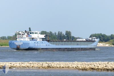
WESTEWIND
General Cargo
Current Trip
| Time Travelled | 2 days |
|---|---|
| Remaining Time | --- |
| Distance Travelled | 585.08 nm |
| Remaining Distance | 14.45 nm |
| AVG Speed | 9.7 Knots |
| MAX Speed | 13.9 Knots |
| AVG Wind | 11.2 knots |
| MAX Wind | 16.2 knots |
| MIN Temp | 3.8°C / 38.84°F |
| MAX Temp | 8.5°C / 47.3°F |
| Dybgang | 4.1 m |
| Position Modtaget | 3 m siden |
Current Position
| Longitude | --- |
|---|---|
| Latitude | --- |
| Status | At anchor |
| Fart | 0.1 Knots |
| Kurs | 153° |
| Område | Kattegat |
| Station | T-AIS |
| Position Modtaget | 3 m siden |
Info
Information
The current position of WESTEWIND is in Kattegat with coordinates 56.03352° / 11.82555° as reported on 2025-03-07 23:56 by AIS to our vessel tracker app. The vessel's current speed is 0.1 Knots and is heading at the port of FREDERIKSVAERK. The estimated time of arrival as calculated by MyShipTracking vessel tracking app is 2025-03-07 19:00 LT
The vessel WESTEWIND (IMO: 9201970, MMSI: 245029000) is a General Cargo that was built in 2003 ( 22 år gamle ). It's sailing under the flag of [NL] Netherlands.
In this page you can find informations about the vessels current position, last detected port calls, and current voyage information. If the vessels is not in coverage by AIS you will find the latest position.
The current position of WESTEWIND is detected by our AIS receivers and we are not responsible for the reliability of the data. The last position was recorded while the vessel was in Coverage by the Ais receivers of our vessel tracking app.
The current draught of WESTEWIND as reported by AIS is 4.1 meters
Weather
| Temperature | 5.4°C / 41.72°F |
|---|---|
| Wind Speed | 8 knots |
| Direction | 239° WSW |
| Pressure | 1017.9 hPa |
| Humidity | 83.3 % |
| Cloud Coverage | 95 % |
Featured Company
Last Port Calls
| Port | Arrival | Departure | Time In Port |
|---|---|---|---|
| 2025-03-05 05:33 | 2025-03-05 07:30 | 1 h | |
| 2025-03-03 18:15 | 2025-03-04 18:16 | 1 d | |
| 2025-03-01 08:52 | 2025-03-01 10:35 | 1 h | |
| 2025-02-25 11:25 | 2025-02-26 16:01 | 1 d | |
| 2025-02-23 14:32 | 2025-02-24 12:15 | 21 h | |
| 2025-02-20 23:24 | 2025-02-21 01:16 | 1 h | |
| 2025-02-19 14:02 | 2025-02-20 12:56 | 22 h | |
| 2025-02-18 21:28 | 2025-02-18 22:19 | 51 m | |
| 2025-02-15 08:33 | 2025-02-17 20:17 | 2 d | |
| 2025-02-13 06:45 | 2025-02-13 17:38 | 10 h |
Most Visited Ports (Last year)
| Port | Arrivals | |
|---|---|---|
| 18 | ||
| 8 | ||
| 7 | ||
| 6 | ||
| 5 | ||
| 4 |
Last Trips
| Origin | Departure | Destination | Arrival | Distance | |
|---|---|---|---|---|---|
| 2025-03-04 19:16 | 2025-03-05 06:33 | 98.20 nm | |||
| 2025-03-01 11:35 | 2025-03-03 19:15 | 96.41 nm | |||
| 2025-02-26 17:01 | 2025-03-01 09:52 | 596.92 nm | |||
| 2025-02-24 13:15 | 2025-02-25 12:25 | 226.54 nm | |||
| 2025-02-21 02:16 | 2025-02-23 15:32 | 601.73 nm | |||
| 2025-02-20 13:56 | 2025-02-21 00:24 | 95.69 nm | |||
| 2025-02-18 23:19 | 2025-02-19 15:02 | 96.74 nm | |||
| 2025-02-17 20:17 | 2025-02-18 22:28 | 241.91 nm | |||
| 2025-02-13 18:38 | 2025-02-15 08:33 | 341.86 nm | |||
| 2025-02-11 14:11 | 2025-02-13 07:45 | 352.82 nm |
Events
| Tid | Hændelsen | Detaljer | Position / Dest | Info |
|---|---|---|---|---|
| 2025-03-07 18:49 | Status er ændret | At anchor Under way using engine |
56.03341 / 11.82650
FREDERIKSVAERK
|
Fart: 0.3 kn Kurs: 199° |
| 2025-03-07 18:43 | STOP Sejllads | 4.16 nm, North of HUNDESTED |
56.03301 / 11.82648
FREDERIKSVAERK
|
Fart: 0.3 kn Kurs: 195° |
| 2025-03-07 10:31 | Ændre havområde | Danish part of the Kattegat Swedish part of the Kattegat |
57.30653 / 11.51318
Kattegat
FREDERIKSVAERK
|
Fart: 9.9 kn Kurs: 165° |
| 2025-03-07 09:19 | Ændre havområde | Swedish part of the Kattegat Danish part of the Kattegat |
57.48205 / 11.37214
Kattegat
FREDERIKSVAERK
|
Fart: 9.8 kn Kurs: 133.7° |
| 2025-03-07 06:52 | Ændre havområde | Danish part of the Kattegat Danish part of the Skaggerak |
57.77831 / 10.87060
Kattegat
FREDERIKSVAERK
|
Fart: 9.8 kn Kurs: 135.1° |
| 2025-03-06 22:38 | Ændre havområde | Danish part of the Skaggerak Danish part of the North Sea |
57.19592 / 8.50126
Skaggerak
FREDERIKSVAERK
|
Fart: 10.5 kn Kurs: 53.8° |
| 2025-03-06 17:29 | ETA er ændret | 2025/03/07 19:00 2025/03/07 12:00 |
56.48260 / 7.55156
FREDERIKSVAERK
|
Fart: 10 kn Kurs: 26.4° |
| 2025-03-06 09:47 | Ændre havområde | Danish part of the North Sea German part of the North Sea |
55.38551 / 6.43011
North Sea
FREDERIKSVAERK
|
Fart: 9.7 kn Kurs: 30.5° |
| 2025-03-06 08:40 | ETA er ændret | 2025/03/07 12:00 2025/03/07 19:00 |
55.23186 / 6.27394
FREDERIKSVAERK
|
Fart: 10.2 kn Kurs: 30.1° |
| 2025-03-06 08:38 | ETA er ændret | 2025/03/07 19:00 2025/03/07 12:00 |
55.22498 / 6.26658
FREDERIKSVAERK
|
Fart: 10.2 kn Kurs: 32.1° |