
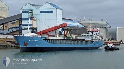
WESTEWIND
General Cargo
Current Trip
| Time Travelled | 1 day |
|---|---|
| Remaining Time | --- |
| Distance Travelled | 152.57 nm |
| Remaining Distance | --- |
| AVG Speed | 9.1 Knots |
| MAX Speed | 10 Knots |
| AVG Wind | 13 knots |
| MAX Wind | 22.9 knots |
| MIN Temp | 6.8°C / 44.24°F |
| MAX Temp | 11°C / 51.8°F |
| Draught | 3.5 m |
| Position Received | Now |
Current Position
| Longitude | 15.51858° |
|---|---|
| Latitude | 56.05781° |
| Status | At anchor |
| Speed | 0.2 Knots |
| Course | 39° |
| Area | Baltic Sea |
| Station | T-AIS |
| Position Received | Now |
Info
Information
The current position of WESTEWIND is in Baltic Sea with coordinates 56.05781° / 15.51858° as reported on 2024-04-30 22:42 by AIS to our vessel tracker app. The vessel's current speed is 0.2 Knots
The vessel WESTEWIND (IMO: 9201970, MMSI: 245029000) is a General Cargo that was built in 2003 ( 21 years old ). It's sailing under the flag of [NL] Netherlands.
In this page you can find informations about the vessels current position, last detected port calls, and current voyage information. If the vessels is not in coverage by AIS you will find the latest position.
The current position of WESTEWIND is detected by our AIS receivers and we are not responsible for the reliability of the data. The last position was recorded while the vessel was in Coverage by the Ais receivers of our vessel tracking app.
The current draught of WESTEWIND as reported by AIS is 3.5 meters
Weather
| Temperature | 7.4°C / 45.32°F |
|---|---|
| Wind Speed | 21 knots |
| Direction | 58° ENE |
| Pressure | 1021.5 hPa |
| Humidity | 89.8 % |
| Cloud Coverage | 62 % |
Featured Company
Last Port Calls
| Port | Arrival | Departure | Time In Port |
|---|---|---|---|
| 2024-04-28 15:19 | 2024-04-29 14:33 | 23 h | |
| 2024-04-24 06:26 | 2024-04-25 18:26 | 1 d | |
| 2024-04-21 16:32 | 2024-04-23 17:12 | 2 d | |
| 2024-04-19 17:38 | 2024-04-20 11:22 | 17 h | |
| 2024-04-19 15:13 | 2024-04-19 17:10 | 1 h | |
| 2024-04-16 04:33 | 2024-04-18 07:19 | 2 d | |
| 2024-04-15 10:35 | 2024-04-15 11:12 | 37 m | |
| 2024-04-13 09:45 | 2024-04-13 22:28 | 12 h | |
| 2024-04-05 15:53 | 2024-04-06 19:06 | 1 d | |
| 2024-03-30 22:43 | 2024-04-02 20:41 | 2 d |
Most Visited Ports (Last year)
| Port | Arrivals | |
|---|---|---|
| 8 | ||
| 7 | ||
| 7 | ||
| 5 | ||
| 5 | ||
| 5 |
Last Trips
| Origin | Departure | Destination | Arrival | Distance | |
|---|---|---|---|---|---|
| 2024-04-25 19:26 | 2024-04-28 17:19 | 658.71 nm | |||
| 2024-04-23 18:12 | 2024-04-24 07:26 | 114.71 nm | |||
| 2024-04-20 13:22 | 2024-04-21 17:32 | 231.59 nm | |||
| 2024-04-19 19:10 | 2024-04-19 19:38 | 2.16 nm | |||
| 2024-04-18 09:19 | 2024-04-19 17:13 | 93.10 nm | |||
| 2024-04-15 13:12 | 2024-04-16 06:33 | 97.45 nm | |||
| 2024-04-14 00:28 | 2024-04-15 12:35 | 338.40 nm | |||
| 2024-04-06 21:06 | 2024-04-13 11:45 | 698.33 nm | |||
| 2024-04-02 21:41 | 2024-04-05 17:53 | 595.65 nm | |||
| 2024-03-30 19:17 | 2024-03-30 22:43 | 31.27 nm |
Events
| Time | Event | Details | Position / Dest | Info |
|---|---|---|---|---|
| 2024-04-30 14:17 | Status Changed | At anchor Default |
56.05861 / 15.51798
KARLSKRONA
|
Speed: 0.8 kn Course: 52° |
| 2024-04-30 14:16 | Status Changed | Default At anchor |
56.05836 / 15.51802
KARLSKRONA
|
Speed: 0.7 kn Course: 97° |
| 2024-04-30 10:13 | Status Changed | At anchor Under way using engine |
56.05853 / 15.51839
KARLSKRONA
|
Speed: 0.2 kn Course: 76° |
| 2024-04-30 06:55 | STOP Moving | 2.93 nm, South East of GARPAHAMNEN - HASSLO |
56.05904 / 15.51840
KARLSKRONA
|
Speed: 0.3 kn Course: 89° |
| 2024-04-30 00:56 | Change Sea Area | Swedish part of the Baltic Sea Danish part of the Kattegat |
55.42920 / 14.62696
Baltic Sea
|
Speed: 10 kn Course: 351.9° |
| 2024-04-29 22:38 | Change Sea Area | Danish part of the Kattegat Swedish part of the Baltic Sea |
55.15331 / 14.25064
Kattegat
|
Speed: 9.4 kn Course: 74° |
| 2024-04-29 16:44 | Change Sea Area | Swedish part of the Baltic Sea Danish part of the Baltic Sea |
55.29451 / 12.65516
Baltic Sea
KARLSKRONA
|
Speed: 9.3 kn Course: 106.7° |
| 2024-04-29 16:32 | Change Sea Area | Danish part of the Baltic Sea Danish part of the Kattegat |
55.31905 / 12.62758
Baltic Sea
KARLSKRONA
|
Speed: 9.4 kn Course: 173.6° |
| 2024-04-29 16:11 | Change Sea Area | Danish part of the Kattegat Swedish part of the Kattegat |
55.37357 / 12.62661
Kattegat
KARLSKRONA
|
Speed: 9.3 kn Course: 183.6° |
| 2024-04-29 15:47 | Change Sea Area | Swedish part of the Kattegat Danish part of the Kattegat |
55.43510 / 12.63124
Kattegat
KARLSKRONA
|
Speed: 9.3 kn Course: 148.4° |