
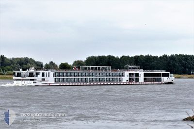
VIKING BESTLA
Passenger
Current Trip
| Time Travelled | 3 days |
|---|---|
| Remaining Time | --- |
| Distance Travelled | 186.45 nm |
| Remaining Distance | --- |
| AVG Speed | 6.2 Knots |
| MAX Speed | 10.1 Knots |
| AVG Wind | 5 knots |
| MAX Wind | 10.2 knots |
| MIN Temp | 1.9°C / 35.42°F |
| MAX Temp | 9.8°C / 49.64°F |
| Dybgang | 1.8 m |
| Position Modtaget | 18 h, 17 m siden |
Current Position
| Longitude | 7.90033° |
|---|---|
| Latitude | 48.67365° |
| Status | Under way using engine |
| Fart | 9.4 Knots |
| Kurs | 195.4° |
| Område | North Sea |
| Station | T-AIS |
| Position Modtaget | 18 h, 17 m siden |
Info
Information
The current position of VIKING BESTLA is in North Sea with coordinates 48.67365° / 7.90033° as reported on 2024-04-26 06:12 by AIS to our vessel tracker app. The vessel's current speed is 9.4 Knots
The vessel VIKING BESTLA (IMO: 7001988, MMSI: 269057467) is a Passenger It's sailing under the flag of [CH] Switzerland.
In this page you can find informations about the vessels current position, last detected port calls, and current voyage information. If the vessels is not in coverage by AIS you will find the latest position.
The current position of VIKING BESTLA is detected by our AIS receivers and we are not responsible for the reliability of the data. The last position was recorded while the vessel was in Coverage by the Ais receivers of our vessel tracking app.
The current draught of VIKING BESTLA as reported by AIS is 1.8 meters
Weather
| Temperature | 5.7°C / 42.26°F |
|---|---|
| Wind Speed | 5 knots |
| Direction | 214° SW |
| Pressure | 1007.2 hPa |
| Humidity | 86.5 % |
| Cloud Coverage | 89 % |
Featured Company
Last Port Calls
| Port | Arrival | Departure | Time In Port |
|---|---|---|---|
| 2024-04-23 09:45 | 2024-04-23 21:34 | 11 h | |
| 2024-04-22 01:18 | 2024-04-22 01:42 | 23 m | |
| 2024-04-20 03:14 | 2024-04-21 22:36 | 1 d | |
| 2024-04-19 22:31 | 2024-04-19 22:59 | 27 m | |
| 2024-04-19 09:56 |
Last Trips
| Origin | Departure | Destination | Arrival | Distance | |
|---|---|---|---|---|---|
| 2024-04-22 03:42 | 2024-04-23 11:45 | 177.48 nm | |||
| 2024-04-22 00:36 | 2024-04-22 03:18 | 23.67 nm | |||
| 2024-04-20 00:59 | 2024-04-20 05:14 | 35.33 nm | |||
| 2024-04-19 11:56 | 2024-04-20 00:31 | 119.74 nm |
Events
| Tid | Hændelsen | Detaljer | Position / Dest | Info |
|---|---|---|---|---|
| 2024-04-26 06:12 | Udenfor Dækning |
48.67365 / 7.90033
North Sea
BASEL
|
Fart: 9.4 kn Kurs: 195.4° |
|
| 2024-04-26 06:12 | Indenfor Dækning |
48.67365 / 7.90033
North Sea
BASEL
|
Fart: 9.4 kn Kurs: 195.4° |
|
| 2024-04-26 04:57 | Udenfor Dækning |
48.75862 / 7.97403
North Sea
BASEL
|
Fart: 7.9 kn Kurs: 235.7° |
|
| 2024-04-26 04:04 | START Sejllads | 5.54 nm, South of MUNCHHAUSEN |
48.82870 / 8.11202
BASEL
|
Fart: 3.4 kn Kurs: 190° |
| 2024-04-26 03:53 | STOP Sejllads | 5.42 nm, South of MUNCHHAUSEN |
48.83065 / 8.11261
BASEL
|
Fart: Kurs: 191° |
| 2024-04-25 17:31 | Indenfor Dækning |
49.59003 / 8.41775
North Sea
BASEL
|
Fart: 7.3 kn Kurs: 147.6° |
|
| 2024-04-24 21:33 | Udenfor Dækning |
49.71151 / 8.39640
North Sea
BASEL
|
Fart: 7.1 kn Kurs: 251.2° |
|
| 2024-04-24 15:55 | Indenfor Dækning |
49.97205 / 7.90296
North Sea
BASEL
|
Fart: 7.3 kn Kurs: 86.7° |
|
| 2024-04-24 02:55 | Udenfor Dækning |
50.47870 / 7.34227
North Sea
BASEL
|
Fart: 6.3 kn Kurs: 145.9° |
|
| 2024-04-23 21:34 | Afsejlet fra sidste havn |
|
50.89470 / 7.01387
BASEL
|
Fart: 6.1 kn Kurs: 90° |