
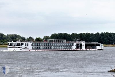
VIKING BESTLA
Passenger
Current Trip
| Time Travelled | 1 day |
|---|---|
| Remaining Time | --- |
| Distance Travelled | 109.62 nm |
| Remaining Distance | --- |
| AVG Speed | 6.6 Noeuds |
| MAX Speed | 8.2 Noeuds |
| AVG Wind | 6.3 knots |
| MAX Wind | 10.2 knots |
| MIN Temp | 2°C / 35.6°F |
| MAX Temp | 7.7°C / 45.86°F |
| Tirant d eau | 1.8 m |
| Position reçue | 15 h, 1 m depuis |
Current Position
| Longitude | 8.39640° |
|---|---|
| Latitude | 49.71151° |
| Etat | Under way using engine |
| Vitesse | 7.1 Noeuds |
| Parcours | 251.2° |
| Zone | North Sea |
| Station | T-AIS |
| Position reçue | 15 h, 1 m depuis |
Info
Information
The current position of VIKING BESTLA is in North Sea with coordinates 49.71151° / 8.39640° as reported on 2024-04-24 21:33 by AIS to our vessel tracker app. The vessel's current speed is 7.1 Noeuds and is heading at the port of BASEL. The estimated time of arrival as calculated by MyShipTracking vessel tracking app is 2024-04-28 06:00 LT
The vessel VIKING BESTLA (IMO: 7001988, MMSI: 269057467) is a Passenger It's sailing under the flag of [CH] Switzerland.
In this page you can find informations about the vessels current position, last detected port calls, and current voyage information. If the vessels is not in coverage by AIS you will find the latest position.
The current position of VIKING BESTLA is detected by our AIS receivers and we are not responsible for the reliability of the data. The last position was recorded while the vessel was in Coverage by the Ais receivers of our vessel tracking app.
The current draught of VIKING BESTLA as reported by AIS is 1.8 meters
Weather
| Temperature | 4.5°C / 40.1°F |
|---|---|
| Wind Speed | 4 knots |
| Direction | 261° W |
| Pressure | 1009.2 hPa |
| Humidity | 86.7 % |
| Cloud Coverage | 100 % |
Featured Company
Last Port Calls
| Port | Arrival | Departure | Time In Port |
|---|---|---|---|
| 2024-04-23 09:45 | 2024-04-23 21:34 | 11 h | |
| 2024-04-22 01:18 | 2024-04-22 01:42 | 23 m | |
| 2024-04-20 03:14 | 2024-04-21 22:36 | 1 d | |
| 2024-04-19 22:31 | 2024-04-19 22:59 | 27 m | |
| 2024-04-19 09:56 |
Last Trips
| Origin | Departure | Destination | Arrival | Distance | |
|---|---|---|---|---|---|
| 2024-04-22 03:42 | 2024-04-23 11:45 | 177.48 nm | |||
| 2024-04-22 00:36 | 2024-04-22 03:18 | 23.67 nm | |||
| 2024-04-20 00:59 | 2024-04-20 05:14 | 35.33 nm | |||
| 2024-04-19 11:56 | 2024-04-20 00:31 | 119.74 nm |
Events
| Heure | Evenement | Détails | Position/ Destination | Info |
|---|---|---|---|---|
| 2024-04-24 21:33 | Hors de la zone couverte |
49.71151 / 8.39640
North Sea
BASEL
|
Vitesse: 7.1 kn Parcours: 251.2° |
|
| 2024-04-24 15:55 | Dans la zone couverte |
49.97205 / 7.90296
North Sea
BASEL
|
Vitesse: 7.3 kn Parcours: 86.7° |
|
| 2024-04-24 02:55 | Hors de la zone couverte |
50.47870 / 7.34227
North Sea
BASEL
|
Vitesse: 6.3 kn Parcours: 145.9° |
|
| 2024-04-23 21:34 | PORT DE DEPART |
|
50.89470 / 7.01387
BASEL
|
Vitesse: 6.1 kn Parcours: 90° |
| 2024-04-23 20:56 | Démarrage |
50.94083 / 6.96601
[DE] KOELN
|
Vitesse: 5.5 kn Parcours: 183° |
|
| 2024-04-23 20:16 | Etat Changé | Under way using engine Moored |
50.94259 / 6.96828
[DE] KOELN
|
Vitesse: Parcours: 190° |
| 2024-04-23 10:26 | Etat Changé | Moored Under way using engine |
50.94260 / 6.96827
[DE] KOELN
|
Vitesse: Parcours: 190° |
| 2024-04-23 09:46 | Arret |
50.94262 / 6.96821
[DE] KOELN
|
Vitesse: 0.3 kn Parcours: 189° |
|
| 2024-04-23 09:45 | Port d'arrivée |
|
50.94264 / 6.96821
[DE] KOELN
|
Vitesse: 0.6 kn Parcours: 189° |
| 2024-04-22 22:45 | Dans la zone couverte |
51.65935 / 6.58140
North Sea
BASEL
|
Vitesse: 6.7 kn Parcours: 96.6° |