
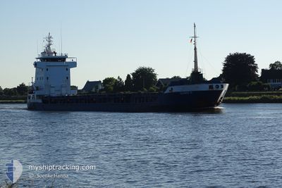
ULRIKE G
General Cargo
Current Trip
| Time Travelled | 6 days |
|---|---|
| Remaining Time | 11 days |
| Distance Travelled | 1185.14 nm |
| Remaining Distance | 2345.90 nm |
| AVG Speed | 8.2 Knots |
| MAX Speed | 11.6 Knots |
| AVG Wind | 9.1 knots |
| MAX Wind | 24 knots |
| MIN Temp | 15.2°C / 59.36°F |
| MAX Temp | 21.6°C / 70.88°F |
| Dybgang | 3.8 m |
| Position Modtaget | 16 h, 30 m siden |
Current Position
| Longitude | 11.48343° |
|---|---|
| Latitude | 37.59343° |
| Status | Under way using engine |
| Fart | 9 Knots |
| Kurs | 273.5° |
| Område | Mediterranean Sea - Western Basin |
| Station | T-AIS |
| Position Modtaget | 16 h, 30 m siden |
Info
Information
The current position of ULRIKE G is in Mediterranean Sea - Western Basin with coordinates 37.59343° / 11.48343° as reported on 2024-04-30 01:41 by AIS to our vessel tracker app. The vessel's current speed is 9 Knots and is heading at the port of HAMBURG. The estimated time of arrival as calculated by MyShipTracking vessel tracking app is 2024-05-11 18:13 LT
The vessel ULRIKE G (IMO: 9156113, MMSI: 304407000) is a General Cargo that was built in 2002 ( 22 år gamle ). It's sailing under the flag of [AG] Antigua Barbuda.
In this page you can find informations about the vessels current position, last detected port calls, and current voyage information. If the vessels is not in coverage by AIS you will find the latest position.
The current position of ULRIKE G is detected by our AIS receivers and we are not responsible for the reliability of the data. The last position was recorded while the vessel was in Coverage by the Ais receivers of our vessel tracking app.
The current draught of ULRIKE G as reported by AIS is 3.8 meters
Weather
| Temperature | 16.7°C / 62.06°F |
|---|---|
| Wind Speed | 14 knots |
| Direction | 252° WSW |
| Pressure | 1008.6 hPa |
| Humidity | 91.1 % |
| Cloud Coverage | 85 % |
Featured Company
Last Port Calls
| Port | Arrival | Departure | Time In Port |
|---|---|---|---|
| 2024-04-24 01:58 | 2024-04-24 12:01 | 10 h | |
| 2024-04-21 01:59 | 2024-04-22 22:13 | 1 d | |
| 2024-04-16 19:28 | 2024-04-17 02:17 | 6 h | |
| 2024-04-12 05:20 | 2024-04-12 09:58 | 4 h | |
| 2024-03-27 23:00 | 2024-03-27 23:34 | 33 m | |
| 2024-03-26 06:29 | 2024-03-26 14:28 | 7 h | |
| 2024-03-24 21:10 | 2024-03-24 21:14 | 4 m | |
| 2024-03-20 10:07 | 2024-03-22 20:59 | 2 d | |
| 2024-03-02 18:03 | 2024-03-05 07:19 | 2 d | |
| 2024-02-28 20:38 | 2024-03-02 16:26 | 2 d |
Last Trips
| Origin | Departure | Destination | Arrival | Distance | |
|---|---|---|---|---|---|
| 2024-04-23 01:13 | 2024-04-24 04:58 | 57.32 nm | |||
| 2024-04-17 05:17 | 2024-04-21 04:59 | 881.62 nm | |||
| 2024-04-12 11:58 | 2024-04-16 22:28 | 1079.46 nm | |||
| 2024-03-28 00:34 | 2024-04-12 07:20 | 3092.47 nm | |||
| 2024-03-26 15:28 | 2024-03-28 00:00 | 354.51 nm | |||
| 2024-03-24 22:14 | 2024-03-26 07:29 | 351.27 nm | |||
| 2024-03-22 21:59 | 2024-03-24 22:10 | 389.88 nm | |||
| 2024-03-05 10:19 | 2024-03-20 11:07 | 3254.68 nm | |||
| 2024-03-02 19:26 | 2024-03-02 21:03 | 17.24 nm | |||
| 2024-02-24 13:44 | 2024-02-28 23:38 | 826.84 nm |
Events
| Tid | Hændelsen | Detaljer | Position / Dest | Info |
|---|---|---|---|---|
| 2024-04-30 01:55 | Status er ændret | Default Under way using engine |
37.59606 / 11.43916
HAMBURG
|
Fart: 9 kn Kurs: 273.5° |
| 2024-04-30 01:41 | Udenfor Dækning |
37.59343 / 11.48343
Mediterranean Sea - Western Basin
HAMBURG
|
Fart: 9 kn Kurs: 273.5° |
|
| 2024-04-29 22:55 | Fundet i havområde | Italian part of the Mediterranean Sea - Western Basin |
37.57295 / 11.98364
Mediterranean Sea - Western Basin
HAMBURG
|
Fart: 8.7 kn Kurs: 272.1° |
| 2024-04-29 22:39 | Status er ændret | Under way using engine Default |
37.57164 / 12.03153
HAMBURG
|
Fart: 8.2 kn Kurs: 273° |
| 2024-04-29 22:19 | Status er ændret | Default Under way using engine |
37.56958 / 12.09122
HAMBURG
|
Fart: 8.2 kn Kurs: 270.1° |
| 2024-04-29 21:44 | Status er ændret | Under way using engine Default |
37.56592 / 12.19609
HAMBURG
|
Fart: 8.4 kn Kurs: 271° |
| 2024-04-29 21:20 | Status er ændret | Default Under way using engine |
37.56276 / 12.26840
HAMBURG
|
Fart: 8.7 kn Kurs: 272.1° |
| 2024-04-29 20:28 | Status er ændret | Under way using engine Default |
37.55453 / 12.42260
HAMBURG
|
Fart: 8.5 kn Kurs: 276° |
| 2024-04-29 20:16 | Indenfor Dækning |
37.55453 / 12.42260
Mediterranean Sea - Eastern Basin
HAMBURG
|
Fart: 8.8 kn Kurs: 275.8° |
|
| 2024-04-29 14:29 | Udenfor Dækning |
37.18763 / 13.43216
Mediterranean Sea - Eastern Basin
HAMBURG
|
Fart: 9.2 kn Kurs: 297.3° |