
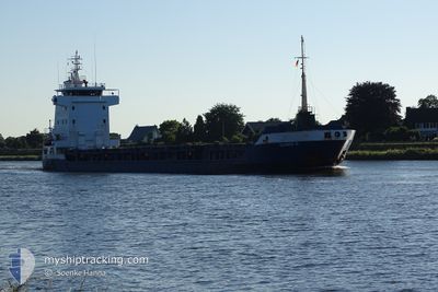
ULRIKE G
General Cargo
Current Trip
| Time Travelled | 3 days |
|---|---|
| Remaining Time | 9 h, 20 mins |
| Distance Travelled | 797.43 nm |
| Remaining Distance | 84.58 nm |
| AVG Speed | 11.2 Knots |
| MAX Speed | 11.2 Knots |
| AVG Wind | 10.8 knots |
| MAX Wind | 35 knots |
| MIN Temp | 7.8°C / 46.04°F |
| MAX Temp | 21.7°C / 71.06°F |
| Draught | 3.8 m |
| Position Received | 1 m ago |
Current Position
| Longitude | 27.40764° |
|---|---|
| Latitude | 40.63781° |
| Status | Under way using engine |
| Speed | 9 Knots |
| Course | 70.8° |
| Area | Sea of Marmara |
| Station | T-AIS |
| Position Received | 1 m ago |
Info
Information
The current position of ULRIKE G is in Sea of Marmara with coordinates 40.63781° / 27.40764° as reported on 2024-04-20 16:16 by AIS to our vessel tracker app. The vessel's current speed is 9 Knots and is heading at the port of GEMLIK. The estimated time of arrival as calculated by MyShipTracking vessel tracking app is 2024-04-21 01:37 LT
The vessel ULRIKE G (IMO: 9156113, MMSI: 304407000) is a General Cargo that was built in 2002 ( 22 years old ). It's sailing under the flag of [AG] Antigua Barbuda.
In this page you can find informations about the vessels current position, last detected port calls, and current voyage information. If the vessels is not in coverage by AIS you will find the latest position.
The current position of ULRIKE G is detected by our AIS receivers and we are not responsible for the reliability of the data. The last position was recorded while the vessel was in Coverage by the Ais receivers of our vessel tracking app.
The current draught of ULRIKE G as reported by AIS is 3.8 meters
Weather
| Temperature | 10.6°C / 51.08°F |
|---|---|
| Wind Speed | 21 knots |
| Direction | 338° NNW |
| Pressure | 1007.7 hPa |
| Humidity | 83 % |
| Cloud Coverage | 100 % |
Featured Company
Last Port Calls
| Port | Arrival | Departure | Time In Port |
|---|---|---|---|
| 2024-04-16 19:28 | 2024-04-17 02:17 | 6 h | |
| 2024-04-12 05:20 | 2024-04-12 09:58 | 4 h | |
| 2024-03-27 23:00 | 2024-03-27 23:34 | 33 m | |
| 2024-03-26 06:29 | 2024-03-26 14:28 | 7 h | |
| 2024-03-24 21:10 | 2024-03-24 21:14 | 4 m | |
| 2024-03-20 10:07 | 2024-03-22 20:59 | 2 d | |
| 2024-03-02 18:03 | 2024-03-05 07:19 | 2 d | |
| 2024-02-28 20:38 | 2024-03-02 16:26 | 2 d | |
| 2024-02-09 19:27 | 2024-02-24 12:44 | 14 d | |
| 2024-02-05 06:13 | 2024-02-05 16:27 | 10 h |
Last Trips
| Origin | Departure | Destination | Arrival | Distance | |
|---|---|---|---|---|---|
| 2024-04-12 11:58 | 2024-04-16 22:28 | 1079.46 nm | |||
| 2024-03-28 00:34 | 2024-04-12 07:20 | 3092.47 nm | |||
| 2024-03-26 15:28 | 2024-03-28 00:00 | 354.51 nm | |||
| 2024-03-24 22:14 | 2024-03-26 07:29 | 351.27 nm | |||
| 2024-03-22 21:59 | 2024-03-24 22:10 | 389.88 nm | |||
| 2024-03-05 10:19 | 2024-03-20 11:07 | 3254.68 nm | |||
| 2024-03-02 19:26 | 2024-03-02 21:03 | 17.24 nm | |||
| 2024-02-24 13:44 | 2024-02-28 23:38 | 826.84 nm | |||
| 2024-02-05 17:27 | 2024-02-09 20:27 | 660.08 nm | |||
| 2024-01-30 21:19 | 2024-02-05 07:13 | 1097.59 nm |
Events
| Time | Event | Details | Position / Dest | Info |
|---|---|---|---|---|
| 2024-04-20 15:44 | Status Changed | Under way using engine Default |
40.60802 / 27.30971
GEMLIK
|
Speed: 8.6 kn Course: 63° |
| 2024-04-20 14:51 | Status Changed | Default Under way using engine |
40.55433 / 27.15708
GEMLIK
|
Speed: 9 kn Course: 69.2° |
| 2024-04-20 14:34 | Status Changed | Under way using engine Default |
40.53952 / 27.10823
GEMLIK
|
Speed: 8.5 kn Course: 68° |
| 2024-04-20 14:29 | Status Changed | Default Under way using engine |
40.53439 / 27.09100
GEMLIK
|
Speed: 8.5 kn Course: 67.3° |
| 2024-04-20 14:27 | Status Changed | Under way using engine Default |
40.53290 / 27.08618
GEMLIK
|
Speed: 8.9 kn Course: 68° |
| 2024-04-20 14:27 | IN Coverage |
40.53378 / 27.08903
Sea of Marmara
GEMLIK
|
Speed: 8.5 kn Course: 67.3° |
|
| 2024-04-20 11:31 | Status Changed | Default Under way using engine |
40.32092 / 26.62089
GEMLIK
|
Speed: 8.4 kn Course: 47.9° |
| 2024-04-20 11:14 | OUT of Coverage |
40.29353 / 26.57988
Sea of Marmara
GEMLIK
|
Speed: 8.4 kn Course: 47.9° |
|
| 2024-04-20 08:25 | Change Sea Area | Turkish part of the Sea of Marmara Turkish part of the Aegean Sea |
40.02816 / 26.25998
Sea of Marmara
GEMLIK
|
Speed: 9.2 kn Course: 66.2° |
| 2024-04-20 08:24 | Status Changed | Under way using engine Default |
40.02745 / 26.25789
GEMLIK
|
Speed: 8.5 kn Course: 86° |