
TIM
General Cargo
Current Trip
| Time Travelled | 1 day |
|---|---|
| Remaining Time | --- |
| Distance Travelled | 290.76 nm |
| Remaining Distance | --- |
| AVG Speed | 10.4 Knots |
| MAX Speed | 12.9 Knots |
| AVG Wind | 8.1 knots |
| MAX Wind | 13 knots |
| MIN Temp | 6°C / 42.8°F |
| MAX Temp | 8.4°C / 47.12°F |
| Dybgang | 3.8 m |
| Position Modtaget | 11 h, 17 m siden |
Current Position
| Longitude | -6.93656° |
|---|---|
| Latitude | 55.76644° |
| Status | Under way using engine |
| Fart | 11.7 Knots |
| Kurs | 329.1° |
| Område | Inner Seas off the West Coast of Scotland |
| Station | T-AIS |
| Position Modtaget | 11 h, 17 m siden |
Info
Information
The current position of TIM is in Inner Seas off the West Coast of Scotland with coordinates 55.76644° / -6.93656° as reported on 2024-04-26 14:04 by AIS to our vessel tracker app. The vessel's current speed is 11.7 Knots and is heading at the port of FLOTTA. The estimated time of arrival as calculated by MyShipTracking vessel tracking app is 2024-04-27 17:00 LT
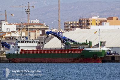
The vessel TIM (IMO: 9434151, MMSI: 212571000) is a General Cargo that was built in 2008 ( 16 år gamle ). It's sailing under the flag of [CY] Cyprus.
In this page you can find informations about the vessels current position, last detected port calls, and current voyage information. If the vessels is not in coverage by AIS you will find the latest position.
The current position of TIM is detected by our AIS receivers and we are not responsible for the reliability of the data. The last position was recorded while the vessel was in Coverage by the Ais receivers of our vessel tracking app.
The current draught of TIM as reported by AIS is 3.8 meters
Weather
| Temperature | 6.6°C / 43.88°F |
|---|---|
| Wind Speed | 6 knots |
| Direction | 342° NNW |
| Pressure | 1007 hPa |
| Humidity | 79.3 % |
| Cloud Coverage | 100 % |
Featured Company
Last Port Calls
| Port | Arrival | Departure | Time In Port |
|---|---|---|---|
| 2024-04-24 23:38 | 2024-04-25 22:43 | 23 h | |
| 2024-04-22 16:56 | 2024-04-22 17:05 | 8 m | |
| 2024-04-15 00:00 | 2024-04-18 13:13 | 3 d | |
| 2024-04-14 10:22 | 2024-04-14 18:52 | 8 h | |
| 2024-04-12 14:49 | 2024-04-12 18:10 | 3 h | |
| 2024-04-12 05:13 | 2024-04-12 05:52 | 38 m | |
| 2024-04-07 05:36 | 2024-04-10 11:17 | 3 d | |
| 2024-02-28 07:29 | 2024-03-07 11:43 | 8 d | |
| 2024-02-25 11:27 | 2024-02-26 16:07 | 1 d | |
| 2024-02-21 16:29 | 2024-02-23 21:06 | 2 d |
Last Trips
| Origin | Departure | Destination | Arrival | Distance | |
|---|---|---|---|---|---|
| 2024-04-22 18:05 | 2024-04-25 00:38 | 320.96 nm | |||
| 2024-04-18 14:13 | 2024-04-22 17:56 | 485.40 nm | |||
| 2024-04-14 19:52 | 2024-04-15 01:00 | 30.28 nm | |||
| 2024-04-12 20:10 | 2024-04-14 11:22 | 372.13 nm | |||
| 2024-04-12 07:52 | 2024-04-12 16:49 | 50.18 nm | |||
| 2024-04-10 14:17 | 2024-04-12 07:13 | 407.46 nm | |||
| 2024-03-07 12:43 | 2024-04-07 08:36 | 2676.27 nm | |||
| 2024-02-26 17:07 | 2024-02-28 08:29 | 358.65 nm | |||
| 2024-02-23 22:06 | 2024-02-25 12:27 | 353.21 nm | |||
| 2024-02-16 22:53 | 2024-02-21 17:29 | 1128.02 nm |
Events
| Tid | Hændelsen | Detaljer | Position / Dest | Info |
|---|---|---|---|---|
| 2024-04-26 14:10 | Status er ændret | Default Under way using engine |
55.78516 / -6.95617
GBFLH
|
Fart: 11.7 kn Kurs: 329.1° |
| 2024-04-26 14:04 | Udenfor Dækning |
55.76644 / -6.93656
Inner Seas off the West Coast of Scotland
GBFLH
|
Fart: 11.7 kn Kurs: 329.1° |
|
| 2024-04-26 08:35 | Status er ændret | Under way using engine Default |
55.22330 / -5.81983
GBFLH
|
Fart: 8.5 kn Kurs: 331° |
| 2024-04-26 08:34 | Status er ændret | Default Under way using engine |
55.22238 / -5.81900
GBFLH
|
Fart: 8.7 kn Kurs: 330.9° |
| 2024-04-26 08:26 | Status er ændret | Under way using engine Default |
55.20319 / -5.79987
GBFLH
|
Fart: 8.8 kn Kurs: 330° |
| 2024-04-26 08:06 | Indenfor Dækning |
55.20319 / -5.79987
Inner Seas off the West Coast of Scotland
GBFLH
|
Fart: 8.8 kn Kurs: 328.8° |
|
| 2024-04-26 06:11 | Status er ændret | Default Under way using engine |
54.86965 / -5.49498
GBFLH
|
Fart: 12.1 kn Kurs: 332.5° |
| 2024-04-26 06:04 | Udenfor Dækning |
54.84893 / -5.47548
Inner Seas off the West Coast of Scotland
GBFLH
|
Fart: 12.1 kn Kurs: 332.5° |
|
| 2024-04-26 04:07 | Ændre havområde | United Kingdom part of the Inner Seas off the West Coast of Scotland United Kingdom part of the Irish Sea and St. George's Channel |
54.45842 / -5.29495
Inner Seas off the West Coast of Scotland
GBFLH
|
Fart: 12.3 kn Kurs: 354.5° |
| 2024-04-26 01:59 | Status er ændret | Under way using engine Default |
54.08396 / -5.59323
GBFLH
|
Fart: 11.4 kn Kurs: 34° |