
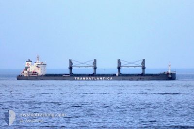
TAC ODESSA
Cargo
Current Trip
| Trip Time | 3 days |
|---|---|
| Trip Distance | 632.62 nm |
| AVG Speed | 9 Knots |
| MAX Speed | 11.4 Knots |
| Dybgang | 10.8 m |
| AVG Wind | 11 knots |
| MAX Wind | 23.3 knots |
| MIN Temp | 20.2°C / 68.36°F |
| MAX Temp | 27.9°C / 82.22°F |
| Position Modtaget | 2 d siden |
Current Position
| Longitude | --- |
|---|---|
| Latitude | --- |
| Status | Under way using engine |
| Fart | 5.9 Knots |
| Kurs | 272.1° |
| Område | South Atlantic Ocean |
| Station | T-AIS |
| Position Modtaget | 2 d siden |
Info
Information
The current position of TAC ODESSA is in South Atlantic Ocean with coordinates -26.19501° / -48.38582° as reported on 2026-01-03 03:50 by AIS to our vessel tracker app. The vessel's current speed is 5.9 Knots and is currently inside the port of SAO FRANCISCO DO SUL.
The vessel TAC ODESSA (IMO: 9880116, MMSI: 370302000) is a Cargo It's sailing under the flag of [PA] Panama.
In this page you can find informations about the vessels current position, last detected port calls, and current voyage information. If the vessels is not in coverage by AIS you will find the latest position.
The current position of TAC ODESSA is detected by our AIS receivers and we are not responsible for the reliability of the data. The last position was recorded while the vessel was in Coverage by the Ais receivers of our vessel tracking app.
The current draught of TAC ODESSA as reported by AIS is 10.8 meters
Weather
| Temperature | 22.4°C / 72.32°F |
|---|---|
| Wind Speed | 4 knots |
| Direction | 82° E |
| Pressure | 1016.9 hPa |
| Humidity | 62.2 % |
| Cloud Coverage | 100 % |
Featured Company
Last Port Calls
| Port | Arrival | Departure | Time In Port |
|---|---|---|---|
| 2026-01-03 03:13 | |||
| 2025-12-28 01:48 | 2025-12-31 02:32 | 3 d | |
| 2025-12-17 19:49 | 2025-12-21 02:51 | 3 d | |
| 2025-12-11 11:45 | 2025-12-12 20:51 | 1 d | |
| 2025-12-06 20:12 | 2025-12-09 14:55 | 2 d | |
| 2025-11-27 20:48 | 2025-11-29 13:26 | 1 d | |
| 2025-11-24 17:42 | 2025-11-27 18:26 | 3 d | |
| 2025-11-13 07:23 | 2025-11-17 21:00 | 4 d | |
| 2025-11-05 14:29 | 2025-11-09 22:37 | 4 d |
Most Visited Ports (Last year)
| Port | Arrivals | |
|---|---|---|
| 24 | ||
| 23 |
Last Trips
| Origin | Departure | Destination | Arrival | Distance | |
|---|---|---|---|---|---|
| 2025-12-31 02:32 | 2026-01-03 03:13 | 632.62 nm | |||
| 2025-12-21 02:51 | 2025-12-28 01:48 | 637.78 nm | |||
| 2025-12-12 20:51 | 2025-12-17 19:49 | 677.85 nm | |||
| 2025-12-09 14:55 | 2025-12-11 11:45 | 9.34 nm | |||
| 2025-11-29 13:26 | 2025-12-06 20:12 | 638.25 nm | |||
| 2025-11-27 18:26 | 2025-11-27 20:48 | 4.00 nm | |||
| 2025-11-17 21:00 | 2025-11-24 17:42 | 632.93 nm | |||
| 2025-11-09 22:37 | 2025-11-13 07:23 | 626.53 nm | |||
| 2025-10-30 18:58 | 2025-11-05 14:29 | 636.42 nm |
Events
| Tid | Hændelsen | Detaljer | Position / Dest | Info |
|---|---|---|---|---|
| 2026-01-03 06:22 | STOP Sejllads |
-26.23682 / -48.63982
[BR] SAO FRANCISCO DO SUL
|
Fart: 0.3 kn Kurs: 138° |
|
| 2026-01-03 06:13 | Skibe i havn |
|
-26.23615 / -48.64095
[BR] SAO FRANCISCO DO SUL
|
Fart: 0.9 kn Kurs: 130° |
| 2026-01-03 03:57 | Status er ændret | Default Under way using engine |
-26.19572 / -48.40327
BRSFS
|
Fart: 5.9 kn Kurs: 272.1° |
| 2026-01-03 03:50 | Udenfor Dækning |
-26.19501 / -48.38582
South Atlantic Ocean
BRSFS
|
Fart: 5.9 kn Kurs: 272.1° |
|
| 2026-01-03 03:35 | Status er ændret | Under way using engine Default |
-26.19709 / -48.36048
BRSFS
|
Fart: 7.5 kn Kurs: 280° |
| 2026-01-03 03:17 | Status er ændret | Default Under way using engine |
-26.19993 / -48.31933
BRSFS
|
Fart: 6.3 kn Kurs: 264.6° |
| 2026-01-03 03:07 | Status er ændret | Under way using engine Default |
-26.19826 / -48.29854
BRSFS
|
Fart: 8.4 kn Kurs: 264° |
| 2026-01-03 03:04 | Status er ændret | Default Under way using engine |
-26.19775 / -48.29180
BRSFS
|
Fart: 9.1 kn Kurs: 264.1° |
| 2026-01-03 02:42 | Status er ændret | Under way using engine Default |
-26.19469 / -48.24422
BRSFS
|
Fart: 9.4 kn Kurs: 263° |
| 2026-01-03 02:00 | Status er ændret | Default Under way using engine |
-26.19477 / -48.12394
BRSFS
|
Fart: 9.5 kn Kurs: 269.2° |