

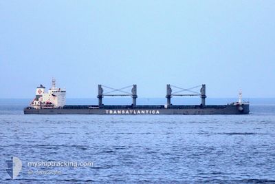
TAC ODESSA
Cargo

Current Trip
BR PRM
| Time Travelled | 1 day |
|---|---|
| Remaining Time | --- |
| Distance Travelled | 269.95 nm |
| Remaining Distance | --- |
| AVG Speed | 11 Knots |
| MAX Speed | 11.9 Knots |
| AVG Wind | 6.2 knots |
| MAX Wind | 10 knots |
| MIN Temp | 19.1°C / 66.38°F |
| MAX Temp | 26.4°C / 79.52°F |
| Draught | 6.8 m |
| Position Received | 14 d ago |
Current Position
| Longitude | --- |
|---|---|
| Latitude | --- |
| Status | Under way using engine |
| Speed | 11 Knots |
| Course | 75.4° |
| Area | South Atlantic Ocean |
| Station | T-AIS |
| Position Received | 14 d ago |
Information
The current position of TAC ODESSA is in South Atlantic Ocean with coordinates -26.11725° / -47.90355° as reported on 2025-03-03 23:11 by AIS to our vessel tracker app. The vessel's current speed is 11 Knots
The vessel TAC ODESSA (IMO: 9880116, MMSI: 370302000) is a Cargo It's sailing under the flag of [PA] Panama.
In this page you can find informations about the vessels current position, last detected port calls, and current voyage information. If the vessels is not in coverage by AIS you will find the latest position.
The current position of TAC ODESSA is detected by our AIS receivers and we are not responsible for the reliability of the data. The last position was recorded while the vessel was in Coverage by the Ais receivers of our vessel tracking app.
The current draught of TAC ODESSA as reported by AIS is 6.8 meters
Weather
| Temperature | 26.4°C / 79.52°F |
|---|---|
| Wind Speed | 8 knots |
| Direction | 49° NE |
| Pressure | 1014.2 hPa |
| Humidity | 74 % |
| Cloud Coverage | 6 % |


Featured Company
Last Port Calls
| Port | Arrival | Departure | Time In Port |
|---|---|---|---|
| 2025-03-13 08:29 | 2025-03-17 01:48 | 3 d | |
| 2025-03-08 05:38 | 2025-03-10 14:35 | 2 d | |
| 2025-02-27 15:09 | 2025-03-03 15:58 | 4 d | |
| 2025-02-19 10:14 | 2025-02-24 17:31 | 5 d | |
| 2025-02-12 14:29 | 2025-02-16 10:20 | 3 d | |
| 2025-02-07 14:31 | 2025-02-09 21:42 | 2 d | |
| 2025-01-29 23:08 | 2025-02-02 23:45 | 4 d | |
| 2025-01-21 05:33 | 2025-01-24 20:34 | 3 d | |
| 2025-01-09 10:27 | 2025-01-13 19:47 | 4 d | |
| 2025-01-04 04:21 | 2025-01-06 18:09 | 2 d |
Most Visited Ports (Last year)
| Port | Arrivals | |
|---|---|---|
| 14 | ||
| 13 | ||
| 1 | ||
| 1 | ||
| 1 | ||
| 1 |
Last Trips
| Origin | Departure | Destination | Arrival | Distance | |
|---|---|---|---|---|---|
| 2025-03-10 14:35 | 2025-03-13 08:29 | 629.03 nm | |||
| 2025-03-03 15:58 | 2025-03-08 05:38 | 631.94 nm | |||
| 2025-02-24 17:31 | 2025-02-27 15:09 | 631.51 nm | |||
| 2025-02-16 10:20 | 2025-02-19 10:14 | 632.01 nm | |||
| 2025-02-09 21:42 | 2025-02-12 14:29 | 630.38 nm | |||
| 2025-02-02 23:45 | 2025-02-07 14:31 | 673.17 nm | |||
| 2025-01-24 20:34 | 2025-01-29 23:08 | 633.91 nm | |||
| 2025-01-13 19:47 | 2025-01-21 05:33 | 638.66 nm | |||
| 2025-01-06 18:09 | 2025-01-09 10:27 | 629.53 nm | |||
| 2025-01-01 17:13 | 2025-01-04 04:21 | 627.29 nm |
Events
| Time | Event | Details | Position / Dest | Info |
|---|---|---|---|---|
| 2025-03-17 04:57 | START Moving | 0.34 nm, North West of SAO FRANCISCO DO SUL |
-26.22814 / -48.64313
BR PRM
|
Speed: 4.8 kn Course: 26° |
| 2025-03-17 04:48 | PORT DEPARTURE |
|
-26.23223 / -48.64171
BR PRM
|
Speed: 2.6 kn Course: 142° |
| 2025-03-13 11:30 | STOP Moving |
-26.23635 / -48.63914
[BR] SAO FRANCISCO DO SUL
|
Speed: 0.2 kn Course: 139° |
|
| 2025-03-13 11:29 | PORT ARRIVAL |
|
-26.23635 / -48.63914
[BR] SAO FRANCISCO DO SUL
|
Speed: 2 kn Course: 137° |
| 2025-03-13 08:46 | START Moving | 13.94 nm, East of ITAPOA |
-26.20263 / -48.34525
BR PRM
|
Speed: 3.4 kn Course: 273° |
| 2025-03-13 05:48 | STOP Moving | 14.83 nm, East of ITAPOA |
-26.18884 / -48.32818
BR PRM
|
Speed: 0.1 kn Course: 219° |
| 2025-03-10 17:35 | PORT DEPARTURE |
|
-20.30628 / -40.24148
BR PRM
|
Speed: 4.4 kn Course: 187° |
| 2025-03-10 17:31 | START Moving |
-20.29988 / -40.24242
[BR] JARDIM CAMBURI
|
Speed: 4.4 kn Course: 187° |
|
| 2025-03-08 08:59 | STOP Moving |
-20.29526 / -40.23701
[BR] JARDIM CAMBURI
|
Speed: 0.2 kn Course: 55° |
|
| 2025-03-08 08:38 | PORT ARRIVAL |
|
-20.29960 / -40.24141
[BR] JARDIM CAMBURI
|
Speed: 4.4 kn Course: 317° |