
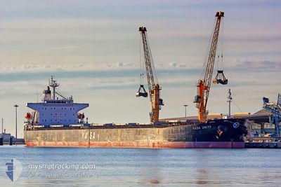
MV YASA UNITY
Bulk Carrier
Current Trip
| Time Travelled | 7 h, 46 mins |
|---|---|
| Remaining Time | --- |
| Distance Travelled | 77.79 nm |
| Remaining Distance | --- |
| AVG Speed | 12.2 Knots |
| MAX Speed | 13.3 Knots |
| AVG Wind | 17.4 knots |
| MAX Wind | 25.9 knots |
| MIN Temp | 28.5°C / 83.3°F |
| MAX Temp | 33.6°C / 92.48°F |
| Dybgang | 6.5 m |
| Position Modtaget | 8 d siden |
Current Position
| Longitude | 57.29323° |
|---|---|
| Latitude | 24.88850° |
| Status | Under way using engine |
| Fart | 12.6 Knots |
| Kurs | 124° |
| Område | Gulf of Oman |
| Station | T-AIS |
| Position Modtaget | 8 d siden |
Info
Information
The current position of MV YASA UNITY is in Gulf of Oman with coordinates 24.88850° / 57.29323° as reported on 2024-05-26 01:54 by AIS to our vessel tracker app. The vessel's current speed is 12.6 Knots and is heading at the port of SUR. The estimated time of arrival as calculated by MyShipTracking vessel tracking app is 2024-05-26 20:00 LT
The vessel MV YASA UNITY (IMO: 9296262, MMSI: 538002548) is a Bulk Carrier that was built in 2006 ( 18 år gamle ). It's sailing under the flag of [MH] Marshall Is.
In this page you can find informations about the vessels current position, last detected port calls, and current voyage information. If the vessels is not in coverage by AIS you will find the latest position.
The current position of MV YASA UNITY is detected by our AIS receivers and we are not responsible for the reliability of the data. The last position was recorded while the vessel was in Coverage by the Ais receivers of our vessel tracking app.
The current draught of MV YASA UNITY as reported by AIS is 6.5 meters
Weather
| Temperature | 28.3°C / 82.94°F |
|---|---|
| Wind Speed | 18 knots |
| Direction | 191° S |
| Pressure | 1004.7 hPa |
| Humidity | 90.2 % |
| Cloud Coverage | 16 % |
Featured Company
Last Port Calls
| Port | Arrival | Departure | Time In Port |
|---|---|---|---|
| 2024-05-29 02:59 | 2024-06-03 09:52 | 5 d | |
| 2024-05-22 04:52 | 2024-05-24 18:18 | 2 d | |
| 2024-05-07 08:41 | 2024-05-20 22:00 | 13 d | |
| 2024-04-30 08:52 | 2024-05-02 09:07 | 2 d |
Most Visited Ports (Last year)
| Port | Arrivals | |
|---|---|---|
| 2 | ||
| 2 | ||
| 2 | ||
| 1 | ||
| 1 | ||
| 1 |
Last Trips
| Origin | Departure | Destination | Arrival | Distance | |
|---|---|---|---|---|---|
| 2024-05-24 22:18 | 2024-05-29 06:59 | 720.97 nm | |||
| 2024-05-21 01:00 | 2024-05-22 08:52 | 328.00 nm | |||
| 2024-05-02 13:07 | 2024-05-07 11:41 | 640.41 nm | |||
| 2024-03-31 18:17 | 2024-04-30 12:52 | 8147.33 nm |
Events
| Tid | Hændelsen | Detaljer | Position / Dest | Info |
|---|---|---|---|---|
| 2024-06-03 09:52 | START Sejllads | 1.26 nm, East of QALHAT |
22.65887 / 59.44415
OM SUH
|
Fart: 3.9 kn Kurs: 48° |
| 2024-06-03 09:52 | Afsejlet fra sidste havn |
|
22.65887 / 59.44415
OM SUH
|
Fart: 2.7 kn Kurs: 47° |
| 2024-05-29 02:59 | STOP Sejllads |
22.65243 / 59.43688
[OM] QALHAT
|
Fart: 0.3 kn Kurs: 48° |
|
| 2024-05-29 02:59 | Skibe i havn |
|
22.65243 / 59.43688
[OM] QALHAT
|
Fart: 3.7 kn Kurs: 168° |
| 2024-05-27 11:10 | START Sejllads | 5.36 nm, North East of QALHAT |
22.73208 / 59.48040
OM SUH
|
Fart: 3.1 kn Kurs: 8° |
| 2024-05-27 08:21 | STOP Sejllads | 4.8 nm, North East of QALHAT |
22.72100 / 59.47897
OM SUH
|
Fart: 0.3 kn Kurs: 26° |
| 2024-05-26 02:01 | Status er ændret | Default Under way using engine |
24.87482 / 57.31500
OM SUH
|
Fart: 12.6 kn Kurs: 124° |
| 2024-05-26 01:54 | Udenfor Dækning |
24.88850 / 57.29323
Gulf of Oman
OM SUH
|
Fart: 12.6 kn Kurs: 124° |
|
| 2024-05-26 00:17 | Ændre havområde | Omani part of the Gulf of Oman United Arab Emirates part of the Gulf of Oman |
25.07655 / 56.97657
Gulf of Oman
OM SUH
|
Fart: 12.6 kn Kurs: 119° |
| 2024-05-25 21:59 | Dybgangen er ændret | 6.5 6.2 |
25.17738 / 56.52593
OM SUH
|
Fart: 4.7 kn Kurs: 95° |