

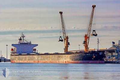
MV YASA UNITY
Bulk Carrier

Current Trip
| Time Travelled | 11 days |
|---|---|
| Remaining Time | --- |
| Distance Travelled | 2978.49 nm |
| Remaining Distance | --- |
| AVG Speed | 10.3 Noeuds |
| MAX Speed | 13.2 Noeuds |
| AVG Wind | 8 knots |
| MAX Wind | 19 knots |
| MIN Temp | 23.9°C / 75.02°F |
| MAX Temp | 30.8°C / 87.44°F |
| Tirant d eau | 14.3 m |
| Position reçue | 2 h, 58 m depuis |
Current Position
| Longitude | --- |
|---|---|
| Latitude | --- |
| Etat | At anchor |
| Vitesse | |
| Parcours | 271° |
| Zone | Bay of Bengal |
| Station | T-AIS |
| Position reçue | 2 h, 58 m depuis |
Information
The current position of MV YASA UNITY is in Bay of Bengal with coordinates 20.21717° / 86.86113° as reported on 2025-03-28 05:11 by AIS to our vessel tracker app. The vessel's current speed is 0 Noeuds
The vessel MV YASA UNITY (IMO: 9296262, MMSI: 538002548) is a Bulk Carrier that was built in 2006 ( 19 Age ). It's sailing under the flag of [MH] Marshall Is.
In this page you can find informations about the vessels current position, last detected port calls, and current voyage information. If the vessels is not in coverage by AIS you will find the latest position.
The current position of MV YASA UNITY is detected by our AIS receivers and we are not responsible for the reliability of the data. The last position was recorded while the vessel was in Coverage by the Ais receivers of our vessel tracking app.
The current draught of MV YASA UNITY as reported by AIS is 14.3 meters
Weather
| Temperature | 29.7°C / 85.46°F |
|---|---|
| Wind Speed | 16 knots |
| Direction | 192° SSW |
| Pressure | 1005.1 hPa |
| Humidity | 69.1 % |
| Cloud Coverage | 11 % |


Featured Company
Last Port Calls
Most Visited Ports (Last year)
| Port | Arrivals | |
|---|---|---|
| 2 | ||
| 2 | ||
| 2 | ||
| 2 | ||
| 1 | ||
| 1 |
Last Trips
| Origin | Departure | Destination | Arrival | Distance | |
|---|---|---|---|---|---|
| 2025-03-15 20:45 | 2025-03-15 21:17 | 1.38 nm | |||
| 2025-03-10 10:29 | 2025-03-14 00:34 | 292.84 nm | |||
| 2025-03-05 17:38 | 2025-03-08 10:30 | 605.61 nm | |||
| 2025-01-27 04:36 | 2025-02-08 09:21 | 354.07 nm | |||
| 2024-12-18 15:45 | 2025-01-26 14:59 | 9118.23 nm |
Events
| Heure | Evenement | Détails | Position/ Destination | Info |
|---|---|---|---|---|
| 2025-03-28 05:17 | Etat Changé | Default At anchor |
20.21708 / 86.86111
INPRT
|
Vitesse: Parcours: 271° |
| 2025-03-28 05:11 | Etat Changé | At anchor Default |
20.21717 / 86.86113
INPRT
|
Vitesse: Parcours: 272° |
| 2025-03-28 05:11 | Hors de la zone couverte |
20.21717 / 86.86113
Bay of Bengal
|
Vitesse: Parcours: 179° |
|
| 2025-03-28 05:02 | Etat Changé | Default At anchor |
20.21727 / 86.86118
INPRT
|
Vitesse: 0.1 kn Parcours: 269° |
| 2025-03-28 03:47 | Etat Changé | At anchor Default |
20.21845 / 86.86107
INPRT
|
Vitesse: 0.1 kn Parcours: 243° |
| 2025-03-28 03:44 | Etat Changé | Default At anchor |
20.21848 / 86.86103
INPRT
|
Vitesse: Parcours: 242° |
| 2025-03-28 02:56 | Etat Changé | At anchor Default |
20.21883 / 86.86087
INPRT
|
Vitesse: 0.1 kn Parcours: 230° |
| 2025-03-28 02:41 | Etat Changé | Default At anchor |
20.21900 / 86.86070
INPRT
|
Vitesse: Parcours: 227° |
| 2025-03-28 02:41 | Etat Changé | At anchor Default |
20.21900 / 86.86070
INPRT
|
Vitesse: Parcours: 228° |
| 2025-03-28 02:35 | Etat Changé | Default At anchor |
20.21902 / 86.86068
INPRT
|
Vitesse: Parcours: 227° |