
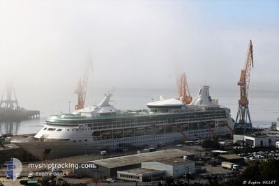
M/V RHAPSODY OTS
Passengers Ship
Current Trip
| Trip Time | 1 day |
|---|---|
| Trip Distance | 477.61 nm |
| AVG Speed | 13.4 Knots |
| MAX Speed | 14.3 Knots |
| Dybgang | 7.7 m |
| AVG Wind | 12.7 knots |
| MAX Wind | 19 knots |
| MIN Temp | 24.9°C / 76.82°F |
| MAX Temp | 28.8°C / 83.84°F |
| Position Modtaget | 2 d siden |
Current Position
| Longitude | -68.96533° |
|---|---|
| Latitude | 12.08568° |
| Status | Under way using engine |
| Fart | 6.4 Knots |
| Kurs | 39.2° |
| Område | Caribbean Sea |
| Station | T-AIS |
| Position Modtaget | 2 d siden |
Info
Information
The current position of M/V RHAPSODY OTS is in Caribbean Sea with coordinates 12.08568° / -68.96533° as reported on 2024-05-17 11:08 by AIS to our vessel tracker app. The vessel's current speed is 6.4 Knots and is currently inside the port of SAN JUAN.
The vessel M/V RHAPSODY OTS (IMO: 9116864, MMSI: 311805000) is a Passengers Ship that was built in 1997 ( 27 år gamle ). It's sailing under the flag of [BS] Bahamas.
In this page you can find informations about the vessels current position, last detected port calls, and current voyage information. If the vessels is not in coverage by AIS you will find the latest position.
The current position of M/V RHAPSODY OTS is detected by our AIS receivers and we are not responsible for the reliability of the data. The last position was recorded while the vessel was in Coverage by the Ais receivers of our vessel tracking app.
The current draught of M/V RHAPSODY OTS as reported by AIS is 7.7 meters
Weather
| Temperature | 29.5°C / 85.1°F |
|---|---|
| Wind Speed | 8 knots |
| Direction | 106° ESE |
| Pressure | 1015.5 hPa |
| Humidity | 69.6 % |
| Cloud Coverage | 14 % |
Featured Company
Last Port Calls
| Port | Arrival | Departure | Time In Port |
|---|---|---|---|
| 2024-05-19 05:13 | |||
| 2024-05-17 07:22 | 2024-05-17 17:46 | 10 h | |
| 2024-05-13 07:30 | 2024-05-13 16:57 | 9 h | |
| 2024-05-12 05:17 | 2024-05-12 20:45 | 15 h | |
| 2024-05-10 07:08 | 2024-05-10 17:02 | 9 h | |
| 2024-05-09 09:30 | 2024-05-09 18:22 | 8 h | |
| 2024-05-08 07:06 | 2024-05-08 16:48 | 9 h | |
| 2024-05-06 07:22 | 2024-05-06 16:58 | 9 h | |
| 2024-05-05 05:18 | 2024-05-05 20:34 | 15 h | |
| 2024-05-03 07:16 | 2024-05-03 17:27 | 10 h |
Most Visited Ports (Last year)
| Port | Arrivals | |
|---|---|---|
| 28 | ||
| 25 | ||
| 20 | ||
| 19 | ||
| 18 | ||
| 18 |
Last Trips
| Origin | Departure | Destination | Arrival | Distance | |
|---|---|---|---|---|---|
| 2024-05-17 17:46 | 2024-05-19 05:13 | 477.61 nm | |||
| 2024-05-13 16:57 | 2024-05-17 07:22 | 666.77 nm | |||
| 2024-05-12 20:45 | 2024-05-13 07:30 | 115.03 nm | |||
| 2024-05-10 17:02 | 2024-05-12 05:17 | 509.14 nm | |||
| 2024-05-09 18:22 | 2024-05-10 07:08 | 107.60 nm | |||
| 2024-05-08 16:48 | 2024-05-09 09:30 | 275.52 nm | |||
| 2024-05-06 16:58 | 2024-05-08 07:06 | 201.40 nm | |||
| 2024-05-05 20:34 | 2024-05-06 07:22 | 114.75 nm | |||
| 2024-05-03 17:27 | 2024-05-05 05:18 | 519.13 nm | |||
| 2024-05-02 17:28 | 2024-05-03 07:16 | 110.48 nm |
Events
| Tid | Hændelsen | Detaljer | Position / Dest | Info |
|---|---|---|---|---|
| 2024-05-19 10:02 | STOP Sejllads |
18.45951 / -66.10012
[PR] SAN JUAN
|
Fart: Kurs: 276° |
|
| 2024-05-19 09:13 | Skibe i havn |
|
18.46833 / -66.12833
[PR] SAN JUAN
|
Fart: 9 kn Kurs: 182° |
| 2024-05-17 21:46 | START Sejllads | 0.48 nm, South West of WILLEMSTAD |
12.09915 / -68.94523
CWWIL
|
Fart: 6.8 kn Kurs: 246° |
| 2024-05-17 21:46 | Afsejlet fra sidste havn |
|
12.09915 / -68.94523
CWWIL
|
Fart: 2.9 kn Kurs: 144° |
| 2024-05-17 11:31 | STOP Sejllads |
12.10381 / -68.94074
[CW] WILLEMSTAD
|
Fart: 0.3 kn Kurs: 108° |
|
| 2024-05-17 11:22 | Skibe i havn |
|
12.10352 / -68.94360
[CW] WILLEMSTAD
|
Fart: 7 kn Kurs: 52° |
| 2024-05-17 11:14 | Status er ændret | Default Under way using engine |
12.09444 / -68.95564
CWWIL
|
Fart: 6.4 kn Kurs: 39.2° |
| 2024-05-17 11:08 | Udenfor Dækning |
12.08568 / -68.96533
Caribbean Sea
[CW] WILLEMSTAD
|
Fart: 6.4 kn Kurs: 39.2° |
|
| 2024-05-17 09:08 | Fundet i havområde | Cura�aoan part of the Caribbean Sea |
11.92545 / -69.09758
Caribbean Sea
CWWIL
|
Fart: 7.1 kn Kurs: 346.8° |
| 2024-05-17 09:07 | Indenfor Dækning |
11.92545 / -69.09758
Caribbean Sea
CWWIL
|
Fart: 7.1 kn Kurs: 346.8° |