
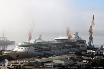
M/V RHAPSODY OTS
Passengers Ship
Current Trip
| Time Travelled | 3 days |
|---|---|
| Remaining Time | 6 h, 16 mins |
| Distance Travelled | 632.71 nm |
| Remaining Distance | 63.54 nm |
| AVG Speed | 11 Knots |
| MAX Speed | 19.1 Knots |
| AVG Wind | 16.3 knots |
| MAX Wind | 20 knots |
| MIN Temp | 27.2°C / 80.96°F |
| MAX Temp | 29.2°C / 84.56°F |
| Draught | 7.7 m |
| Position Received | 6 h, 13 m ago |
Current Position
| Longitude | -68.32267° |
|---|---|
| Latitude | 11.88375° |
| Status | Under way using engine |
| Speed | 5.5 Knots |
| Course | 172.6° |
| Area | Caribbean Sea |
| Station | T-AIS |
| Position Received | 6 h, 13 m ago |
Info
Information
The current position of M/V RHAPSODY OTS is in Caribbean Sea with coordinates 11.88375° / -68.32267° as reported on 2024-05-17 01:07 by AIS to our vessel tracker app. The vessel's current speed is 5.5 Knots and is heading at the port of WILLEMSTAD. The estimated time of arrival as calculated by MyShipTracking vessel tracking app is 2024-05-17 09:37 LT
The vessel M/V RHAPSODY OTS (IMO: 9116864, MMSI: 311805000) is a Passengers Ship that was built in 1997 ( 27 years old ). It's sailing under the flag of [BS] Bahamas.
In this page you can find informations about the vessels current position, last detected port calls, and current voyage information. If the vessels is not in coverage by AIS you will find the latest position.
The current position of M/V RHAPSODY OTS is detected by our AIS receivers and we are not responsible for the reliability of the data. The last position was recorded while the vessel was in Coverage by the Ais receivers of our vessel tracking app.
The current draught of M/V RHAPSODY OTS as reported by AIS is 7.7 meters
Weather
| Temperature | 27.4°C / 81.32°F |
|---|---|
| Wind Speed | 17 knots |
| Direction | 97° E |
| Pressure | 1011 hPa |
| Humidity | 83.4 % |
| Cloud Coverage | 5 % |
Featured Company
Last Port Calls
| Port | Arrival | Departure | Time In Port |
|---|---|---|---|
| 2024-05-13 07:30 | 2024-05-13 16:57 | 9 h | |
| 2024-05-12 05:17 | 2024-05-12 20:45 | 15 h | |
| 2024-05-10 07:08 | 2024-05-10 17:02 | 9 h | |
| 2024-05-09 09:30 | 2024-05-09 18:22 | 8 h | |
| 2024-05-08 07:06 | 2024-05-08 16:48 | 9 h | |
| 2024-05-06 07:22 | 2024-05-06 16:58 | 9 h | |
| 2024-05-05 05:18 | 2024-05-05 20:34 | 15 h | |
| 2024-05-03 07:16 | 2024-05-03 17:27 | 10 h | |
| 2024-05-02 07:10 | 2024-05-02 17:28 | 10 h | |
| 2024-05-01 07:10 | 2024-05-01 17:01 | 9 h |
Last Trips
| Origin | Departure | Destination | Arrival | Distance | |
|---|---|---|---|---|---|
| 2024-05-12 20:45 | 2024-05-13 07:30 | 115.03 nm | |||
| 2024-05-10 17:02 | 2024-05-12 05:17 | 509.14 nm | |||
| 2024-05-09 18:22 | 2024-05-10 07:08 | 107.60 nm | |||
| 2024-05-08 16:48 | 2024-05-09 09:30 | 275.52 nm | |||
| 2024-05-06 16:58 | 2024-05-08 07:06 | 201.40 nm | |||
| 2024-05-05 20:34 | 2024-05-06 07:22 | 114.75 nm | |||
| 2024-05-03 17:27 | 2024-05-05 05:18 | 519.13 nm | |||
| 2024-05-02 17:28 | 2024-05-03 07:16 | 110.48 nm | |||
| 2024-05-01 17:01 | 2024-05-02 07:10 | 223.38 nm | |||
| 2024-04-29 17:16 | 2024-05-01 07:10 | 244.28 nm |
Events
| Time | Event | Details | Position / Dest | Info |
|---|---|---|---|---|
| 2024-05-17 01:14 | Status Changed | Default Under way using engine |
11.87379 / -68.32227
CWWIL
|
Speed: 5.5 kn Course: 172.6° |
| 2024-05-17 01:07 | OUT of Coverage |
11.88375 / -68.32267
Caribbean Sea
CWWIL
|
Speed: 5.5 kn Course: 172.6° |
|
| 2024-05-17 01:04 | Status Changed | Under way using engine Default |
11.88926 / -68.32352
CWWIL
|
Speed: 8 kn Course: 167° |
| 2024-05-17 00:58 | Status Changed | Default Under way using engine |
11.90333 / -68.32667
CWWIL
|
Speed: 11.4 kn Course: 165.9° |
| 2024-05-17 00:14 | Change Sea Area | Bonaire part of the Caribbean Sea Puerto Rican part of the Caribbean Sea |
12.01626 / -68.34892
Caribbean Sea
CWWIL
|
Speed: 4.7 kn Course: 190.9° |
| 2024-05-17 00:12 | Status Changed | Under way using engine Default |
12.01779 / -68.34864
CWWIL
|
Speed: 5 kn Course: 191° |
| 2024-05-16 23:58 | IN Coverage |
12.01626 / -68.34892
Caribbean Sea
CWWIL
|
Speed: 4.7 kn Course: 190.9° |
|
| 2024-05-16 22:23 | START Moving | 7.19 nm, South East of GOTO |
12.14337 / -68.28771
CWWIL
|
Speed: 7.2 kn Course: 243° |
| 2024-05-16 21:25 | Status Changed | Default Moored |
12.14833 / -68.27834
CWWIL
|
Speed: Course: 159° |
| 2024-05-16 21:20 | OUT of Coverage |
12.14907 / -68.27791
Caribbean Sea
CWWIL
|
Speed: Course: 299.6° |