
LUV
Cargo
Current Trip
UNBEKANNT
| Time Travelled | 2 days |
|---|---|
| Remaining Time | --- |
| Distance Travelled | 42.31 nm |
| Remaining Distance | --- |
| AVG Speed | 5.1 Knots |
| MAX Speed | 7.3 Knots |
| AVG Wind | 5.4 knots |
| MAX Wind | 10.8 knots |
| MIN Temp | 6.7°C / 44.06°F |
| MAX Temp | 16.2°C / 61.16°F |
| Dybgang | 1.1 m |
| Position Modtaget | 8 m siden |
Current Position
| Longitude | --- |
|---|---|
| Latitude | --- |
| Status | Under way using engine |
| Fart | 5.3 Knots |
| Kurs | 111.5° |
| Område | North Sea |
| Station | T-AIS |
| Position Modtaget | 8 m siden |
Info
Information
The current position of LUV is in North Sea with coordinates 51.34481° / 6.67004° as reported on 2026-03-04 12:26 by AIS to our vessel tracker app. The vessel's current speed is 5.3 Knots
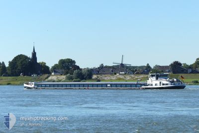
The vessel LUV (MMSI: 211433070) is a Cargo It's sailing under the flag of [DE] Germany.
In this page you can find informations about the vessels current position, last detected port calls, and current voyage information. If the vessels is not in coverage by AIS you will find the latest position.
The current position of LUV is detected by our AIS receivers and we are not responsible for the reliability of the data. The last position was recorded while the vessel was in Coverage by the Ais receivers of our vessel tracking app.
The current draught of LUV as reported by AIS is 1.1 meters
Weather
| Temperature | 15.1°C / 59.18°F |
|---|---|
| Wind Speed | 1 knots |
| Direction | 76° ENE |
| Pressure | 1026.7 hPa |
| Humidity | 49.4 % |
| Cloud Coverage | 22 % |
Featured Company
Last Port Calls
| Port | Arrival | Departure | Time In Port |
|---|---|---|---|
| 2026-02-28 19:47 | 2026-03-02 07:34 | 1 d | |
| 2026-02-24 20:56 | 2026-02-25 06:27 | 9 h | |
| 2026-02-19 19:44 | 2026-02-24 14:57 | 4 d | |
| 2026-02-19 15:26 | 2026-02-19 17:59 | 2 h | |
| 2026-02-19 01:15 | 2026-02-19 13:25 | 12 h | |
| 2026-02-17 10:54 | 2026-02-18 21:04 | 1 d | |
| 2026-02-16 11:12 | 2026-02-16 11:50 | 37 m | |
| 2026-02-15 08:56 | 2026-02-15 12:28 | 3 h | |
| 2026-02-13 18:04 | 2026-02-13 18:41 | 37 m | |
| 2026-02-11 18:13 | 2026-02-12 07:03 | 12 h |
Last Trips
| Origin | Departure | Destination | Arrival | Distance | |
|---|---|---|---|---|---|
| 2026-02-25 06:27 | 2026-02-28 19:47 | 172.69 nm | |||
| 2026-02-24 14:57 | 2026-02-24 20:56 | 32.23 nm | |||
| 2026-02-19 17:59 | 2026-02-19 19:44 | 10.28 nm | |||
| 2026-02-19 13:25 | 2026-02-19 15:26 | 18.19 nm | |||
| 2026-02-18 21:04 | 2026-02-19 01:15 | 31.76 nm | |||
| 2026-02-16 11:50 | 2026-02-17 10:54 | 61.05 nm | |||
| 2026-02-15 12:28 | 2026-02-16 11:12 | 67.30 nm | |||
| 2026-02-13 18:41 | 2026-02-15 08:56 | 87.42 nm | |||
| 2026-02-12 07:03 | 2026-02-13 18:04 | 100.91 nm | |||
| 2026-02-11 11:32 | 2026-02-11 18:13 | 16.18 nm |
Events
| Tid | Hændelsen | Detaljer | Position / Dest | Info |
|---|---|---|---|---|
| 2026-03-04 08:22 | START Sejllads | --- |
51.56347 / 6.64809
UNBEKANNT
|
Fart: 5.1 kn Kurs: 314.7° |
| 2026-03-04 08:21 | Status er ændret | Under way using engine Moored |
51.56265 / 6.65020
UNBEKANNT
|
Fart: 0.9 kn Kurs: 286° |
| 2026-03-04 05:38 | Status er ændret | Moored Default |
51.56244 / 6.65083
UNBEKANNT
|
Fart: Kurs: -1° |
| 2026-03-04 05:36 | Status er ændret | Default Moored |
51.56167 / 6.65167
UNBEKANNT
|
Fart: Kurs: 284° |
| 2026-03-04 00:29 | Status er ændret | Moored Default |
51.56244 / 6.65083
UNBEKANNT
|
Fart: Kurs: -1° |
| 2026-03-04 00:13 | Status er ændret | Default Moored |
51.56167 / 6.65167
UNBEKANNT
|
Fart: Kurs: 284° |
| 2026-03-03 13:49 | Dybgangen er ændret | 1.1 2.5 |
51.56243 / 6.65083
UNBEKANNT
|
Fart: Kurs: 284° |
| 2026-03-03 13:42 | Status er ændret | Moored Under way using engine |
51.56244 / 6.65086
UNBEKANNT
|
Fart: 0.2 kn Kurs: 283° |
| 2026-03-03 13:41 | STOP Sejllads | --- |
51.56245 / 6.65083
UNBEKANNT
|
Fart: 0.3 kn Kurs: 283° |
| 2026-03-03 13:32 | Status er ændret | Under way using engine Moored |
51.56498 / 6.64046
UNBEKANNT
|
Fart: Kurs: 68° |