
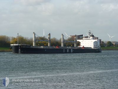
IVS NORTH BERWICK
Cargo
Current Trip
MG TOA
| Time Travelled | 1 day |
|---|---|
| Remaining Time | --- |
| Distance Travelled | 367.85 nm |
| Remaining Distance | --- |
| AVG Speed | 14.3 Knots |
| MAX Speed | 15.7 Knots |
| AVG Wind | 8.9 knots |
| MAX Wind | 13 knots |
| MIN Temp | 23.8°C / 74.84°F |
| MAX Temp | 26.4°C / 79.52°F |
| Dybgang | 13 m |
| Position Modtaget | 19 d siden |
Current Position
| Longitude | 57.00458° |
|---|---|
| Latitude | 24.67822° |
| Status | Under way using engine |
| Fart | 10.9 Knots |
| Kurs | 135.2° |
| Område | Gulf of Oman |
| Station | T-AIS |
| Position Modtaget | 19 d siden |
Info
Information
The current position of IVS NORTH BERWICK is in Gulf of Oman with coordinates 24.67822° / 57.00458° as reported on 2024-04-22 05:57 by AIS to our vessel tracker app. The vessel's current speed is 10.9 Knots
The vessel IVS NORTH BERWICK (IMO: 9740902, MMSI: 563850000) is a Cargo It's sailing under the flag of [SG] Singapore.
In this page you can find informations about the vessels current position, last detected port calls, and current voyage information. If the vessels is not in coverage by AIS you will find the latest position.
The current position of IVS NORTH BERWICK is detected by our AIS receivers and we are not responsible for the reliability of the data. The last position was recorded while the vessel was in Coverage by the Ais receivers of our vessel tracking app.
The current draught of IVS NORTH BERWICK as reported by AIS is 13 meters
Weather
| Temperature | 25°C / 77°F |
|---|---|
| Wind Speed | 9 knots |
| Direction | 18° NNE |
| Pressure | 1019.4 hPa |
| Humidity | 74.1 % |
| Cloud Coverage | 72 % |
Featured Company
Last Port Calls
| Port | Arrival | Departure | Time In Port |
|---|---|---|---|
| 2024-05-05 16:46 | 2024-05-11 02:47 | 5 d | |
| 2024-04-18 17:06 | 2024-04-20 18:39 | 2 d | |
| 2024-03-22 11:43 | 2024-03-25 14:49 | 3 d | |
| 2024-03-12 02:45 | |||
| 2024-03-01 18:14 | 2024-03-02 17:46 | 23 h |
Last Trips
| Origin | Departure | Destination | Arrival | Distance | |
|---|---|---|---|---|---|
| 2024-04-20 22:39 | 2024-05-05 19:46 | 3442.13 nm | |||
| 2024-03-25 16:49 | 2024-04-18 21:06 | 4936.92 nm | |||
| 2024-03-02 19:46 | 2024-03-12 05:45 | 1259.06 nm | |||
| 2024-02-24 23:43 | 2024-03-01 20:14 | 1324.60 nm |
Events
| Tid | Hændelsen | Detaljer | Position / Dest | Info |
|---|---|---|---|---|
| 2024-05-11 02:47 | Afsejlet fra sidste havn |
|
-18.13741 / 49.42782
MG TOA
|
Fart: 4 kn Kurs: -1° |
| 2024-05-11 02:38 | START Sejllads |
-18.14667 / 49.42500
[MG] TOAMASINA
|
Fart: 4 kn Kurs: -1° |
|
| 2024-05-05 16:53 | STOP Sejllads |
-18.14667 / 49.42500
[MG] TOAMASINA
|
Fart: Kurs: -1° |
|
| 2024-05-05 16:46 | Skibe i havn |
|
-18.14725 / 49.42678
[MG] TOAMASINA
|
Fart: 2.6 kn Kurs: 182° |
| 2024-05-05 16:10 | START Sejllads | 2.72 nm, North of TOAMASINA |
-18.10360 / 49.42380
MG TOA
|
Fart: 4 kn Kurs: 165° |
| 2024-05-04 23:56 | STOP Sejllads | 3.66 nm, North of TOAMASINA |
-18.08833 / 49.41833
MG TOA
|
Fart: Kurs: -1° |