
IBRAHIM KONAN
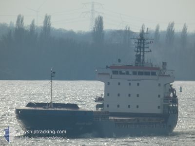
General Cargo
Current Trip
| Time Travelled | 13 days |
|---|---|
| Remaining Time | 3 days |
| Distance Travelled | 2708.92 nm |
| Remaining Distance | 661.61 nm |
| AVG Speed | 8.6 Knots |
| MAX Speed | 11.8 Knots |
| AVG Wind | 16.7 knots |
| MAX Wind | 31 knots |
| MIN Temp | 0.2°C / 32.36°F |
| MAX Temp | 17.4°C / 63.32°F |
| Dybgang | 6.5 m |
| Position Modtaget | 2 h, 54 m siden |
Current Position
| Longitude | --- |
|---|---|
| Latitude | --- |
| Status | Under way using engine |
| Fart | 8.7 Knots |
| Kurs | 83.5° |
| Område | Mediterranean Sea - Eastern Basin |
| Station | T-AIS |
| Position Modtaget | 2 h, 54 m siden |
Info
Information
The current position of IBRAHIM KONAN is in Mediterranean Sea - Eastern Basin with coordinates 35.82415° / 14.71543° as reported on 2025-12-05 21:39 by AIS to our vessel tracker app. The vessel's current speed is 8.7 Knots and is heading at the port of IZMIR. The estimated time of arrival as calculated by MyShipTracking vessel tracking app is 2025-12-09 05:35 LT
The vessel IBRAHIM KONAN (IMO: 9306328, MMSI: 357224000) is a General Cargo that was built in 2006 ( 19 år gamle ). It's sailing under the flag of [PA] Panama.
In this page you can find informations about the vessels current position, last detected port calls, and current voyage information. If the vessels is not in coverage by AIS you will find the latest position.
The current position of IBRAHIM KONAN is detected by our AIS receivers and we are not responsible for the reliability of the data. The last position was recorded while the vessel was in Coverage by the Ais receivers of our vessel tracking app.
The current draught of IBRAHIM KONAN as reported by AIS is 6.5 meters
Weather
| Temperature | 16°C / 60.8°F |
|---|---|
| Wind Speed | 17 knots |
| Direction | 346° NNW |
| Pressure | 1006.1 hPa |
| Humidity | 70.7 % |
| Cloud Coverage | 47 % |
Featured Company
Last Port Calls
| Port | Arrival | Departure | Time In Port |
|---|---|---|---|
| 2025-11-21 00:31 | 2025-11-22 18:22 | 1 d | |
| 2025-11-15 05:00 | 2025-11-19 12:26 | 4 d | |
| 2025-10-23 09:11 | 2025-10-25 08:31 | 1 d | |
| 2025-10-17 13:56 | 2025-10-18 07:44 | 17 h | |
| 2025-10-15 20:12 | 2025-10-16 16:39 | 20 h | |
| 2025-10-09 13:27 | 2025-10-11 00:04 | 1 d | |
| 2025-10-08 10:55 | 2025-10-09 06:03 | 19 h | |
| 2025-10-03 08:00 | 2025-10-04 06:08 | 22 h |
Most Visited Ports (Last year)
| Port | Arrivals | |
|---|---|---|
| 2 | ||
| 2 | ||
| 2 | ||
| 1 | ||
| 1 | ||
| 1 |
Last Trips
| Origin | Departure | Destination | Arrival | Distance | |
|---|---|---|---|---|---|
| 2025-11-19 12:26 | 2025-11-21 00:31 | 308.48 nm | |||
| 2025-10-25 08:31 | 2025-11-15 05:00 | 3667.44 nm | |||
| 2025-10-18 07:44 | 2025-10-23 09:11 | 464.00 nm | |||
| 2025-10-16 16:39 | 2025-10-17 13:56 | 203.11 nm | |||
| 2025-10-11 00:04 | 2025-10-15 20:12 | 179.41 nm | |||
| 2025-10-09 06:03 | 2025-10-09 13:27 | 62.16 nm | |||
| 2025-10-04 06:08 | 2025-10-08 10:55 | 877.44 nm | |||
| 2025-09-18 22:01 | 2025-10-03 08:00 | 2876.98 nm |
Events
| Tid | Hændelsen | Detaljer | Position / Dest | Info |
|---|---|---|---|---|
| 2025-12-05 21:45 | Status er ændret | Default Under way using engine |
35.82509 / 14.73397
TRIZM
|
Fart: 8.7 kn Kurs: 83.5° |
| 2025-12-05 21:39 | Udenfor Dækning |
35.82415 / 14.71543
Mediterranean Sea - Eastern Basin
TRIZM
|
Fart: 8.7 kn Kurs: 83.5° |
|
| 2025-12-05 20:57 | START Sejllads | 2.71 nm, East of MARSAXLOKK |
35.83925 / 14.59913
TRIZM
|
Fart: 4.2 kn Kurs: 98° |
| 2025-12-05 20:53 | Status er ændret | Under way using engine Default |
35.83853 / 14.59628
TRIZM
|
Fart: 0.5 kn Kurs: 26° |
| 2025-12-05 20:47 | Status er ændret | Default At anchor |
35.83830 / 14.59553
TRIZM
|
Fart: 0.2 kn Kurs: 9° |
| 2025-12-05 20:26 | Status er ændret | At anchor Default |
35.83780 / 14.59523
TRIZM
|
Fart: 0.5 kn Kurs: 351° |
| 2025-12-05 20:20 | Status er ændret | Default At anchor |
35.83778 / 14.59533
TRIZM
|
Fart: 0.3 kn Kurs: 350° |
| 2025-12-05 19:53 | Status er ændret | At anchor Default |
35.83753 / 14.59550
TRIZM
|
Fart: 0.2 kn Kurs: 346° |
| 2025-12-05 19:38 | Status er ændret | Default At anchor |
35.83752 / 14.59560
TRIZM
|
Fart: 0.5 kn Kurs: 345° |
| 2025-12-05 19:35 | Status er ændret | At anchor Default |
35.83753 / 14.59563
TRIZM
|
Fart: 0.3 kn Kurs: 352° |