

IBRAHIM KONAN
General Cargo

Current Trip
| Time Travelled | 17 days |
|---|---|
| Remaining Time | --- |
| Distance Travelled | 2299.00 nm |
| Remaining Distance | --- |
| AVG Speed | 7.8 Knop |
| MAX Speed | 7.8 Knop |
| AVG Wind | 9.5 knots |
| MAX Wind | 27.9 knots |
| MIN Temp | -1.2°C / 29.84°F |
| MAX Temp | 16.5°C / 61.7°F |
| Djupgående | 6.2 m |
| Position mottagen | 3 d sen |
Current Position
| Longitud | --- |
|---|---|
| Latitude | --- |
| Status | Under way using engine |
| Fart | 9.7 Knop |
| Kurs | 82.4° |
| Område | Black Sea |
| Station | T-AIS |
| Position mottagen | 3 d sen |
Information
The current position of IBRAHIM KONAN is in Black Sea with coordinates 41.28035° / 29.28317° as reported on 2025-02-25 08:35 by AIS to our vessel tracker app. The vessel's current speed is 9.7 Knop
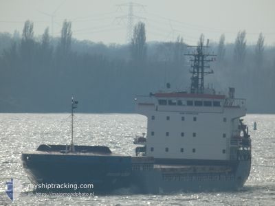
The vessel IBRAHIM KONAN (IMO: 9306328, MMSI: 357224000) is a General Cargo that was built in 2006 ( 19 År gammal ). It's sailing under the flag of [PA] Panama.
In this page you can find informations about the vessels current position, last detected port calls, and current voyage information. If the vessels is not in coverage by AIS you will find the latest position.
The current position of IBRAHIM KONAN is detected by our AIS receivers and we are not responsible for the reliability of the data. The last position was recorded while the vessel was in Coverage by the Ais receivers of our vessel tracking app.
The current draught of IBRAHIM KONAN as reported by AIS is 6.2 meters
Weather
| Temperature | 2.8°C / 37.04°F |
|---|---|
| Wind Speed | 1 knots |
| Direction | 86° E |
| Pressure | 1023.9 hPa |
| Humidity | 95 % |
| Cloud Coverage | 100 % |


Featured Company
Last Port Calls
| Port | Arrival | Departure | Time In Port |
|---|---|---|---|
| 2025-02-10 13:03 | 2025-02-10 20:28 | 7 h | |
| 2025-02-02 14:36 | 2025-02-04 17:15 | 2 d | |
| 2025-01-17 00:58 | 2025-01-30 19:21 | 13 d | |
| 2024-12-22 13:36 | 2024-12-29 00:05 | 6 d | |
| 2024-12-10 19:46 | 2024-12-17 11:47 | 6 d | |
| 2024-12-03 00:56 | 2024-12-03 06:24 | 5 h |
Last Trips
| Origin | Departure | Destination | Arrival | Distance | |
|---|---|---|---|---|---|
| 2025-02-04 18:15 | 2025-02-10 14:03 | 1305.96 nm | |||
| 2025-01-30 19:21 | 2025-02-02 15:36 | 571.91 nm | |||
| 2024-12-29 02:05 | 2025-01-17 00:58 | 3116.39 nm | |||
| 2024-12-17 14:47 | 2024-12-22 15:36 | 569.55 nm | |||
| 2024-12-03 07:24 | 2024-12-10 22:46 | 1656.47 nm | |||
| 2024-11-20 03:17 | 2024-12-03 01:56 | 1738.25 nm |
Events
| Tid | Event | Detaljer | Position / Dest | Information |
|---|---|---|---|---|
| 2025-02-28 18:41 | STOPPAR förflyttning | 1.67 nm, North of SAMSUN |
41.31971 / 36.36570
TRSSX
|
Fart: Kurs: 135° |
| 2025-02-28 18:37 | STARTAR förflyttning | 1.81 nm, North of SAMSUN |
41.32255 / 36.36149
TRSSX
|
Fart: 7 kn Kurs: 104° |
| 2025-02-27 21:10 | STOPPAR förflyttning | 1.7 nm, North of SAMSUN |
41.31990 / 36.36694
TRSSX
|
Fart: Kurs: 195° |
| 2025-02-27 20:49 | STARTAR förflyttning | 1.49 nm, North of SAMSUN |
41.31684 / 36.36436
TRSSX
|
Fart: 11.9 kn Kurs: 214° |
| 2025-02-27 18:21 | STOPPAR förflyttning | 1.7 nm, North of SAMSUN |
41.32000 / 36.36682
TRSSX
|
Fart: Kurs: 194° |
| 2025-02-27 18:13 | STARTAR förflyttning | 2.2 nm, North East of SAMSUN |
41.32519 / 36.37920
TRSSX
|
Fart: 24.2 kn Kurs: 54° |
| 2025-02-27 17:30 | STOPPAR förflyttning | 1.69 nm, North of SAMSUN |
41.31996 / 36.36617
TRSSX
|
Fart: 0.1 kn Kurs: 160° |
| 2025-02-27 17:29 | STARTAR förflyttning | 1.88 nm, North of SAMSUN |
41.32399 / 36.35884
TRSSX
|
Fart: 32.6 kn Kurs: 314° |
| 2025-02-27 17:04 | STOPPAR förflyttning | 1.68 nm, North of SAMSUN |
41.31985 / 36.36582
TRSSX
|
Fart: 0.1 kn Kurs: 146° |
| 2025-02-27 16:57 | STARTAR förflyttning | 1.75 nm, North of SAMSUN |
41.32063 / 36.36759
TRSSX
|
Fart: 4.8 kn Kurs: 148° |