
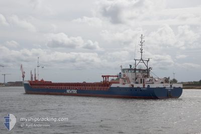
FRISIAN INO
General Cargo
Current Trip
| Time Travelled | 14 days |
|---|---|
| Remaining Time | --- |
| Distance Travelled | 2198.91 nm |
| Remaining Distance | --- |
| AVG Speed | 8.6 Knots |
| MAX Speed | 11.4 Knots |
| AVG Wind | 11.5 knots |
| MAX Wind | 23.2 knots |
| MIN Temp | -2.3°C / 27.86°F |
| MAX Temp | 16.9°C / 62.42°F |
| Dybgang | 2.8 m |
| Position Modtaget | 3 d siden |
Current Position
| Longitude | --- |
|---|---|
| Latitude | --- |
| Status | Under way using engine |
| Fart | 9.6 Knots |
| Kurs | 193.2° |
| Område | North Sea |
| Station | T-AIS |
| Position Modtaget | 3 d siden |
Info
Information
The current position of FRISIAN INO is in North Sea with coordinates 55.71596° / 6.85625° as reported on 2025-03-14 18:32 by AIS to our vessel tracker app. The vessel's current speed is 9.6 Knots
The vessel FRISIAN INO (IMO: 9463877, MMSI: 246807000) is a General Cargo that was built in 2012 ( 13 år gamle ). It's sailing under the flag of [NL] Netherlands.
In this page you can find informations about the vessels current position, last detected port calls, and current voyage information. If the vessels is not in coverage by AIS you will find the latest position.
The current position of FRISIAN INO is detected by our AIS receivers and we are not responsible for the reliability of the data. The last position was recorded while the vessel was in Coverage by the Ais receivers of our vessel tracking app.
The current draught of FRISIAN INO as reported by AIS is 2.8 meters
Weather
| Temperature | 4.7°C / 40.46°F |
|---|---|
| Wind Speed | 10 knots |
| Direction | 102° ESE |
| Pressure | 1032.3 hPa |
| Humidity | 62 % |
| Cloud Coverage | 1 % |
Featured Company
Last Port Calls
| Port | Arrival | Departure | Time In Port |
|---|---|---|---|
| 2025-03-02 18:33 | 2025-03-03 09:29 | 14 h | |
| 2025-02-22 09:09 | 2025-02-23 11:28 | 1 d | |
| 2025-02-07 09:29 | 2025-02-07 14:25 | 4 h | |
| 2025-01-29 03:08 | 2025-01-29 12:07 | 8 h | |
| 2025-01-22 12:24 | 2025-01-23 16:03 | 1 d | |
| 2025-01-15 08:33 | 2025-01-16 21:12 | 1 d | |
| 2025-01-08 16:25 | 2025-01-09 22:53 | 1 d | |
| 2025-01-06 07:35 | 2025-01-07 17:42 | 1 d |
Last Trips
| Origin | Departure | Destination | Arrival | Distance | |
|---|---|---|---|---|---|
| 2025-02-23 11:28 | 2025-03-02 18:33 | 1474.04 nm | |||
| 2025-02-07 14:25 | 2025-02-22 09:09 | 1027.37 nm | |||
| 2025-01-29 12:07 | 2025-02-07 09:29 | 1395.61 nm | |||
| 2025-01-23 16:03 | 2025-01-29 03:08 | 1275.83 nm | |||
| 2025-01-16 21:12 | 2025-01-22 12:24 | 864.79 nm | |||
| 2025-01-09 22:53 | 2025-01-15 08:33 | 1032.16 nm | |||
| 2025-01-07 17:42 | 2025-01-08 16:25 | 16.24 nm | |||
| 2024-12-31 18:48 | 2025-01-06 07:35 | 1167.31 nm |
Events
| Tid | Hændelsen | Detaljer | Position / Dest | Info |
|---|---|---|---|---|
| 2025-03-15 11:09 | STOP Sejllads | 10.33 nm, North of SCHIERMONNIKOOG |
53.64011 / 6.18436
NLEEM
|
Fart: Kurs: 60° |
| 2025-03-14 18:32 | Udenfor Dækning |
55.71596 / 6.85625
North Sea
NLEEM
|
Fart: 9.6 kn Kurs: 193.2° |
|
| 2025-03-14 08:40 | START Sejllads | 8.81 nm, East of LEMVIG |
56.58426 / 8.56323
NLEEM
|
Fart: 6.9 kn Kurs: 210.2° |
| 2025-03-14 08:21 | STOP Sejllads | 8.9 nm, East of LEMVIG |
56.58524 / 8.56600
NLEEM
|
Fart: 0.3 kn Kurs: 207° |
| 2025-03-14 05:36 | START Sejllads | 5.16 nm, East of NYKOBING MORS |
56.80179 / 9.02359
NLEEM
|
Fart: 4.1 kn Kurs: 222° |
| 2025-03-14 05:34 | Status er ændret | Under way using engine Moored |
56.80309 / 9.02563
NLEEM
|
Fart: 1.4 kn Kurs: 76° |
| 2025-03-13 22:57 | Dybgangen er ændret | 2.8 3.8 |
56.80358 / 9.02263
NLEEM
|
Fart: Kurs: 52° |
| 2025-03-13 22:57 | Destination er ændret | NLEEM DKFUH |
56.80358 / 9.02263
NLEEM
|
Fart: Kurs: 52° |
| 2025-03-13 22:57 | ETA er ændret | 2025/03/15 12:00 2025/03/12 22:00 |
56.80358 / 9.02263
NLEEM
|
Fart: Kurs: 52° |
| 2025-03-12 21:10 | Status er ændret | Moored Under way using engine |
56.80358 / 9.02262
DKFUH
|
Fart: Kurs: 52° |