

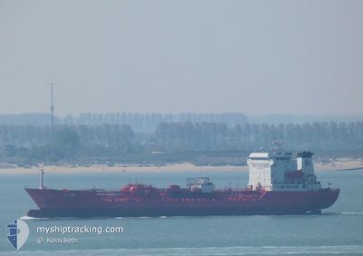
FERICEK
Oil/Chemical Tanker

Current Trip
| Trip Time | 7 days |
|---|---|
| Trip Distance | 868.61 nm |
| AVG Speed | 10.4 Knots |
| MAX Speed | 14.9 Knots |
| Dybgang | 5 m |
| AVG Wind | 13.4 knots |
| MAX Wind | 28.5 knots |
| MIN Temp | 2.8°C / 37.04°F |
| MAX Temp | 17.8°C / 64.04°F |
| Position Modtaget | 2 d siden |
Current Position
| Longitude | --- |
|---|---|
| Latitude | --- |
| Status | Under way using engine |
| Fart | 9.2 Knots |
| Kurs | 217° |
| Område | Mediterranean Sea - Eastern Basin |
| Station | T-AIS |
| Position Modtaget | 2 d siden |
Information
The current position of FERICEK is in Mediterranean Sea - Eastern Basin with coordinates 31.27736° / 32.32742° as reported on 2025-03-25 09:43 by AIS to our vessel tracker app. The vessel's current speed is 9.2 Knots and is currently inside the port of PORT SAID.
The vessel FERICEK (IMO: 9125267, MMSI: 271046574) is a Oil/Chemical Tanker that was built in 1996 ( 29 år gamle ). It's sailing under the flag of [TR] Turkey.
In this page you can find informations about the vessels current position, last detected port calls, and current voyage information. If the vessels is not in coverage by AIS you will find the latest position.
The current position of FERICEK is detected by our AIS receivers and we are not responsible for the reliability of the data. The last position was recorded while the vessel was in Coverage by the Ais receivers of our vessel tracking app.
The current draught of FERICEK as reported by AIS is 5 meters
Weather
| Temperature | 21.1°C / 69.98°F |
|---|---|
| Wind Speed | 14 knots |
| Direction | 55° NE |
| Pressure | 1006.9 hPa |
| Humidity | 65 % |
| Cloud Coverage | 100 % |


Featured Company
Last Port Calls
| Port | Arrival | Departure | Time In Port |
|---|---|---|---|
| 2025-03-25 11:42 | |||
| 2025-03-16 13:46 | 2025-03-17 19:12 | 1 d | |
| 2025-03-14 07:46 | 2025-03-15 06:48 | 23 h | |
| 2025-03-07 21:32 | 2025-03-11 00:33 | 3 d | |
| 2025-02-28 13:41 | 2025-03-01 14:53 | 1 d | |
| 2025-02-24 16:25 | 2025-02-26 06:53 | 1 d | |
| 2025-02-21 08:05 | 2025-02-22 17:29 | 1 d | |
| 2025-02-12 07:56 | 2025-02-12 13:24 | 5 h | |
| 2025-02-09 10:07 | 2025-02-10 20:47 | 1 d | |
| 2025-01-27 17:58 | 2025-01-28 18:07 | 1 d |
Last Trips
| Origin | Departure | Destination | Arrival | Distance | |
|---|---|---|---|---|---|
| 2025-03-17 19:12 | 2025-03-25 11:42 | 868.61 nm | |||
| 2025-03-15 06:48 | 2025-03-16 13:46 | 308.97 nm | |||
| 2025-03-11 00:33 | 2025-03-14 07:46 | 617.88 nm | |||
| 2025-03-01 14:53 | 2025-03-07 21:32 | 430.59 nm | |||
| 2025-02-26 06:53 | 2025-02-28 13:41 | 405.57 nm | |||
| 2025-02-22 17:29 | 2025-02-24 16:25 | 455.08 nm | |||
| 2025-02-12 13:24 | 2025-02-21 08:05 | 2077.22 nm | |||
| 2025-02-10 20:47 | 2025-02-12 07:56 | 343.00 nm | |||
| 2025-01-28 18:07 | 2025-02-09 10:07 | 889.62 nm | |||
| 2025-01-22 22:33 | 2025-01-27 17:58 | 1148.83 nm |
Events
| Tid | Hændelsen | Detaljer | Position / Dest | Info |
|---|---|---|---|---|
| 2025-03-25 10:17 | STOP Sejllads |
31.25437 / 32.30083
[EG] PORT SAID
|
Fart: 0.1 kn Kurs: 308° |
|
| 2025-03-25 09:49 | Status er ændret | Default Under way using engine |
31.26502 / 32.31734
[EG] PORT SAID
|
Fart: 9.2 kn Kurs: 217° |
| 2025-03-25 09:43 | Udenfor Dækning |
31.27736 / 32.32742
Mediterranean Sea - Eastern Basin
[EG] PORT SAID
|
Fart: 9.2 kn Kurs: 217° |
|
| 2025-03-25 09:42 | Skibe i havn |
|
31.27805 / 32.32802
[EG] PORT SAID
|
Fart: 11.1 kn Kurs: 215.8° |
| 2025-03-25 09:38 | Status er ændret | Under way using engine Default |
31.28902 / 32.33738
EGPSD
|
Fart: 11.1 kn Kurs: 215° |
| 2025-03-25 09:34 | Status er ændret | Default Under way using engine |
31.29870 / 32.34549
EGPSD
|
Fart: 11.3 kn Kurs: 218.7° |
| 2025-03-25 09:10 | Status er ændret | Under way using engine Default |
31.34874 / 32.36167
EGPSD
|
Fart: 5.7 kn Kurs: 167° |
| 2025-03-25 09:02 | Status er ændret | Default Under way using engine |
31.35953 / 32.35951
EGPSD
|
Fart: 6.2 kn Kurs: 175.3° |
| 2025-03-25 08:47 | Status er ændret | Under way using engine Default |
31.38348 / 32.35713
EGPSD
|
Fart: 6.8 kn Kurs: 175° |
| 2025-03-25 08:46 | Indenfor Dækning |
31.38348 / 32.35713
Mediterranean Sea - Eastern Basin
|
Fart: 6.5 kn Kurs: 174.8° |