

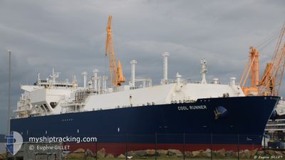
COOL RUNNER
Lng Tanker

Current Trip
| Time Travelled | 25 days |
|---|---|
| Remaining Time | --- |
| Distance Travelled | 3656.59 nm |
| Remaining Distance | --- |
| AVG Speed | 9.7 Knots |
| MAX Speed | 14.8 Knots |
| AVG Wind | 12.9 knots |
| MAX Wind | 34.2 knots |
| MIN Temp | 3.5°C / 38.3°F |
| MAX Temp | 20.1°C / 68.18°F |
| Dybgang | 9.5 m |
| Position Modtaget | 38 m siden |
Current Position
| Longitude | --- |
|---|---|
| Latitude | --- |
| Status | Under way using engine |
| Fart | 5.7 Knots |
| Kurs | 43.2° |
| Område | North Atlantic Ocean |
| Station | T-AIS |
| Position Modtaget | 38 m siden |
Information
The current position of COOL RUNNER is in North Atlantic Ocean with coordinates 29.71878° / -14.26745° as reported on 2025-03-29 06:29 by AIS to our vessel tracker app. The vessel's current speed is 5.7 Knots and is heading at the port of TERNEUZEN. The estimated time of arrival as calculated by MyShipTracking vessel tracking app is 2025-04-02 10:00 LT
The vessel COOL RUNNER (IMO: 9636797, MMSI: 229673000) is a Lng Tanker that was built in 2014 ( 11 år gamle ). It's sailing under the flag of [MT] Malta.
In this page you can find informations about the vessels current position, last detected port calls, and current voyage information. If the vessels is not in coverage by AIS you will find the latest position.
The current position of COOL RUNNER is detected by our AIS receivers and we are not responsible for the reliability of the data. The last position was recorded while the vessel was in Coverage by the Ais receivers of our vessel tracking app.
The current draught of COOL RUNNER as reported by AIS is 9.5 meters
Weather
| Temperature | 18.2°C / 64.76°F |
|---|---|
| Wind Speed | 4 knots |
| Direction | 236° SW |
| Pressure | 1010.8 hPa |
| Humidity | 79.1 % |
| Cloud Coverage | --- |


Featured Company
Last Trips
Events
| Tid | Hændelsen | Detaljer | Position / Dest | Info |
|---|---|---|---|---|
| 2025-03-29 06:30 | Status er ændret | Default Under way using engine |
29.71970 / -14.26631
FOR ORDERS
|
Fart: 5.7 kn Kurs: 43.2° |
| 2025-03-29 06:12 | Status er ændret | Under way using engine Default |
29.69987 / -14.29087
FOR ORDERS
|
Fart: 5.6 kn Kurs: 43° |
| 2025-03-29 05:45 | Status er ændret | Default Under way using engine |
29.66902 / -14.32559
FOR ORDERS
|
Fart: 5.7 kn Kurs: 46.1° |
| 2025-03-29 02:14 | Status er ændret | Under way using engine Default |
29.43579 / -14.62010
FOR ORDERS
|
Fart: 6.2 kn Kurs: 42° |
| 2025-03-29 02:03 | Status er ændret | Default Under way using engine |
29.42338 / -14.63566
FOR ORDERS
|
Fart: 6.1 kn Kurs: 44.2° |
| 2025-03-29 01:56 | Status er ændret | Under way using engine Default |
29.41446 / -14.64653
FOR ORDERS
|
Fart: 6.1 kn Kurs: 50° |
| 2025-03-29 01:20 | Status er ændret | Default Under way using engine |
29.37290 / -14.69699
FOR ORDERS
|
Fart: 6.1 kn Kurs: 48.2° |
| 2025-03-29 01:16 | Status er ændret | Under way using engine Default |
29.36777 / -14.70299
FOR ORDERS
|
Fart: 5.9 kn Kurs: 39° |
| 2025-03-29 00:47 | Status er ændret | Default Under way using engine |
29.33467 / -14.74180
FOR ORDERS
|
Fart: 6 kn Kurs: 45.1° |
| 2025-03-29 00:31 | Status er ændret | Under way using engine Default |
29.31562 / -14.76497
FOR ORDERS
|
Fart: 6 kn Kurs: 47° |