

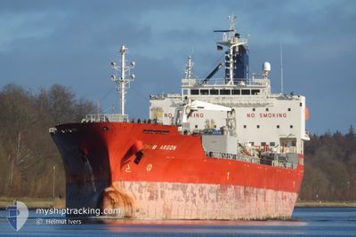
CHEM ARGON
Tanker

Current Trip
| Time Travelled | 14 days |
|---|---|
| Remaining Time | 1 day |
| Distance Travelled | 3532.92 nm |
| Remaining Distance | 550.67 nm |
| AVG Speed | 10.6 Knots |
| MAX Speed | 14.8 Knots |
| AVG Wind | 18.3 knots |
| MAX Wind | 39.8 knots |
| MIN Temp | -2.5°C / 27.5°F |
| MAX Temp | 18.9°C / 66.02°F |
| Dybgang | 9 m |
| Position Modtaget | 5 d siden |
Current Position
| Longitude | --- |
|---|---|
| Latitude | --- |
| Status | Under way using engine |
| Fart | 11.6 Knots |
| Kurs | 264.4° |
| Område | North Atlantic Ocean |
| Station | T-AIS |
| Position Modtaget | 5 d siden |
Information
The current position of CHEM ARGON is in North Atlantic Ocean with coordinates 38.98961° / -35.59604° as reported on 2025-03-01 02:55 by AIS to our vessel tracker app. The vessel's current speed is 11.6 Knots and is heading at the port of NEW YORK. The estimated time of arrival as calculated by MyShipTracking vessel tracking app is 2025-03-07 23:04 LT
The vessel CHEM ARGON (IMO: 9716004, MMSI: 636019198) is a Tanker It's sailing under the flag of [LR] Liberia.
In this page you can find informations about the vessels current position, last detected port calls, and current voyage information. If the vessels is not in coverage by AIS you will find the latest position.
The current position of CHEM ARGON is detected by our AIS receivers and we are not responsible for the reliability of the data. The last position was recorded while the vessel was in Coverage by the Ais receivers of our vessel tracking app.
The current draught of CHEM ARGON as reported by AIS is 9 meters
Weather
| Temperature | 16.5°C / 61.7°F |
|---|---|
| Wind Speed | 28 knots |
| Direction | 180° S |
| Pressure | 1010.6 hPa |
| Humidity | 77.9 % |
| Cloud Coverage | 100 % |


Featured Company
Last Port Calls
| Port | Arrival | Departure | Time In Port |
|---|---|---|---|
| 2025-02-18 19:38 | 2025-02-20 04:39 | 1 d | |
| 2025-02-12 00:46 | 2025-02-16 19:40 | 4 d | |
| 2025-02-10 18:21 | 2025-02-11 23:53 | 1 d | |
| 2025-02-08 09:11 | 2025-02-10 17:57 | 2 d | |
| 2025-02-02 15:50 | 2025-02-05 00:06 | 2 d | |
| 2025-02-01 06:33 | 2025-02-01 06:38 | 4 m | |
| 2025-01-29 13:32 | 2025-01-30 15:18 | 1 d | |
| 2025-01-27 07:22 | 2025-01-28 21:18 | 1 d | |
| 2025-01-06 11:29 |
Most Visited Ports (Last year)
| Port | Arrivals | |
|---|---|---|
| 6 | ||
| 4 | ||
| 3 | ||
| 3 | ||
| 3 | ||
| 2 |
Last Trips
| Origin | Departure | Destination | Arrival | Distance | |
|---|---|---|---|---|---|
| 2025-02-16 20:40 | 2025-02-18 20:38 | 364.11 nm | |||
| 2025-02-12 00:53 | 2025-02-12 01:46 | 3.05 nm | |||
| 2025-02-10 18:57 | 2025-02-10 19:21 | 1.69 nm | |||
| 2025-02-05 02:06 | 2025-02-08 10:11 | 827.24 nm | |||
| 2025-02-01 07:38 | 2025-02-02 17:50 | 414.27 nm | |||
| 2025-01-30 16:18 | 2025-02-01 07:33 | 366.09 nm | |||
| 2025-01-28 22:18 | 2025-01-29 14:32 | 96.21 nm | |||
| 2025-01-06 05:29 | 2025-01-27 08:22 | 5166.65 nm |
Events
| Tid | Hændelsen | Detaljer | Position / Dest | Info |
|---|---|---|---|---|
| 2025-03-01 03:09 | Status er ændret | Default Under way using engine |
38.98773 / -35.65214
USBAY
|
Fart: 11.6 kn Kurs: 264.4° |
| 2025-03-01 02:55 | Status er ændret | Under way using engine Default |
38.98961 / -35.59604
USBAY
|
Fart: 11.7 kn Kurs: 264° |
| 2025-03-01 02:55 | Udenfor Dækning |
38.98961 / -35.59604
North Atlantic Ocean
USBAY
|
Fart: 11.6 kn Kurs: 264.4° |
|
| 2025-03-01 02:49 | Status er ændret | Default Under way using engine |
38.99108 / -35.57055
USBAY
|
Fart: 11.8 kn Kurs: 266.8° |
| 2025-03-01 02:45 | Ændre havområde | High seas of the North Atlantic Ocean Portuguese (Azores) part of the North Atlantic Ocean |
38.99215 / -35.55318
North Atlantic Ocean
USBAY
|
Fart: 11.8 kn Kurs: 266.8° |
| 2025-03-01 02:45 | Status er ændret | Under way using engine Default |
38.99218 / -35.55185
USBAY
|
Fart: 11.9 kn Kurs: 263° |
| 2025-03-01 02:45 | Indenfor Dækning |
38.99215 / -35.55318
North Atlantic Ocean
USBAY
|
Fart: 11.8 kn Kurs: 266.8° |
|
| 2025-03-01 01:47 | Status er ændret | Default Under way using engine |
39.01405 / -35.31073
USBAY
|
Fart: 11.4 kn Kurs: 268.9° |
| 2025-03-01 01:35 | Status er ændret | Under way using engine Default |
39.01578 / -35.26129
USBAY
|
Fart: 11.6 kn Kurs: 266° |
| 2025-03-01 01:35 | Udenfor Dækning |
39.01578 / -35.26129
North Atlantic Ocean
USBAY
|
Fart: 11.4 kn Kurs: 268.9° |