
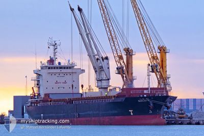
BERKAY N
General Cargo
Current Trip
| Time Travelled | 12 days |
|---|---|
| Remaining Time | 8 h, 54 mins |
| Distance Travelled | 721.14 nm |
| Remaining Distance | 25.28 nm |
| AVG Speed | 6.5 Knots |
| MAX Speed | 13.3 Knots |
| AVG Wind | 22.8 knots |
| MAX Wind | 36 knots |
| MIN Temp | 3.4°C / 38.12°F |
| MAX Temp | 13°C / 55.4°F |
| Dybgang | 5.5 m |
| Position Modtaget | Nu |
Current Position
| Longitude | --- |
|---|---|
| Latitude | --- |
| Status | Under way sailing |
| Fart | 4.3 Knots |
| Kurs | 166° |
| Område | North Sea |
| Station | T-AIS |
| Position Modtaget | Nu |
Info
Information
The current position of BERKAY N is in North Sea with coordinates 52.58731° / 3.94093° as reported on 2024-12-31 20:51 by AIS to our vessel tracker app. The vessel's current speed is 4.3 Knots and is heading at the port of IJMUIDEN. The estimated time of arrival as calculated by MyShipTracking vessel tracking app is 2025-01-01 05:45 LT
The vessel BERKAY N (IMO: 9524827, MMSI: 314496000) is a General Cargo that was built in 2008 ( 16 år gamle ). It's sailing under the flag of [BB] Barbados.
In this page you can find informations about the vessels current position, last detected port calls, and current voyage information. If the vessels is not in coverage by AIS you will find the latest position.
The current position of BERKAY N is detected by our AIS receivers and we are not responsible for the reliability of the data. The last position was recorded while the vessel was in Coverage by the Ais receivers of our vessel tracking app.
The current draught of BERKAY N as reported by AIS is 5.5 meters
Weather
| Temperature | 9.2°C / 48.56°F |
|---|---|
| Wind Speed | 35 knots |
| Direction | 221° SW |
| Pressure | 1014.3 hPa |
| Humidity | 87 % |
| Cloud Coverage | 100 % |
Featured Company
Last Port Calls
| Port | Arrival | Departure | Time In Port |
|---|---|---|---|
| 2024-12-18 07:00 | 2024-12-19 20:43 | 1 d | |
| 2024-12-03 00:50 | 2024-12-04 15:58 | 1 d | |
| 2024-11-28 21:14 | 2024-12-01 14:54 | 2 d | |
| 2024-11-13 19:02 | 2024-11-17 06:58 | 3 d | |
| 2024-10-30 21:04 | 2024-10-31 02:33 | 5 h | |
| 2024-10-22 13:56 | 2024-10-24 13:41 | 1 d | |
| 2024-10-14 07:11 | 2024-10-18 12:22 | 4 d |
Last Trips
| Origin | Departure | Destination | Arrival | Distance | |
|---|---|---|---|---|---|
| 2024-12-04 15:58 | 2024-12-18 07:00 | 3385.63 nm | |||
| 2024-12-01 14:54 | 2024-12-03 00:50 | 172.19 nm | |||
| 2024-11-17 06:58 | 2024-11-28 21:14 | 205.06 nm | |||
| 2024-10-31 03:33 | 2024-11-13 19:02 | 2871.65 nm | |||
| 2024-10-24 16:41 | 2024-10-30 22:04 | 1637.57 nm | |||
| 2024-10-18 14:22 | 2024-10-22 16:56 | 964.44 nm | |||
| 2024-09-24 11:37 | 2024-10-14 09:11 | 4094.05 nm |
Events
| Tid | Hændelsen | Detaljer | Position / Dest | Info |
|---|---|---|---|---|
| 2024-12-31 20:36 | Status er ændret | Under way sailing Default |
52.60074 / 3.93207
NLIJM
|
Fart: 1.6 kn Kurs: 258° |
| 2024-12-31 20:30 | Status er ændret | Default Under way sailing |
52.59963 / 3.93723
NLIJM
|
Fart: 2.2 kn Kurs: 243° |
| 2024-12-31 20:24 | Status er ændret | Under way sailing Default |
52.59908 / 3.94351
NLIJM
|
Fart: 2.3 kn Kurs: 237° |
| 2024-12-31 20:08 | Status er ændret | Default Under way sailing |
52.59812 / 3.95688
NLIJM
|
Fart: 1.8 kn Kurs: 237° |
| 2024-12-31 20:05 | Status er ændret | Under way sailing Default |
52.59795 / 3.95867
NLIJM
|
Fart: 2.3 kn Kurs: 250° |
| 2024-12-31 19:33 | Status er ændret | Default Under way sailing |
52.59165 / 3.98608
NLIJM
|
Fart: 1.8 kn Kurs: 254° |
| 2024-12-31 19:29 | Status er ændret | Under way sailing Default |
52.59051 / 3.98868
NLIJM
|
Fart: 1.7 kn Kurs: 240° |
| 2024-12-31 19:21 | Status er ændret | Default Under way sailing |
52.58789 / 3.99491
NLIJM
|
Fart: 1.9 kn Kurs: 238° |
| 2024-12-31 19:13 | START Sejllads |
52.58945 / 3.99679
NLIJM
|
Fart: 3.1 kn Kurs: 171° |
|
| 2024-12-31 19:07 | STOP Sejllads |
52.59201 / 3.99602
NLIJM
|
Fart: 0.3 kn Kurs: 201° |