
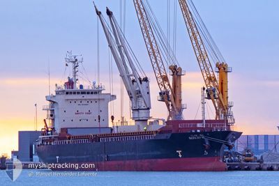
BERKAY N
General Cargo
Current Trip
| Time Travelled | 3 days |
|---|---|
| Remaining Time | --- |
| Distance Travelled | 997.24 nm |
| Remaining Distance | --- |
| AVG Speed | 10.5 Knop |
| MAX Speed | 11.6 Knop |
| AVG Wind | 8.1 knots |
| MAX Wind | 13.1 knots |
| MIN Temp | 20.6°C / 69.08°F |
| MAX Temp | 22.2°C / 71.96°F |
| Djupgående | 10.1 m |
| Position mottagen | 16 m sen |
Current Position
| Longitud | 12.97437° |
|---|---|
| Latitude | 36.90987° |
| Status | Under way using engine |
| Fart | 10.2 Knop |
| Kurs | 290.4° |
| Område | Mediterranean Sea - Eastern Basin |
| Station | T-AIS |
| Position mottagen | 16 m sen |
Info
Information
The current position of BERKAY N is in Mediterranean Sea - Eastern Basin with coordinates 36.90987° / 12.97437° as reported on 2024-06-01 16:16 by AIS to our vessel tracker app. The vessel's current speed is 10.2 Knop and is heading at the port of FOYNES. The estimated time of arrival as calculated by MyShipTracking vessel tracking app is 2024-06-10 07:00 LT
The vessel BERKAY N (IMO: 9524827, MMSI: 314496000) is a General Cargo that was built in 2008 ( 16 År gammal ). It's sailing under the flag of [BB] Barbados.
In this page you can find informations about the vessels current position, last detected port calls, and current voyage information. If the vessels is not in coverage by AIS you will find the latest position.
The current position of BERKAY N is detected by our AIS receivers and we are not responsible for the reliability of the data. The last position was recorded while the vessel was in Coverage by the Ais receivers of our vessel tracking app.
The current draught of BERKAY N as reported by AIS is 10.1 meters
Weather
| Temperature | 21.9°C / 71.42°F |
|---|---|
| Wind Speed | 9 knots |
| Direction | 123° ESE |
| Pressure | 1014.3 hPa |
| Humidity | 80.9 % |
| Cloud Coverage | 59 % |
Featured Company
Most Visited Ports (Last year)
| Port | Arrivals | |
|---|---|---|
| 7 | ||
| 5 | ||
| 2 | ||
| 2 | ||
| 1 | ||
| 1 |
Events
| Tid | Event | Detaljer | Position / Dest | Information |
|---|---|---|---|---|
| 2024-06-01 16:32 | Status ändrad | Under way using engine Default |
36.92472 / 12.92009
IEFOV
|
Fart: 10.1 kn Kurs: 289° |
| 2024-06-01 16:22 | Status ändrad | Default Under way using engine |
36.91576 / 12.95402
IEFOV
|
Fart: 10.2 kn Kurs: 290.4° |
| 2024-06-01 16:14 | Status ändrad | Under way using engine Default |
36.90821 / 12.97992
IEFOV
|
Fart: 10.2 kn Kurs: 290° |
| 2024-06-01 16:14 | I täckningsområde |
36.90987 / 12.97437
Mediterranean Sea - Eastern Basin
IEFOV
|
Fart: 10.2 kn Kurs: 290.4° |
|
| 2024-06-01 11:58 | Status ändrad | Default Under way using engine |
36.67539 / 13.86258
IEFOV
|
Fart: 10.9 kn Kurs: 290.3° |
| 2024-06-01 11:53 | UTANFÖR täckningsområde |
36.67032 / 13.88025
Mediterranean Sea - Eastern Basin
IEFOV
|
Fart: 10.9 kn Kurs: 290.3° |
|
| 2024-06-01 10:20 | Status ändrad | Under way using engine Default |
36.57299 / 14.20683
IEFOV
|
Fart: 10.9 kn Kurs: 289° |
| 2024-06-01 10:10 | Status ändrad | Default Under way using engine |
36.56221 / 14.24385
IEFOV
|
Fart: 10.8 kn Kurs: 290.2° |
| 2024-06-01 09:42 | Status ändrad | Under way using engine Default |
36.53414 / 14.33943
IEFOV
|
Fart: 10.6 kn Kurs: 289° |
| 2024-06-01 09:38 | Status ändrad | Default Under way using engine |
36.52980 / 14.35427
IEFOV
|
Fart: 10.6 kn Kurs: 290.6° |