
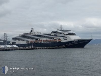
ZAANDAM
Passengers Ship
Current Trip
| Time Travelled | 4 days |
|---|---|
| Remaining Time | --- |
| Distance Travelled | 1141.11 nm |
| Remaining Distance | --- |
| AVG Speed | 11.9 Knots |
| MAX Speed | 17.8 Knots |
| AVG Wind | 14 knots |
| MAX Wind | 20 knots |
| MIN Temp | 22.1°C / 71.78°F |
| MAX Temp | 26.7°C / 80.06°F |
| Draught | 8.1 m |
| Position Received | 4 d ago |
Current Position
| Longitude | --- |
|---|---|
| Latitude | --- |
| Status | Under way using engine |
| Speed | 16 Knots |
| Course | 170° |
| Area | Caribbean Sea |
| Station | T-AIS |
| Position Received | 4 d ago |
Info
Information
The current position of ZAANDAM is in Caribbean Sea with coordinates 13.22887° / -60.88152° as reported on 2025-02-13 01:10 by AIS to our vessel tracker app. The vessel's current speed is 16 Knots and is heading at the port of CASTRIES. The estimated time of arrival as calculated by MyShipTracking vessel tracking app is 2025-02-12 12:00 LT
The vessel ZAANDAM (IMO: 9156527, MMSI: 246442000) is a Passengers Ship that was built in 2000 ( 25 years old ). It's sailing under the flag of [NL] Netherlands.
In this page you can find informations about the vessels current position, last detected port calls, and current voyage information. If the vessels is not in coverage by AIS you will find the latest position.
The current position of ZAANDAM is detected by our AIS receivers and we are not responsible for the reliability of the data. The last position was recorded while the vessel was in Coverage by the Ais receivers of our vessel tracking app.
The current draught of ZAANDAM as reported by AIS is 8.1 meters
Weather
| Temperature | 23.5°C / 74.3°F |
|---|---|
| Wind Speed | 4 knots |
| Direction | 52° NE |
| Pressure | 1011.3 hPa |
| Humidity | 94.1 % |
| Cloud Coverage | 93 % |
Featured Company
Last Port Calls
| Port | Arrival | Departure | Time In Port |
|---|---|---|---|
| 2025-02-13 11:05 | 2025-02-13 19:54 | 8 h | |
| 2025-02-12 11:16 | 2025-02-12 21:32 | 10 h | |
| 2025-02-11 11:09 | 2025-02-11 20:15 | 9 h | |
| 2025-02-08 11:07 | 2025-02-09 00:34 | 13 h | |
| 2025-01-26 00:35 | 2025-02-07 22:35 | 12 d | |
| 2025-01-25 10:43 | 2025-01-25 19:46 | 9 h | |
| 2025-01-25 10:23 | |||
| 2025-01-23 14:40 | 2025-01-23 22:00 | 7 h | |
| 2025-01-22 10:35 | 2025-01-22 21:19 | 10 h | |
| 2025-01-21 13:08 | 2025-01-21 23:11 | 10 h |
Last Trips
| Origin | Departure | Destination | Arrival | Distance | |
|---|---|---|---|---|---|
| 2025-02-12 17:32 | 2025-02-13 07:05 | 193.79 nm | |||
| 2025-02-11 16:15 | 2025-02-12 07:16 | 272.41 nm | |||
| 2025-02-08 19:34 | 2025-02-11 07:09 | 1089.65 nm | |||
| 2025-02-07 17:35 | 2025-02-08 06:07 | 167.52 nm | |||
| 2025-01-25 14:46 | 2025-01-25 19:35 | 78.42 nm | |||
| 2025-01-23 18:00 | 2025-01-25 05:43 | 691.36 nm | |||
| 2025-01-23 18:00 | 2025-01-25 05:23 | 690.58 nm | |||
| 2025-01-22 17:19 | 2025-01-23 10:40 | 279.92 nm | |||
| 2025-01-21 19:11 | 2025-01-22 06:35 | 106.31 nm | |||
| 2025-01-19 15:18 | 2025-01-21 09:08 | 730.05 nm |
Events
| Time | Event | Details | Position / Dest | Info |
|---|---|---|---|---|
| 2025-02-17 22:22 | START Moving | 4.11 nm, East of SANTANA |
-.06824 / -51.10372
LCCAS
|
Speed: 3.5 kn Course: 220° |
| 2025-02-17 16:56 | STOP Moving | 4.03 nm, East of SANTANA |
-.06454 / -51.10485
LCCAS
|
Speed: 0.1 kn Course: 253° |
| 2025-02-13 19:54 | START Moving | 0.27 nm, South of SCARBOROUGH |
11.17482 / -60.73605
LCCAS
|
Speed: 4.6 kn Course: 133° |
| 2025-02-13 19:54 | PORT DEPARTURE |
|
11.17482 / -60.73605
LCCAS
|
Speed: 1.7 kn Course: 187° |
| 2025-02-13 11:25 | STOP Moving |
11.17981 / -60.73753
[TT] SCARBOROUGH
|
Speed: Course: 192° |
|
| 2025-02-13 11:05 | PORT ARRIVAL |
|
11.17848 / -60.73745
[TT] SCARBOROUGH
|
Speed: 2 kn Course: 174° |
| 2025-02-13 01:18 | Status Changed | Default Under way using engine |
13.19603 / -60.87558
LCCAS
|
Speed: 16 kn Course: 170° |
| 2025-02-13 01:10 | Change Sea Area | Saint Vincent and the Grenadines part of the Caribbean Sea Saint Lucia part of the Caribbean Sea |
13.22887 / -60.88152
Caribbean Sea
|
Speed: 16 kn Course: 170° |
| 2025-02-13 01:10 | Status Changed | Under way using engine Default |
13.22887 / -60.88152
LCCAS
|
Speed: 16.5 kn Course: 168° |
| 2025-02-13 01:10 | OUT of Coverage |
13.22887 / -60.88152
Caribbean Sea
|
Speed: 16 kn Course: 170° |