

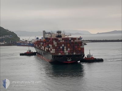
YM UNIFORM
Container Ship

Current Trip
| Time Travelled | 3 days |
|---|---|
| Remaining Time | 9 days |
| Distance Travelled | 1559.82 nm |
| Remaining Distance | 4343.82 nm |
| AVG Speed | 18.4 Knots |
| MAX Speed | 22.6 Knots |
| AVG Wind | 11.9 knots |
| MAX Wind | 33 knots |
| MIN Temp | -0.9°C / 30.38°F |
| MAX Temp | 17.2°C / 62.96°F |
| Draught | 13.8 m |
| Position Received | 19 h, 37 m ago |
Current Position
| Longitude | --- |
|---|---|
| Latitude | --- |
| Status | Under way using engine |
| Speed | 18.3 Knots |
| Course | 89.7° |
| Area | North Pacific Ocean |
| Station | T-AIS |
| Position Received | 19 h, 37 m ago |
Information
The current position of YM UNIFORM is in North Pacific Ocean with coordinates 41.63153° / 141.31112° as reported on 2025-03-26 18:51 by AIS to our vessel tracker app. The vessel's current speed is 18.3 Knots and is heading at the port of LOS ANGELES. The estimated time of arrival as calculated by MyShipTracking vessel tracking app is 2025-04-05 11:12 LT
The vessel YM UNIFORM (IMO: 9337482, MMSI: 636013693) is a Container Ship that was built in 2009 ( 16 years old ). It's sailing under the flag of [LR] Liberia.
In this page you can find informations about the vessels current position, last detected port calls, and current voyage information. If the vessels is not in coverage by AIS you will find the latest position.
The current position of YM UNIFORM is detected by our AIS receivers and we are not responsible for the reliability of the data. The last position was recorded while the vessel was in Coverage by the Ais receivers of our vessel tracking app.
The current draught of YM UNIFORM as reported by AIS is 13.8 meters
Weather
| Temperature | 0.8°C / 33.44°F |
|---|---|
| Wind Speed | 9 knots |
| Direction | 158° SSE |
| Pressure | 1012.1 hPa |
| Humidity | 80.8 % |
| Cloud Coverage | 100 % |


Featured Company
Last Port Calls
| Port | Arrival | Departure | Time In Port |
|---|---|---|---|
| 2025-03-23 16:54 | 2025-03-24 08:26 | 15 h | |
| 2025-03-21 06:55 | 2025-03-22 07:10 | 1 d | |
| 2025-03-19 15:54 | 2025-03-20 08:01 | 16 h | |
| 2025-03-17 20:26 | 2025-03-18 16:29 | 20 h | |
| 2025-03-13 01:25 | 2025-03-13 22:41 | 21 h | |
| 2025-03-08 22:08 | 2025-03-09 15:13 | 17 h | |
| 2025-03-06 04:25 | 2025-03-07 09:44 | 1 d | |
| 2025-02-14 20:48 | 2025-02-18 09:59 | 3 d | |
| 2025-02-02 05:10 | 2025-02-06 06:56 | 4 d | |
| 2025-01-30 05:13 | 2025-01-31 02:00 | 20 h |
Most Visited Ports (Last year)
| Port | Arrivals | |
|---|---|---|
| 10 | ||
| 10 | ||
| 6 | ||
| 5 | ||
| 5 | ||
| 4 |
Last Trips
| Origin | Departure | Destination | Arrival | Distance | |
|---|---|---|---|---|---|
| 2025-03-22 07:10 | 2025-03-23 16:54 | 342.04 nm | |||
| 2025-03-20 08:01 | 2025-03-21 06:55 | 240.78 nm | |||
| 2025-03-18 16:29 | 2025-03-19 15:54 | 349.40 nm | |||
| 2025-03-13 22:41 | 2025-03-17 20:26 | 1267.17 nm | |||
| 2025-03-09 15:13 | 2025-03-13 01:25 | 459.13 nm | |||
| 2025-03-07 09:44 | 2025-03-08 22:08 | 118.01 nm | |||
| 2025-02-18 09:59 | 2025-03-06 04:25 | 4812.32 nm | |||
| 2025-02-06 06:56 | 2025-02-14 20:48 | 193.34 nm | |||
| 2025-01-31 02:00 | 2025-02-02 05:10 | 661.73 nm | |||
| 2025-01-30 04:49 | 2025-01-30 05:13 | 0.67 nm |
Events
| Time | Event | Details | Position / Dest | Info |
|---|---|---|---|---|
| 2025-03-26 19:06 | Status Changed | Default Under way using engine |
41.63170 / 141.41728
CNNGB>USLAX
|
Speed: 18.3 kn Course: 89.7° |
| 2025-03-26 18:51 | Change Sea Area | Japanese part of the North Pacific Ocean Japanese part of the Japan Sea |
41.63153 / 141.31112
North Pacific Ocean
CNNGB>USLAX
|
Speed: 18.3 kn Course: 89.7° |
| 2025-03-26 18:51 | OUT of Coverage |
41.63153 / 141.31112
North Pacific Ocean
CNNGB>USLAX
|
Speed: 18.3 kn Course: 89.7° |
|
| 2025-03-26 18:28 | Draught Changed | 13.8 12.6 |
41.63255 / 141.16094
CNNGB>USLAX
|
Speed: 18.2 kn Course: 92.6° |
| 2025-03-26 18:28 | Destination Changed | CNNGB>USLAX TWKHH>TWKEL |
41.63255 / 141.16094
CNNGB>USLAX
|
Speed: 18.2 kn Course: 92.6° |
| 2025-03-26 18:28 | ETA Changed | 2025/04/07 10:00 2025/03/20 22:45 |
41.63255 / 141.16094
CNNGB>USLAX
|
Speed: 18.2 kn Course: 92.6° |
| 2025-03-26 18:27 | Status Changed | Under way using engine Default |
41.63280 / 141.15538
TWKHH>TWKEL
|
Speed: 21.7 kn Course: 91° |
| 2025-03-26 18:13 | Status Changed | Default Under way using engine |
41.63344 / 141.05060
TWKHH>TWKEL
|
Speed: 22.1 kn Course: 91.8° |
| 2025-03-26 16:45 | Status Changed | Under way using engine Default |
41.41478 / 140.45746
TWKHH>TWKEL
|
Speed: 22 kn Course: 57° |
| 2025-03-26 16:42 | Status Changed | Default Under way using engine |
41.40231 / 140.43195
TWKHH>TWKEL
|
Speed: 22.6 kn Course: 54.6° |