

YM INTELLIGENT
Container Ship

Current Trip
KHH>SHA
| Time Travelled | 3 h, 0 mins |
|---|---|
| Remaining Time | --- |
| Distance Travelled | 46.19 nm |
| Remaining Distance | --- |
| AVG Speed | 17.4 Knots |
| MAX Speed | 20.5 Knots |
| AVG Wind | 6.6 knots |
| MAX Wind | 9.2 knots |
| MIN Temp | 24.1°C / 75.38°F |
| MAX Temp | 24.9°C / 76.82°F |
| Draught | 9.2 m |
| Position Received | 2 h, 34 m ago |
Current Position
| Longitude | --- |
|---|---|
| Latitude | --- |
| Status | Under way using engine |
| Speed | 16.1 Knots |
| Course | 328° |
| Area | South China Sea |
| Station | T-AIS |
| Position Received | 2 h, 34 m ago |
Information
The current position of YM INTELLIGENT is in South China Sea with coordinates 22.58133° / 120.15357° as reported on 2025-03-27 19:15 by AIS to our vessel tracker app. The vessel's current speed is 16.1 Knots
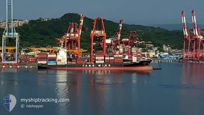
The vessel YM INTELLIGENT (IMO: 9319117, MMSI: 416486000) is a Container Ship that was built in 2006 ( 19 years old ). It's sailing under the flag of [TW] Taiwan.
In this page you can find informations about the vessels current position, last detected port calls, and current voyage information. If the vessels is not in coverage by AIS you will find the latest position.
The current position of YM INTELLIGENT is detected by our AIS receivers and we are not responsible for the reliability of the data. The last position was recorded while the vessel was in Coverage by the Ais receivers of our vessel tracking app.
The current draught of YM INTELLIGENT as reported by AIS is 9.2 meters
Weather
| Temperature | 24.1°C / 75.38°F |
|---|---|
| Wind Speed | 4 knots |
| Direction | 247° WSW |
| Pressure | 1009.4 hPa |
| Humidity | 80.7 % |
| Cloud Coverage | 43 % |


Featured Company
Last Port Calls
| Port | Arrival | Departure | Time In Port |
|---|---|---|---|
| 2025-03-27 07:18 | 2025-03-28 02:49 | 19 h | |
| 2025-03-23 16:18 | 2025-03-24 06:14 | 13 h | |
| 2025-03-22 20:10 | 2025-03-23 10:02 | 13 h | |
| 2025-03-20 21:17 | 2025-03-21 12:01 | 14 h | |
| 2025-03-18 04:53 | 2025-03-18 11:34 | 6 h | |
| 2025-03-12 17:56 | 2025-03-13 17:52 | 23 h | |
| 2025-03-11 08:58 | 2025-03-11 21:10 | 12 h | |
| 2025-03-10 08:13 | 2025-03-10 19:42 | 11 h | |
| 2025-03-07 04:05 | 2025-03-07 16:13 | 12 h | |
| 2025-03-06 02:33 | 2025-03-06 21:09 | 18 h |
Last Trips
| Origin | Departure | Destination | Arrival | Distance | |
|---|---|---|---|---|---|
| 2025-03-24 06:14 | 2025-03-27 07:18 | 922.66 nm | |||
| 2025-03-23 10:02 | 2025-03-23 16:18 | 77.77 nm | |||
| 2025-03-21 12:01 | 2025-03-22 20:10 | 497.82 nm | |||
| 2025-03-18 11:34 | 2025-03-20 21:17 | 764.56 nm | |||
| 2025-03-13 17:52 | 2025-03-18 04:53 | 772.75 nm | |||
| 2025-03-11 21:10 | 2025-03-12 17:56 | 142.00 nm | |||
| 2025-03-10 19:42 | 2025-03-11 08:58 | 119.39 nm | |||
| 2025-03-07 16:13 | 2025-03-10 08:13 | 731.05 nm | |||
| 2025-03-06 21:09 | 2025-03-07 04:05 | 75.86 nm | |||
| 2025-03-04 08:57 | 2025-03-06 02:33 | 508.63 nm |
Events
| Time | Event | Details | Position / Dest | Info |
|---|---|---|---|---|
| 2025-03-27 19:22 | Status Changed | Default Under way using engine |
22.61082 / 120.13786
KHH>SHA
|
Speed: 16.1 kn Course: 328° |
| 2025-03-27 19:15 | OUT of Coverage |
22.58133 / 120.15357
South China Sea
|
Speed: 16.1 kn Course: 328° |
|
| 2025-03-27 19:13 | Status Changed | Under way using engine Default |
22.57447 / 120.15823
KHH>SHA
|
Speed: 15.9 kn Course: 311° |
| 2025-03-27 19:06 | Status Changed | Default Under way using engine |
22.55265 / 120.18398
KHH>SHA
|
Speed: 17.2 kn Course: 271° |
| 2025-03-27 18:51 | Status Changed | Under way using engine Default |
22.54642 / 120.25748
KHH>SHA
|
Speed: 16.3 kn Course: 266° |
| 2025-03-27 18:51 | IN Coverage |
22.54622 / 120.25400
South China Sea
|
Speed: 16.7 kn Course: 266° |
|
| 2025-03-27 18:50 | Status Changed | Default Under way using engine |
22.54668 / 120.26240
KHH>SHA
|
Speed: 16.3 kn Course: 268° |
| 2025-03-27 18:50 | Status Changed | Under way using engine Default |
22.54673 / 120.26337
KHH>SHA
|
Speed: 15.4 kn Course: 266° |
| 2025-03-27 18:49 | PORT DEPARTURE |
|
22.54673 / 120.26337
KHH>SHA
|
Speed: 15.4 kn Course: 266° |
| 2025-03-27 18:30 | START Moving |
22.55328 / 120.32491
[TW] KAOHSIUNG
|
Speed: 5.3 kn Course: 287° |