
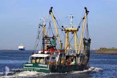
YE76 TOBBER
Fishing Vessel
Current Trip
| Trip Time | 1 h, 6 mins |
|---|---|
| Trip Distance | 10.48 nm |
| AVG Speed | 9.6 Knots |
| MAX Speed | 10 Knots |
| Draught | 0 m |
| AVG Wind | 9.2 knots |
| MAX Wind | 9.7 knots |
| MIN Temp | 7.6°C / 45.68°F |
| MAX Temp | 8.3°C / 46.94°F |
| Position Received | 7 h, 25 m ago |
Current Position
| Longitude | --- |
|---|---|
| Latitude | --- |
| Status | Engaged in Fishing |
| Speed | |
| Course | --- |
| Area | North Sea |
| Station | T-AIS |
| Position Received | 7 h, 25 m ago |
Info
Information
The current position of YE76 TOBBER is in North Sea with coordinates 51.49860° / 4.05521° as reported on 2025-12-12 16:12 by AIS to our vessel tracker app. The vessel's current speed is 0 Knots and is currently inside the port of YERSEKE.
The vessel YE76 TOBBER (IMO: 8431621, MMSI: 245731000) is a Fishing Vessel that was built in 1980 ( 45 years old ). It's sailing under the flag of [NL] Netherlands.
In this page you can find informations about the vessels current position, last detected port calls, and current voyage information. If the vessels is not in coverage by AIS you will find the latest position.
The current position of YE76 TOBBER is detected by our AIS receivers and we are not responsible for the reliability of the data. The last position was recorded while the vessel was in Coverage by the Ais receivers of our vessel tracking app.
Weather
| Temperature | 9.4°C / 48.92°F |
|---|---|
| Wind Speed | 8 knots |
| Direction | 199° SSW |
| Pressure | 1020.7 hPa |
| Humidity | 91.8 % |
| Cloud Coverage | 97 % |
Featured Company
Last Port Calls
| Port | Arrival | Departure | Time In Port |
|---|---|---|---|
| 2025-12-12 08:31 | |||
| 2025-12-12 06:33 | 2025-12-12 07:25 | 52 m | |
| 2025-12-12 05:37 | 2025-12-12 05:56 | 18 m | |
| 2025-12-05 06:30 | 2025-12-08 00:59 | 2 d | |
| 2025-11-28 03:18 | 2025-12-01 08:45 | 3 d | |
| 2025-11-11 22:08 | 2025-11-11 22:26 | 18 m | |
| 2025-11-11 20:24 | |||
| 2025-11-07 05:32 | 2025-11-07 07:31 | 1 h | |
| 2025-11-06 13:52 | 2025-11-06 15:01 | 1 h | |
| 2025-11-03 00:32 | 2025-11-03 00:49 | 16 m |
Most Visited Ports (Last year)
| Port | Arrivals | |
|---|---|---|
| 49 | ||
| 22 | ||
| 21 | ||
| 15 | ||
| 13 | ||
| 11 |
Last Trips
| Origin | Departure | Destination | Arrival | Distance | |
|---|---|---|---|---|---|
| 2025-12-12 07:25 | 2025-12-12 08:31 | 10.48 nm | |||
| 2025-12-12 05:56 | 2025-12-12 06:33 | 6.11 nm | |||
| 2025-12-08 00:59 | 2025-12-12 05:37 | 416.01 nm | |||
| 2025-12-01 08:45 | 2025-12-05 06:30 | 334.24 nm | |||
| 2025-11-11 22:26 | 2025-11-28 03:18 | 345.15 nm | |||
| 2025-11-11 20:24 | 2025-11-11 22:08 | 16.39 nm | |||
| 2025-11-06 15:01 | 2025-11-07 05:32 | 62.27 nm | |||
| 2025-11-03 00:49 | 2025-11-06 13:52 | 338.02 nm | |||
| 2025-10-31 07:17 | 2025-11-03 00:32 | 27.45 nm | |||
| 2025-10-31 05:46 | 2025-10-31 06:25 | 6.24 nm |
Events
| Time | Event | Details | Position / Dest | Info |
|---|---|---|---|---|
| 2025-12-12 16:12 | OUT of Coverage |
51.49860 / 4.05521
North Sea
[NL] YERSEKE
|
Speed: Course: 511° |
|
| 2025-12-12 16:06 | IN Coverage |
51.49859 / 4.05520
North Sea
[NL] YERSEKE
|
Speed: Course: 511° |
|
| 2025-12-12 08:28 | OUT of Coverage |
51.49885 / 4.05525
North Sea
[NL] YERSEKE
|
Speed: 1 kn Course: 3.9° |
|
| 2025-12-12 07:31 | PORT ARRIVAL |
|
51.49885 / 4.05525
[NL] YERSEKE
|
Speed: 9.2 kn Course: 148° |
| 2025-12-12 06:25 | START Moving | 0.24 nm, North East of COLIJNSPLAAT |
51.60484 / 3.85363
FISHINGGROUNDS
|
Speed: 8.6 kn Course: 53.3° |
| 2025-12-12 06:25 | PORT DEPARTURE |
|
51.60484 / 3.85363
FISHINGGROUNDS
|
Speed: 5 kn Course: 72.7° |
| 2025-12-12 05:35 | STOP Moving |
51.60272 / 3.85066
[NL] COLIJNSPLAAT
|
Speed: Course: 511° |
|
| 2025-12-12 05:33 | PORT ARRIVAL |
|
51.60346 / 3.85042
[NL] COLIJNSPLAAT
|
Speed: 3.9 kn Course: 211.2° |
| 2025-12-12 04:56 | PORT DEPARTURE |
|
51.61540 / 3.69822
FISHINGGROUNDS
|
Speed: 7.7 kn Course: 121.5° |
| 2025-12-12 04:53 | START Moving |
51.61825 / 3.68860
[NL] NEELTJE JANS
|
Speed: 6.3 kn Course: 94.2° |