
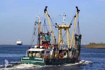
YE76 TOBBER
Fishing Vessel
Current Trip
FISHINGGROUNDS
| Time Travelled | 4 days |
|---|---|
| Remaining Time | --- |
| Distance Travelled | 222.28 nm |
| Remaining Distance | --- |
| AVG Speed | 3.6 Knopen |
| MAX Speed | 10.4 Knopen |
| AVG Wind | 14.8 knots |
| MAX Wind | 24 knots |
| MIN Temp | 5.6°C / 42.08°F |
| MAX Temp | 8.7°C / 47.66°F |
| Diepgang | 0 M |
| Positie ontvangen | Nu |
Current Position
| Lengtegraad | 8.56503° |
|---|---|
| Breedtegraat | 55.08786° |
| Status | Engaged in Fishing |
| Snelheid | |
| Koers | --- |
| Gebied | North Sea |
| Station | T-AIS |
| Positie ontvangen | Nu |
Info
Information
The current position of YE76 TOBBER is in North Sea with coordinates 55.08786° / 8.56503° as reported on 2024-04-19 17:48 by AIS to our vessel tracker app. The vessel's current speed is 0 Knopen
The vessel YE76 TOBBER (IMO: 8431621, MMSI: 245731000) is a Fishing Vessel that was built in 1980 ( 44 Jaar oud ). It's sailing under the flag of [NL] Netherlands.
In this page you can find informations about the vessels current position, last detected port calls, and current voyage information. If the vessels is not in coverage by AIS you will find the latest position.
The current position of YE76 TOBBER is detected by our AIS receivers and we are not responsible for the reliability of the data. The last position was recorded while the vessel was in Coverage by the Ais receivers of our vessel tracking app.
Weather
| Temperature | 7.1°C / 44.78°F |
|---|---|
| Wind Speed | 22 knots |
| Direction | 24° NNE |
| Pressure | 1005.6 hPa |
| Humidity | 71.9 % |
| Cloud Coverage | 96 % |
Featured Company
Last Port Calls
| Port | Arrival | Departure | Time In Port |
|---|---|---|---|
| 2024-04-15 13:08 | |||
| 2024-03-19 14:30 | 2024-03-19 14:48 | 18 m | |
| 2024-03-19 11:21 | 2024-03-19 12:51 | 1 h | |
| 2024-03-19 10:04 | 2024-03-19 10:42 | 37 m | |
| 2024-03-19 07:15 | 2024-03-19 07:45 | 30 m | |
| 2024-03-17 22:50 | 2024-03-17 23:08 | 17 m | |
| 2024-03-14 18:43 | 2024-03-17 21:11 | 3 d | |
| 2024-03-14 16:16 | 2024-03-14 16:53 | 37 m | |
| 2024-03-10 23:35 | 2024-03-10 23:53 | 17 m | |
| 2024-03-07 13:32 | 2024-03-10 21:36 | 3 d |
Most Visited Ports (Last year)
| Port | Arrivals | |
|---|---|---|
| 86 | ||
| 39 | ||
| 18 | ||
| 9 | ||
| 3 | ||
| 3 |
Last Trips
| Origin | Departure | Destination | Arrival | Distance | |
|---|---|---|---|---|---|
| 2024-03-19 13:51 | 2024-03-19 15:30 | 16.21 nm | |||
| 2024-03-19 11:42 | 2024-03-19 12:21 | 5.29 nm | |||
| 2024-03-19 08:45 | 2024-03-19 11:04 | 20.68 nm | |||
| 2024-03-18 00:08 | 2024-03-19 08:15 | 149.36 nm | |||
| 2024-03-17 22:11 | 2024-03-17 23:50 | 16.46 nm | |||
| 2024-03-14 17:53 | 2024-03-14 19:43 | 16.23 nm | |||
| 2024-03-11 00:53 | 2024-03-14 17:16 | 401.49 nm | |||
| 2024-03-10 22:36 | 2024-03-11 00:35 | 16.73 nm | |||
| 2024-03-07 13:12 | 2024-03-07 14:32 | 10.19 nm | |||
| 2024-03-07 12:09 | 2024-03-07 12:49 | 6.08 nm |
Events
| Tijd | Evenement | Details | Positie / Bestemming | Info |
|---|---|---|---|---|
| 2024-04-19 07:13 | Stop beweging | 6.13 nm, North East of LIST SYLT |
55.08733 / 8.56755
FISHINGGROUNDS
|
Snelheid: 0.2 kn Koers: 511° |
| 2024-04-19 06:34 | Wijzig zee gebeid | Danish part of the North Sea German part of the North Sea |
55.05714 / 8.47230
North Sea
|
Snelheid: 9.6 kn Koers: 94.5° |
| 2024-04-17 21:28 | Binnenbereik |
54.81054 / 7.90009
North Sea
|
Snelheid: 3.6 kn Koers: 17.6° |
|
| 2024-04-17 18:18 | Buitenbereik |
54.74124 / 8.02368
North Sea
|
Snelheid: 3.3 kn Koers: 280.9° |
|
| 2024-04-17 09:06 | Start beweging | 9.34 nm, West of HOERNUM |
54.70091 / 8.04912
FISHINGGROUNDS
|
Snelheid: 3.3 kn Koers: 64.6° |
| 2024-04-17 09:03 | Stop beweging | 9.39 nm, West of HOERNUM |
54.70227 / 8.04649
FISHINGGROUNDS
|
Snelheid: 0.3 kn Koers: 511° |
| 2024-04-16 23:44 | Binnenbereik |
54.53200 / 7.93673
North Sea
|
Snelheid: 3.2 kn Koers: 34.7° |
|
| 2024-04-16 22:42 | Buitenbereik |
54.49724 / 7.98547
North Sea
|
Snelheid: 3.5 kn Koers: 156.8° |
|
| 2024-04-16 17:01 | Binnenbereik |
54.55992 / 7.92142
North Sea
|
Snelheid: 3.1 kn Koers: 147.9° |
|
| 2024-04-16 15:05 | Buitenbereik |
54.48190 / 8.00784
North Sea
|
Snelheid: 3.2 kn Koers: 148.4° |