
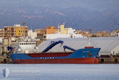
WILSON PORTO
General Cargo
Current Trip
| Time Travelled | 4 days |
|---|---|
| Remaining Time | --- |
| Distance Travelled | 761.85 nm |
| Remaining Distance | --- |
| AVG Speed | 9.9 Knots |
| MAX Speed | 11.8 Knots |
| AVG Wind | 8.1 knots |
| MAX Wind | 28 knots |
| MIN Temp | 7.5°C / 45.5°F |
| MAX Temp | 14.9°C / 58.82°F |
| Draught | 5.8 m |
| Position Received | 1 h, 18 m ago |
Current Position
| Longitude | --- |
|---|---|
| Latitude | --- |
| Status | Under way using engine |
| Speed | 11.4 Knots |
| Course | 164.8° |
| Area | North Atlantic Ocean |
| Station | T-AIS |
| Position Received | 1 h, 18 m ago |
Info
Information
The current position of WILSON PORTO is in North Atlantic Ocean with coordinates 37.06934° / -9.65025° as reported on 2025-02-17 03:12 by AIS to our vessel tracker app. The vessel's current speed is 11.4 Knots and is heading at the port of CARONTE. The estimated time of arrival as calculated by MyShipTracking vessel tracking app is 2025-02-20 23:00 LT
The vessel WILSON PORTO (IMO: 9291717, MMSI: 257545000) is a General Cargo that was built in 2004 ( 21 years old ). It's sailing under the flag of [NO] Norway.
In this page you can find informations about the vessels current position, last detected port calls, and current voyage information. If the vessels is not in coverage by AIS you will find the latest position.
The current position of WILSON PORTO is detected by our AIS receivers and we are not responsible for the reliability of the data. The last position was recorded while the vessel was in Coverage by the Ais receivers of our vessel tracking app.
The current draught of WILSON PORTO as reported by AIS is 5.8 meters
Weather
| Temperature | 14.9°C / 58.82°F |
|---|---|
| Wind Speed | 8 knots |
| Direction | 13° NNE |
| Pressure | 1016.3 hPa |
| Humidity | 71.4 % |
| Cloud Coverage | 39 % |
Featured Company
Last Port Calls
| Port | Arrival | Departure | Time In Port |
|---|---|---|---|
| 2025-02-10 19:47 | 2025-02-12 21:37 | 2 d | |
| 2025-02-04 22:23 | 2025-02-05 21:28 | 23 h | |
| 2025-02-04 05:46 | 2025-02-04 21:01 | 15 h | |
| 2025-01-30 13:12 | 2025-02-03 21:05 | 4 d | |
| 2025-01-14 20:34 | 2025-01-15 20:59 | 1 d | |
| 2025-01-08 03:52 | 2025-01-09 02:26 | 22 h | |
| 2024-12-19 19:18 | 2024-12-21 00:19 | 1 d | |
| 2024-12-17 03:11 | 2024-12-17 21:14 | 18 h | |
| 2024-12-11 01:44 | 2024-12-13 22:17 | 2 d | |
| 2024-12-01 16:57 | 2024-12-04 18:16 | 3 d |
Last Trips
| Origin | Departure | Destination | Arrival | Distance | |
|---|---|---|---|---|---|
| 2025-02-05 21:28 | 2025-02-10 19:47 | 818.24 nm | |||
| 2025-02-04 21:01 | 2025-02-04 22:23 | 15.84 nm | |||
| 2025-02-03 21:05 | 2025-02-04 05:46 | 87.35 nm | |||
| 2025-01-15 20:59 | 2025-01-30 13:12 | 1958.55 nm | |||
| 2025-01-09 02:26 | 2025-01-14 20:34 | 1122.92 nm | |||
| 2024-12-21 00:19 | 2025-01-08 03:52 | 1088.60 nm | |||
| 2024-12-17 21:14 | 2024-12-19 19:18 | 218.97 nm | |||
| 2024-12-13 22:17 | 2024-12-17 03:11 | 723.39 nm | |||
| 2024-12-04 18:16 | 2024-12-11 01:44 | 1407.36 nm | |||
| 2024-11-29 08:51 | 2024-12-01 16:57 | 202.36 nm |
Events
| Time | Event | Details | Position / Dest | Info |
|---|---|---|---|---|
| 2025-02-17 03:19 | Status Changed | Default Under way using engine |
37.04765 / -9.64347
FRCOZ
|
Speed: 11.4 kn Course: 164.8° |
| 2025-02-17 03:12 | OUT of Coverage |
37.06934 / -9.65025
North Atlantic Ocean
FRCOZ
|
Speed: 11.4 kn Course: 164.8° |
|
| 2025-02-17 03:08 | Status Changed | Under way using engine Default |
37.08049 / -9.65373
FRCOZ
|
Speed: 11.2 kn Course: 167° |
| 2025-02-17 03:07 | Status Changed | Default Under way using engine |
37.08241 / -9.65431
FRCOZ
|
Speed: 10.5 kn Course: 162.3° |
| 2025-02-17 03:07 | Status Changed | Under way using engine Default |
37.08343 / -9.65463
FRCOZ
|
Speed: 10.5 kn Course: 167° |
| 2025-02-17 02:55 | Status Changed | Default Under way using engine |
37.11591 / -9.66468
FRCOZ
|
Speed: 10.3 kn Course: 161° |
| 2025-02-17 02:48 | Status Changed | Under way using engine Default |
37.13627 / -9.67079
FRCOZ
|
Speed: 10.3 kn Course: 172° |
| 2025-02-17 02:47 | Status Changed | Default Under way using engine |
37.13868 / -9.67154
FRCOZ
|
Speed: 10.3 kn Course: 163.9° |
| 2025-02-17 02:16 | Status Changed | Under way using engine Default |
37.22773 / -9.69523
FRCOZ
|
Speed: 10.4 kn Course: 165° |
| 2025-02-17 02:15 | Status Changed | Default Under way using engine |
37.23019 / -9.69582
FRCOZ
|
Speed: 10.5 kn Course: 169.2° |