

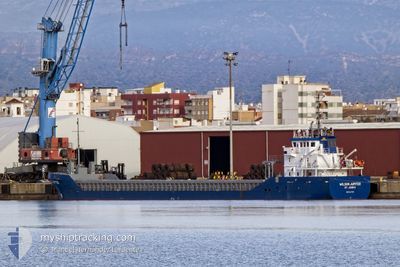
WILSON JUPITER
Cargo

Current Trip
| Trip Time | 3 days |
|---|---|
| Trip Distance | 640.60 nm |
| AVG Speed | 9.6 Knots |
| MAX Speed | 11.9 Knots |
| Draught | 5.5 m |
| AVG Wind | 8.5 knots |
| MAX Wind | 14.5 knots |
| MIN Temp | -4.2°C / 24.44°F |
| MAX Temp | 5.8°C / 42.44°F |
| Position Received | 4 m ago |
Current Position
| Longitude | --- |
|---|---|
| Latitude | --- |
| Status | Moored |
| Speed | |
| Course | 201° |
| Area | Kattegat |
| Station | T-AIS |
| Position Received | 4 m ago |
Information
The current position of WILSON JUPITER is in Kattegat with coordinates 57.06770° / 9.97398° as reported on 2025-02-04 07:17 by AIS to our vessel tracker app. The vessel's current speed is 0 Knots and is currently inside the port of AALBORG.
The vessel WILSON JUPITER (IMO: 9411795, MMSI: 305819000) is a Cargo It's sailing under the flag of [AG] Antigua Barbuda.
In this page you can find informations about the vessels current position, last detected port calls, and current voyage information. If the vessels is not in coverage by AIS you will find the latest position.
The current position of WILSON JUPITER is detected by our AIS receivers and we are not responsible for the reliability of the data. The last position was recorded while the vessel was in Coverage by the Ais receivers of our vessel tracking app.
The current draught of WILSON JUPITER as reported by AIS is 5.5 meters
Weather
| Temperature | 3.6°C / 38.48°F |
|---|---|
| Wind Speed | 10 knots |
| Direction | 203° SSW |
| Pressure | 1020.8 hPa |
| Humidity | 96.1 % |
| Cloud Coverage | 100 % |


Featured Company
Last Port Calls
| Port | Arrival | Departure | Time In Port |
|---|---|---|---|
| 2025-02-02 14:13 | |||
| 2025-01-28 15:09 | 2025-01-29 15:12 | 1 d | |
| 2025-01-20 18:12 | 2025-01-25 17:54 | 4 d | |
| 2025-01-20 12:30 | 2025-01-20 17:30 | 5 h | |
| 2025-01-20 07:00 | 2025-01-20 12:22 | 5 h | |
| 2025-01-20 00:52 | 2025-01-20 06:41 | 5 h | |
| 2025-01-10 23:26 | 2025-01-14 18:32 | 3 d | |
| 2025-01-10 12:25 | 2025-01-10 12:49 | 23 m | |
| 2025-01-09 12:39 | 2025-01-09 13:00 | 21 m | |
| 2025-01-08 03:37 | 2025-01-08 13:29 | 9 h |
Most Visited Ports (Last year)
| Port | Arrivals | |
|---|---|---|
| 4 | ||
| 4 | ||
| 4 | ||
| 3 | ||
| 3 | ||
| 3 |
Last Trips
| Origin | Departure | Destination | Arrival | Distance | |
|---|---|---|---|---|---|
| 2025-01-29 16:12 | 2025-02-02 15:13 | 640.60 nm | |||
| 2025-01-25 18:54 | 2025-01-28 16:09 | 685.04 nm | |||
| 2025-01-20 18:30 | 2025-01-20 19:12 | 6.62 nm | |||
| 2025-01-20 13:22 | 2025-01-20 13:30 | 2.54 nm | |||
| 2025-01-20 07:41 | 2025-01-20 08:00 | 3.36 nm | |||
| 2025-01-14 18:32 | 2025-01-20 01:52 | 728.57 nm | |||
| 2025-01-10 12:49 | 2025-01-10 23:26 | 15.47 nm | |||
| 2025-01-09 13:00 | 2025-01-10 12:25 | 0.47 nm | |||
| 2025-01-08 14:29 | 2025-01-09 12:39 | 184.92 nm | |||
| 2025-01-08 03:24 | 2025-01-08 04:37 | 12.53 nm |
Events
| Time | Event | Details | Position / Dest | Info |
|---|---|---|---|---|
| 2025-02-03 23:14 | Status Changed | Moored Default |
57.06771 / 9.97397
[DK] AALBORG
|
Speed: Course: 201° |
| 2025-02-03 23:12 | Status Changed | Default Moored |
57.06772 / 9.97397
[DK] AALBORG
|
Speed: Course: 201° |
| 2025-02-03 18:11 | Status Changed | Moored Default |
57.06773 / 9.97398
[DK] AALBORG
|
Speed: Course: 201° |
| 2025-02-03 18:09 | Status Changed | Default Moored |
57.06771 / 9.97398
[DK] AALBORG
|
Speed: Course: 201° |
| 2025-02-02 14:50 | Status Changed | Moored Under way using engine |
57.06771 / 9.97397
[DK] AALBORG
|
Speed: Course: 200° |
| 2025-02-02 14:48 | STOP Moving |
57.06772 / 9.97396
[DK] AALBORG
|
Speed: 0.3 kn Course: 201° |
|
| 2025-02-02 14:13 | PORT ARRIVAL |
|
57.06253 / 10.04600
[DK] AALBORG
|
Speed: 9.3 kn Course: 326.9° |
| 2025-02-02 07:40 | ETA Changed | 2025/02/02 16:00 2025/02/02 13:00 |
57.41890 / 10.72588
DKAAL
|
Speed: 9.5 kn Course: 184° |
| 2025-02-02 05:34 | Change Sea Area | Danish part of the Kattegat Danish part of the Skaggerak |
57.75892 / 10.77008
Kattegat
DKAAL
|
Speed: 9.9 kn Course: 180.8° |
| 2025-02-02 00:34 | Detected in Sea | Danish part of the Skaggerak |
57.84211 / 9.14459
Skaggerak
DKAAL
|
Speed: 10.1 kn Course: 94.5° |