
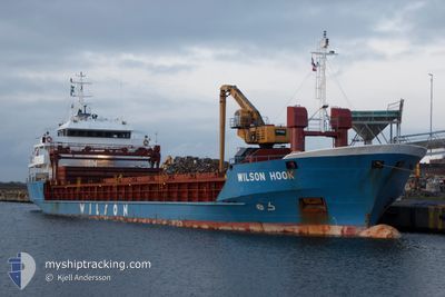
WILSON HOOK
General Cargo
Current Trip
| Time Travelled | 11 days |
|---|---|
| Remaining Time | --- |
| Distance Travelled | 1570.33 nm |
| Remaining Distance | --- |
| AVG Speed | 9.9 Knots |
| MAX Speed | 13.2 Knots |
| AVG Wind | 16 knots |
| MAX Wind | 31 knots |
| MIN Temp | 0.6°C / 33.08°F |
| MAX Temp | 16.4°C / 61.52°F |
| Draught | 4.1 m |
| Position Received | 8 d ago |
Current Position
| Longitude | --- |
|---|---|
| Latitude | --- |
| Status | Under way using engine |
| Speed | 9.1 Knots |
| Course | 73.6° |
| Area | Black Sea |
| Station | T-AIS |
| Position Received | 8 d ago |
Info
Information
The current position of WILSON HOOK is in Black Sea with coordinates 41.32700° / 29.59683° as reported on 2025-02-08 14:14 by AIS to our vessel tracker app. The vessel's current speed is 9.1 Knots and is heading at the port of FATSA. The estimated time of arrival as calculated by MyShipTracking vessel tracking app is 2025-02-10 05:00 LT
The vessel WILSON HOOK (IMO: 9017434, MMSI: 257077560) is a General Cargo that was built in 2003 ( 22 years old ). It's sailing under the flag of [NO] Norway.
In this page you can find informations about the vessels current position, last detected port calls, and current voyage information. If the vessels is not in coverage by AIS you will find the latest position.
The current position of WILSON HOOK is detected by our AIS receivers and we are not responsible for the reliability of the data. The last position was recorded while the vessel was in Coverage by the Ais receivers of our vessel tracking app.
The current draught of WILSON HOOK as reported by AIS is 4.1 meters
Weather
| Temperature | 5.7°C / 42.26°F |
|---|---|
| Wind Speed | 17 knots |
| Direction | 55° NE |
| Pressure | 1017.7 hPa |
| Humidity | 87 % |
| Cloud Coverage | 100 % |
Featured Company
Last Port Calls
| Port | Arrival | Departure | Time In Port |
|---|---|---|---|
| 2025-02-03 03:37 | 2025-02-04 17:53 | 1 d | |
| 2025-01-25 08:37 | 2025-01-25 18:51 | 10 h | |
| 2025-01-16 16:41 | 2025-01-17 16:24 | 23 h | |
| 2025-01-07 17:14 | 2025-01-10 18:24 | 3 d | |
| 2025-01-02 03:36 | 2025-01-02 21:41 | 18 h | |
| 2024-12-29 10:27 | 2024-12-30 03:04 | 16 h | |
| 2024-12-13 16:31 | 2024-12-17 08:30 | 3 d | |
| 2024-12-06 21:50 | 2024-12-09 19:10 | 2 d | |
| 2024-12-02 18:03 | 2024-12-05 06:12 | 2 d |
Last Trips
| Origin | Departure | Destination | Arrival | Distance | |
|---|---|---|---|---|---|
| 2025-01-25 19:51 | 2025-02-03 06:37 | 2058.52 nm | |||
| 2025-01-17 17:24 | 2025-01-25 09:37 | 1891.83 nm | |||
| 2025-01-10 19:24 | 2025-01-16 17:41 | 487.95 nm | |||
| 2025-01-02 22:41 | 2025-01-07 18:14 | 228.13 nm | |||
| 2024-12-30 04:04 | 2025-01-02 04:36 | 4.73 nm | |||
| 2024-12-17 09:30 | 2024-12-29 11:27 | 1187.08 nm | |||
| 2024-12-09 19:10 | 2024-12-13 17:31 | 971.19 nm | |||
| 2024-12-05 06:12 | 2024-12-06 21:50 | 358.99 nm | |||
| 2024-11-29 21:24 | 2024-12-02 18:03 | 555.86 nm |
Events
| Time | Event | Details | Position / Dest | Info |
|---|---|---|---|---|
| 2025-02-12 16:01 | STOP Moving | 3.5 nm, South West of BARTIN |
41.65179 / 32.17008
TR ISK > TR FAS
|
Speed: Course: 288° |
| 2025-02-08 14:16 | Status Changed | Default Under way using engine |
41.32839 / 29.60254
TR ISK > TR FAS
|
Speed: 9.1 kn Course: 73.6° |
| 2025-02-08 14:14 | OUT of Coverage |
41.32700 / 29.59683
Black Sea
TR ISK > TR FAS
|
Speed: 9.1 kn Course: 73.6° |
|
| 2025-02-08 11:55 | Change Sea Area | Turkish part of the Black Sea Turkish part of the Sea of Marmara |
41.22857 / 29.14711
Black Sea
TR ISK > TR FAS
|
Speed: 8.7 kn Course: 49.3° |
| 2025-02-08 07:28 | Status Changed | Under way using engine Default |
40.65693 / 28.74722
TR ISK > TR FAS
|
Speed: 9.8 kn Course: 25° |
| 2025-02-08 07:25 | Status Changed | Default Under way using engine |
40.65021 / 28.74317
TR ISK > TR FAS
|
Speed: 9.6 kn Course: 25° |
| 2025-02-08 06:59 | Status Changed | Under way using engine Default |
40.58492 / 28.70682
TR ISK > TR FAS
|
Speed: 7.4 kn Course: 21° |
| 2025-02-08 06:57 | Status Changed | Default Under way using engine |
40.57989 / 28.70420
TR ISK > TR FAS
|
Speed: 4.8 kn Course: 22° |
| 2025-02-08 06:50 | Status Changed | Under way using engine Default |
40.57026 / 28.69957
TR ISK > TR FAS
|
Speed: 3 kn Course: 27° |
| 2025-02-08 06:42 | Status Changed | Default Under way using engine |
40.56737 / 28.69570
TR ISK > TR FAS
|
Speed: 1.6 kn Course: 129° |