

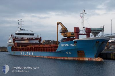
WILSON HOOK
General Cargo

Current Trip
| Time Travelled | 14 h, 10 mins |
|---|---|
| Remaining Time | 4 days |
| Distance Travelled | 144.01 nm |
| Remaining Distance | 1257.65 nm |
| AVG Speed | 8.8 Knots |
| MAX Speed | 11.9 Knots |
| AVG Wind | 5.7 knots |
| MAX Wind | 7 knots |
| MIN Temp | 9.1°C / 48.38°F |
| MAX Temp | 15.7°C / 60.26°F |
| Dybgang | 5 m |
| Position Modtaget | 8 h, 36 m siden |
Current Position
| Longitude | --- |
|---|---|
| Latitude | --- |
| Status | Under way using engine |
| Fart | 11.1 Knots |
| Kurs | 287° |
| Område | North Atlantic Ocean |
| Station | T-AIS |
| Position Modtaget | 8 h, 36 m siden |
Information
The current position of WILSON HOOK is in North Atlantic Ocean with coordinates 35.95920° / -6.22124° as reported on 2025-03-27 06:46 by AIS to our vessel tracker app. The vessel's current speed is 11.1 Knots and is heading at the port of ROTTERDAM. The estimated time of arrival as calculated by MyShipTracking vessel tracking app is 2025-04-01 11:24 LT
The vessel WILSON HOOK (IMO: 9017434, MMSI: 257077560) is a General Cargo that was built in 2003 ( 22 år gamle ). It's sailing under the flag of [NO] Norway.
In this page you can find informations about the vessels current position, last detected port calls, and current voyage information. If the vessels is not in coverage by AIS you will find the latest position.
The current position of WILSON HOOK is detected by our AIS receivers and we are not responsible for the reliability of the data. The last position was recorded while the vessel was in Coverage by the Ais receivers of our vessel tracking app.
The current draught of WILSON HOOK as reported by AIS is 5 meters
Weather
| Temperature | 14.1°C / 57.38°F |
|---|---|
| Wind Speed | 6 knots |
| Direction | 287° WNW |
| Pressure | 1017.1 hPa |
| Humidity | 68.8 % |
| Cloud Coverage | 72 % |


Featured Company
Last Port Calls
| Port | Arrival | Departure | Time In Port |
|---|---|---|---|
| 2025-03-25 11:47 | 2025-03-27 02:13 | 1 d | |
| 2025-03-20 16:21 | 2025-03-21 06:00 | 13 h | |
| 2025-03-11 05:47 | 2025-03-11 19:20 | 13 h | |
| 2025-03-09 09:04 | 2025-03-11 05:34 | 1 d | |
| 2025-03-06 15:24 | 2025-03-08 05:23 | 1 d | |
| 2025-02-27 11:39 | 2025-02-27 21:40 | 10 h | |
| 2025-02-19 12:05 | 2025-02-20 09:00 | 20 h | |
| 2025-02-03 06:37 | 2025-02-04 20:53 | 1 d | |
| 2025-01-25 09:37 | 2025-01-25 19:51 | 10 h | |
| 2025-01-16 17:41 | 2025-01-17 17:24 | 23 h |
Last Trips
| Origin | Departure | Destination | Arrival | Distance | |
|---|---|---|---|---|---|
| 2025-03-21 06:00 | 2025-03-25 11:47 | 515.24 nm | |||
| 2025-03-11 19:20 | 2025-03-20 16:21 | 1844.80 nm | |||
| 2025-03-11 05:34 | 2025-03-11 05:47 | 1.84 nm | |||
| 2025-03-08 05:23 | 2025-03-09 09:04 | 186.54 nm | |||
| 2025-02-27 21:40 | 2025-03-06 15:24 | 1685.15 nm | |||
| 2025-02-20 09:00 | 2025-02-27 11:39 | 1748.45 nm | |||
| 2025-02-04 20:53 | 2025-02-19 12:05 | 1574.25 nm | |||
| 2025-01-25 19:51 | 2025-02-03 06:37 | 2058.52 nm | |||
| 2025-01-17 17:24 | 2025-01-25 09:37 | 1891.83 nm | |||
| 2025-01-10 19:24 | 2025-01-16 17:41 | 487.95 nm |
Events
| Tid | Hændelsen | Detaljer | Position / Dest | Info |
|---|---|---|---|---|
| 2025-03-27 06:50 | Status er ændret | Default Under way using engine |
35.96245 / -6.23346
ES ALG > NL RTM
|
Fart: 11.1 kn Kurs: 287° |
| 2025-03-27 06:46 | Status er ændret | Under way using engine Default |
35.95920 / -6.22124
ES ALG > NL RTM
|
Fart: 11.2 kn Kurs: 269° |
| 2025-03-27 06:46 | Udenfor Dækning |
35.95920 / -6.22124
North Atlantic Ocean
ES ALG > NL RTM
|
Fart: 11.1 kn Kurs: 287° |
|
| 2025-03-27 06:46 | Ændre havområde | Spanish part of the North Atlantic Ocean Moroccan part of the North Atlantic Ocean |
35.95920 / -6.22124
North Atlantic Ocean
ES ALG > NL RTM
|
Fart: 11.1 kn Kurs: 287° |
| 2025-03-27 05:57 | Status er ændret | Default Under way using engine |
35.95760 / -6.03572
ES ALG > NL RTM
|
Fart: 10.8 kn Kurs: 270.1° |
| 2025-03-27 05:41 | Ændre havområde | Moroccan part of the North Atlantic Ocean Spanish part of the Strait of Gibraltar |
35.95780 / -5.97479
North Atlantic Ocean
ES ALG > NL RTM
|
Fart: 10.6 kn Kurs: 269.2° |
| 2025-03-27 04:49 | Status er ændret | Under way using engine Default |
35.95895 / -5.79425
ES ALG > NL RTM
|
Fart: 9 kn Kurs: 271° |
| 2025-03-27 04:47 | Status er ændret | Default Under way using engine |
35.95877 / -5.78685
ES ALG > NL RTM
|
Fart: 9 kn Kurs: 271.9° |
| 2025-03-27 04:33 | Status er ændret | Under way using engine Default |
35.95830 / -5.74450
ES ALG > NL RTM
|
Fart: 9.3 kn Kurs: 271° |
| 2025-03-27 04:32 | Status er ændret | Default Under way using engine |
35.95821 / -5.73980
ES ALG > NL RTM
|
Fart: 8.7 kn Kurs: 271.1° |