
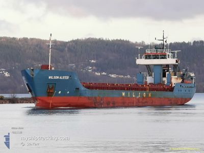
WILSON ALSTER
General Cargo
Current Trip
| Time Travelled | 3 days |
|---|---|
| Remaining Time | 1 day |
| Distance Travelled | 342.57 nm |
| Remaining Distance | 401.41 nm |
| AVG Speed | 9.2 Knots |
| MAX Speed | 13.7 Knots |
| AVG Wind | 9.1 knots |
| MAX Wind | 22.1 knots |
| MIN Temp | 3.8°C / 38.84°F |
| MAX Temp | 10.6°C / 51.08°F |
| Draught | 2.9 m |
| Position Received | 22 h, 20 m ago |
Current Position
| Longitude | -5.67507° |
|---|---|
| Latitude | 52.71981° |
| Status | Under way using engine |
| Speed | 12 Knots |
| Course | 182.7° |
| Area | Irish Sea and St. George's Channel |
| Station | T-AIS |
| Position Received | 22 h, 20 m ago |
Info
Information
The current position of WILSON ALSTER is in Irish Sea and St. George's Channel with coordinates 52.71981° / -5.67507° as reported on 2024-04-26 03:18 by AIS to our vessel tracker app. The vessel's current speed is 12 Knots and is heading at the port of ANTWERP. The estimated time of arrival as calculated by MyShipTracking vessel tracking app is 2024-04-28 17:02 LT
The vessel WILSON ALSTER (IMO: 9222429, MMSI: 314019000) is a General Cargo that was built in 2005 ( 19 years old ). It's sailing under the flag of [BB] Barbados.
In this page you can find informations about the vessels current position, last detected port calls, and current voyage information. If the vessels is not in coverage by AIS you will find the latest position.
The current position of WILSON ALSTER is detected by our AIS receivers and we are not responsible for the reliability of the data. The last position was recorded while the vessel was in Coverage by the Ais receivers of our vessel tracking app.
The current draught of WILSON ALSTER as reported by AIS is 2.9 meters
Weather
| Temperature | 7.7°C / 45.86°F |
|---|---|
| Wind Speed | 4 knots |
| Direction | 24° NNE |
| Pressure | 1000.4 hPa |
| Humidity | 87.2 % |
| Cloud Coverage | 72 % |
Featured Company
Last Port Calls
| Port | Arrival | Departure | Time In Port |
|---|---|---|---|
| 2024-04-20 13:18 | 2024-04-23 06:18 | 2 d | |
| 2024-04-14 23:51 | 2024-04-15 18:26 | 18 h | |
| 2024-04-11 03:58 | 2024-04-13 08:01 | 2 d | |
| 2024-04-07 15:49 | 2024-04-09 08:44 | 1 d | |
| 2024-04-02 18:58 | 2024-04-03 13:08 | 18 h | |
| 2024-04-01 08:08 | 2024-04-02 14:31 | 1 d | |
| 2024-03-29 10:06 | 2024-03-29 19:18 | 9 h | |
| 2024-03-27 13:11 | 2024-03-28 22:59 | 1 d | |
| 2024-03-26 23:27 | 2024-03-26 23:51 | 24 m | |
| 2024-03-25 05:19 | 2024-03-26 14:16 | 1 d |
Last Trips
| Origin | Departure | Destination | Arrival | Distance | |
|---|---|---|---|---|---|
| 2024-04-15 20:26 | 2024-04-20 14:18 | 986.02 nm | |||
| 2024-04-13 10:01 | 2024-04-15 01:51 | 313.80 nm | |||
| 2024-04-09 10:44 | 2024-04-11 05:58 | 398.48 nm | |||
| 2024-04-03 15:08 | 2024-04-07 17:49 | 61.55 nm | |||
| 2024-04-02 16:31 | 2024-04-02 20:58 | 40.29 nm | |||
| 2024-03-29 20:18 | 2024-04-01 10:08 | 525.00 nm | |||
| 2024-03-28 23:59 | 2024-03-29 11:06 | 107.40 nm | |||
| 2024-03-27 00:51 | 2024-03-27 14:11 | 95.18 nm | |||
| 2024-03-26 15:16 | 2024-03-27 00:27 | 60.98 nm | |||
| 2024-03-18 19:55 | 2024-03-25 06:19 | 767.32 nm |
Events
| Time | Event | Details | Position / Dest | Info |
|---|---|---|---|---|
| 2024-04-26 03:18 | Status Changed | Default Under way using engine |
52.71812 / -5.67523
ANTWERPEN
|
Speed: 12 kn Course: 182.7° |
| 2024-04-26 03:18 | Status Changed | Under way using engine Default |
52.71981 / -5.67507
ANTWERPEN
|
Speed: 12.2 kn Course: 183° |
| 2024-04-26 03:18 | OUT of Coverage |
52.71981 / -5.67507
Irish Sea and St. George's Channel
ANTWERPEN
|
Speed: 12 kn Course: 182.7° |
|
| 2024-04-26 03:14 | Status Changed | Default Under way using engine |
52.73216 / -5.67412
ANTWERPEN
|
Speed: 12 kn Course: 183° |
| 2024-04-25 23:10 | Detected in Sea | Irish part of the Irish Sea and St. George's Channel |
53.48068 / -5.61772
Irish Sea and St. George's Channel
ANTWERPEN
|
Speed: 8.5 kn Course: 182.6° |
| 2024-04-25 23:10 | Status Changed | Under way using engine Default |
53.48068 / -5.61772
ANTWERPEN
|
Speed: 8.4 kn Course: 182° |
| 2024-04-25 22:58 | IN Coverage |
53.48068 / -5.61772
Irish Sea and St. George's Channel
ANTWERPEN
|
Speed: 8.5 kn Course: 182.6° |
|
| 2024-04-25 19:30 | Status Changed | Default Under way using engine |
54.01057 / -5.42777
ANTWERPEN
|
Speed: 9.8 kn Course: 198.2° |
| 2024-04-25 19:25 | Status Changed | Under way using engine Default |
54.02305 / -5.42084
ANTWERPEN
|
Speed: 9.8 kn Course: 198° |
| 2024-04-25 19:25 | OUT of Coverage |
54.02305 / -5.42084
Irish Sea and St. George's Channel
ANTWERPEN
|
Speed: 9.8 kn Course: 198.2° |