
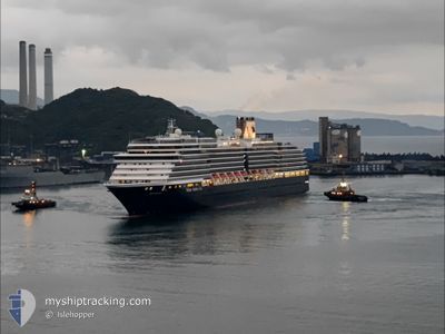
WESTERDAM
Passenger
Current Trip
| Time Travelled | 1 day |
|---|---|
| Remaining Time | 14 h, 15 mins |
| Distance Travelled | 585.14 nm |
| Remaining Distance | 365.88 nm |
| AVG Speed | 18.6 Knots |
| MAX Speed | 21.3 Knots |
| AVG Wind | 8.9 knots |
| MAX Wind | 22 knots |
| MIN Temp | 7.2°C / 44.96°F |
| MAX Temp | 16.3°C / 61.34°F |
| Draught | 8 m |
| Position Received | 17 h, 54 m ago |
Current Position
| Longitude | -127.13155° |
|---|---|
| Latitude | 49.51457° |
| Status | Under way using engine |
| Speed | 17.7 Knots |
| Course | 310° |
| Area | North Pacific Ocean |
| Station | T-AIS |
| Position Received | 17 h, 54 m ago |
Info
Information
The current position of WESTERDAM is in North Pacific Ocean with coordinates 49.51457° / -127.13155° as reported on 2024-05-20 11:07 by AIS to our vessel tracker app. The vessel's current speed is 17.7 Knots and is heading at the port of JUNEAU. The estimated time of arrival as calculated by MyShipTracking vessel tracking app is 2024-05-21 19:16 LT
The vessel WESTERDAM (IMO: 9226891, MMSI: 244128000) is a Passenger It's sailing under the flag of [NL] Netherlands.
In this page you can find informations about the vessels current position, last detected port calls, and current voyage information. If the vessels is not in coverage by AIS you will find the latest position.
The current position of WESTERDAM is detected by our AIS receivers and we are not responsible for the reliability of the data. The last position was recorded while the vessel was in Coverage by the Ais receivers of our vessel tracking app.
The current draught of WESTERDAM as reported by AIS is 8 meters
Weather
| Temperature | 7.2°C / 44.96°F |
|---|---|
| Wind Speed | 5 knots |
| Direction | 320° NW |
| Pressure | 1020.9 hPa |
| Humidity | 72.7 % |
| Cloud Coverage | 100 % |
Featured Company
Last Port Calls
| Port | Arrival | Departure | Time In Port |
|---|---|---|---|
| 2024-05-19 12:34 | 2024-05-19 22:06 | 9 h | |
| 2024-05-19 02:25 | 2024-05-19 06:56 | 4 h | |
| 2024-05-17 14:38 | 2024-05-17 21:10 | 6 h | |
| 2024-05-14 19:50 | 2024-05-15 07:14 | 11 h | |
| 2024-05-12 12:39 | 2024-05-12 23:03 | 10 h | |
| 2024-05-11 14:43 | 2024-05-12 04:29 | 13 h | |
| 2024-05-09 17:42 | 2024-05-10 02:06 | 8 h | |
| 2024-05-08 16:02 | 2024-05-09 01:14 | 9 h | |
| 2024-04-29 21:52 | 2024-04-30 06:36 | 8 h | |
| 2024-04-28 22:24 | 2024-04-29 08:12 | 9 h |
Last Trips
| Origin | Departure | Destination | Arrival | Distance | |
|---|---|---|---|---|---|
| 2024-05-18 23:56 | 2024-05-19 05:34 | 84.39 nm | |||
| 2024-05-17 13:10 | 2024-05-18 19:25 | 582.39 nm | |||
| 2024-05-14 23:14 | 2024-05-17 06:38 | 570.62 nm | |||
| 2024-05-12 16:03 | 2024-05-14 11:50 | 883.47 nm | |||
| 2024-05-11 21:29 | 2024-05-12 05:39 | 83.67 nm | |||
| 2024-05-09 18:06 | 2024-05-11 07:43 | 598.83 nm | |||
| 2024-05-08 17:14 | 2024-05-09 09:42 | 236.15 nm | |||
| 2024-04-30 15:36 | 2024-05-08 08:02 | 3248.28 nm | |||
| 2024-04-29 17:12 | 2024-04-30 06:52 | 201.20 nm | |||
| 2024-04-27 21:21 | 2024-04-29 07:24 | 553.49 nm |
Events
| Time | Event | Details | Position / Dest | Info |
|---|---|---|---|---|
| 2024-05-20 11:21 | Status Changed | Default Under way using engine |
49.55833 / -127.21167
US JNU
|
Speed: 17.7 kn Course: 310° |
| 2024-05-20 11:07 | Status Changed | Under way using engine Default |
49.51457 / -127.13155
US JNU
|
Speed: 17.7 kn Course: 310° |
| 2024-05-20 11:07 | OUT of Coverage |
49.51457 / -127.13155
North Pacific Ocean
US JNU
|
Speed: 17.7 kn Course: 310° |
|
| 2024-05-20 11:05 | Status Changed | Default Under way using engine |
49.50569 / -127.11538
US JNU
|
Speed: 17.7 kn Course: 310.2° |
| 2024-05-20 10:56 | Status Changed | Under way using engine Default |
49.47781 / -127.06421
US JNU
|
Speed: 17 kn Course: 309° |
| 2024-05-20 10:54 | Status Changed | Default Under way using engine |
49.47167 / -127.05500
US JNU
|
Speed: 17.5 kn Course: 309.9° |
| 2024-05-20 05:51 | Status Changed | Under way using engine Default |
48.60385 / -125.20276
US JNU
|
Speed: 18 kn Course: 303° |
| 2024-05-20 05:29 | Status Changed | Default Under way using engine |
48.53902 / -125.06106
US JNU
|
Speed: 18.5 kn Course: 280.5° |
| 2024-05-20 05:23 | Change Sea Area | Canadian part of the North Pacific Ocean Canadian part of the The Coastal Waters of Southeast Alaska and British Columbia |
48.52668 / -125.01708
North Pacific Ocean
US JNU
|
Speed: 18.5 kn Course: 278.5° |
| 2024-05-20 05:23 | Status Changed | Under way using engine Default |
48.52668 / -125.01708
US JNU
|
Speed: 18 kn Course: 272° |