
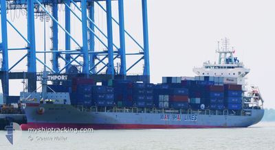
WAN HAI 277
Cargo
Current Trip
| Time Travelled | 2 days |
|---|---|
| Remaining Time | --- |
| Distance Travelled | 1152.97 nm |
| Remaining Distance | 6.09 nm |
| AVG Speed | 15.4 Knots |
| MAX Speed | 20.4 Knots |
| AVG Wind | 11.4 knots |
| MAX Wind | 24.3 knots |
| MIN Temp | 17.9°C / 64.22°F |
| MAX Temp | 25.3°C / 77.54°F |
| Draught | 7.1 m |
| Position Received | 10 m ago |
Current Position
| Longitude | 121.28446° |
|---|---|
| Latitude | 25.21047° |
| Status | Under way using engine |
| Speed | 6.9 Knots |
| Course | 140.8° |
| Area | South China Sea |
| Station | T-AIS |
| Position Received | 10 m ago |
Info
Information
The current position of WAN HAI 277 is in South China Sea with coordinates 25.21047° / 121.28446° as reported on 2024-04-28 02:56 by AIS to our vessel tracker app. The vessel's current speed is 6.9 Knots and is heading at the port of TAIPEI. The estimated time of arrival as calculated by MyShipTracking vessel tracking app is 2024-04-28 03:30 LT
The vessel WAN HAI 277 (IMO: 9833383, MMSI: 563121900) is a Cargo It's sailing under the flag of [SG] Singapore.
In this page you can find informations about the vessels current position, last detected port calls, and current voyage information. If the vessels is not in coverage by AIS you will find the latest position.
The current position of WAN HAI 277 is detected by our AIS receivers and we are not responsible for the reliability of the data. The last position was recorded while the vessel was in Coverage by the Ais receivers of our vessel tracking app.
The current draught of WAN HAI 277 as reported by AIS is 7.1 meters
Weather
| Temperature | 23.4°C / 74.12°F |
|---|---|
| Wind Speed | 22 knots |
| Direction | 208° SSW |
| Pressure | 1012.5 hPa |
| Humidity | 87.9 % |
| Cloud Coverage | 100 % |
Featured Company
Last Port Calls
| Port | Arrival | Departure | Time In Port |
|---|---|---|---|
| 2024-04-24 22:40 | 2024-04-25 08:06 | 9 h | |
| 2024-04-23 21:29 | 2024-04-24 20:57 | 23 h | |
| 2024-04-23 10:37 | 2024-04-23 20:32 | 9 h | |
| 2024-04-18 08:07 | 2024-04-18 19:45 | 11 h | |
| 2024-04-08 23:53 | 2024-04-11 04:30 | 2 d | |
| 2024-04-06 19:23 | 2024-04-07 20:45 | 1 d | |
| 2024-03-30 19:47 | 2024-03-31 05:21 | 9 h | |
| 2024-03-30 02:59 | 2024-03-30 13:10 | 10 h | |
| 2024-03-26 14:20 | 2024-03-27 07:01 | 16 h | |
| 2024-03-26 03:34 | 2024-03-26 13:46 | 10 h |
Most Visited Ports (Last year)
| Port | Arrivals | |
|---|---|---|
| 20 | ||
| 17 | ||
| 9 | ||
| 9 | ||
| 8 | ||
| 8 |
Last Trips
| Origin | Departure | Destination | Arrival | Distance | |
|---|---|---|---|---|---|
| 2024-04-25 05:57 | 2024-04-25 07:40 | 11.10 nm | |||
| 2024-04-24 05:32 | 2024-04-24 06:29 | 8.39 nm | |||
| 2024-04-19 03:45 | 2024-04-23 19:37 | 1639.06 nm | |||
| 2024-04-11 12:30 | 2024-04-18 16:07 | 2025.78 nm | |||
| 2024-04-08 04:45 | 2024-04-09 07:53 | 196.89 nm | |||
| 2024-03-31 13:21 | 2024-04-07 03:23 | 2069.70 nm | |||
| 2024-03-30 21:10 | 2024-03-31 03:47 | 88.96 nm | |||
| 2024-03-27 16:01 | 2024-03-30 10:59 | 1159.34 nm | |||
| 2024-03-26 22:46 | 2024-03-26 23:20 | 5.99 nm | |||
| 2024-03-26 11:23 | 2024-03-26 12:34 | 11.51 nm |
Events
| Time | Event | Details | Position / Dest | Info |
|---|---|---|---|---|
| 2024-04-28 03:00 | Status Changed | Default Under way using engine |
25.20235 / 121.29208
TW TPE
|
Speed: 6.9 kn Course: 140.8° |
| 2024-04-28 02:02 | Change Sea Area | Taiwanese part of the South China Sea Taiwanese part of the Eastern China Sea |
25.29252 / 121.28262
South China Sea
TW TPE
|
Speed: 11.3 kn Course: 235.9° |
| 2024-04-28 01:52 | Status Changed | Under way using engine Default |
25.30805 / 121.30902
TW TPE
|
Speed: 12.1 kn Course: 237° |
| 2024-04-28 01:44 | Status Changed | Default Under way using engine |
25.32229 / 121.33298
TW TPE
|
Speed: 11.8 kn Course: 236.1° |
| 2024-04-28 01:23 | Status Changed | Under way using engine Default |
25.35928 / 121.39590
TW TPE
|
Speed: 12.7 kn Course: 240° |
| 2024-04-28 01:20 | Status Changed | Default Under way using engine |
25.36448 / 121.40430
TW TPE
|
Speed: 13.1 kn Course: 240.3° |
| 2024-04-28 01:13 | Status Changed | Under way using engine Default |
25.37656 / 121.42667
TW TPE
|
Speed: 13.1 kn Course: 240° |
| 2024-04-28 01:08 | Status Changed | Default Under way using engine |
25.38698 / 121.44710
TW TPE
|
Speed: 12.9 kn Course: 232.2° |
| 2024-04-27 23:19 | ETA Changed | 2024/04/28 03:30 2024/04/28 05:00 |
25.59672 / 121.77613
TW TPE
|
Speed: 13.4 kn Course: 237.8° |
| 2024-04-27 22:43 | Change Sea Area | Taiwanese part of the Eastern China Sea Japanese part of the North Pacific Ocean |
25.67956 / 121.91148
Eastern China Sea
TW TPE
|
Speed: 16 kn Course: 232.2° |