
W KAMPALA
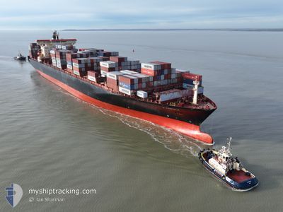
Container Ship
Current Trip
| Time Travelled | 13 h, 58 mins |
|---|---|
| Remaining Time | 1 h, 18 mins |
| Distance Travelled | 246.25 nm |
| Remaining Distance | 32.73 nm |
| AVG Speed | 17.9 Knots |
| MAX Speed | 21.9 Knots |
| AVG Wind | 17.9 knots |
| MAX Wind | 24.4 knots |
| MIN Temp | 11.5°C / 52.7°F |
| MAX Temp | 19.6°C / 67.28°F |
| Draught | 12.3 m |
| Position Received | 18 m ago |
Current Position
| Longitude | 26.24207° |
|---|---|
| Latitude | 38.88569° |
| Status | Under way using engine |
| Speed | 20.6 Knots |
| Course | 105.5° |
| Area | Aegean Sea |
| Station | T-AIS |
| Position Received | 18 m ago |
Info
Information
The current position of W KAMPALA is in Aegean Sea with coordinates 38.88569° / 26.24207° as reported on 2024-04-27 17:53 by AIS to our vessel tracker app. The vessel's current speed is 20.6 Knots and is heading at the port of NEMRUT. The estimated time of arrival as calculated by MyShipTracking vessel tracking app is 2024-04-27 19:29 LT
The vessel W KAMPALA (IMO: 9215311, MMSI: 538009125) is a Container Ship that was built in 2001 ( 23 years old ). It's sailing under the flag of [MH] Marshall Is.
In this page you can find informations about the vessels current position, last detected port calls, and current voyage information. If the vessels is not in coverage by AIS you will find the latest position.
The current position of W KAMPALA is detected by our AIS receivers and we are not responsible for the reliability of the data. The last position was recorded while the vessel was in Coverage by the Ais receivers of our vessel tracking app.
The current draught of W KAMPALA as reported by AIS is 12.3 meters
Weather
| Temperature | 17.6°C / 63.68°F |
|---|---|
| Wind Speed | 9 knots |
| Direction | 27° NNE |
| Pressure | 1013.2 hPa |
| Humidity | 67.4 % |
| Cloud Coverage | 81 % |
Featured Company
Last Port Calls
| Port | Arrival | Departure | Time In Port |
|---|---|---|---|
| 2024-04-26 05:57 | 2024-04-27 04:13 | 22 h | |
| 2024-04-24 14:41 | 2024-04-26 00:59 | 1 d | |
| 2024-04-22 17:20 | 2024-04-23 23:41 | 1 d | |
| 2024-04-20 05:18 | 2024-04-21 08:01 | 1 d | |
| 2024-04-11 08:04 | 2024-04-12 14:37 | 1 d | |
| 2024-04-08 18:38 | 2024-04-09 18:59 | 1 d | |
| 2024-04-07 03:04 | 2024-04-08 08:07 | 1 d | |
| 2024-04-04 09:22 | 2024-04-06 05:40 | 1 d | |
| 2024-03-25 08:24 | 2024-03-27 01:41 | 1 d | |
| 2024-03-23 13:57 | 2024-03-24 11:30 | 21 h |
Last Trips
| Origin | Departure | Destination | Arrival | Distance | |
|---|---|---|---|---|---|
| 2024-04-26 03:59 | 2024-04-26 08:57 | 45.99 nm | |||
| 2024-04-24 02:41 | 2024-04-24 17:41 | 55.76 nm | |||
| 2024-04-21 11:01 | 2024-04-22 20:20 | 398.70 nm | |||
| 2024-04-12 16:37 | 2024-04-20 08:18 | 2942.15 nm | |||
| 2024-04-09 20:59 | 2024-04-11 10:04 | 379.51 nm | |||
| 2024-04-08 10:07 | 2024-04-08 20:38 | 126.97 nm | |||
| 2024-04-06 06:40 | 2024-04-07 05:04 | 404.29 nm | |||
| 2024-03-27 04:41 | 2024-04-04 10:22 | 3093.12 nm | |||
| 2024-03-24 14:30 | 2024-03-25 11:24 | 256.17 nm | |||
| 2024-03-23 12:38 | 2024-03-23 16:57 | 48.33 nm |
Events
| Time | Event | Details | Position / Dest | Info |
|---|---|---|---|---|
| 2024-04-27 18:02 | Status Changed | Default Under way using engine |
38.87189 / 26.30448
TRNEM
|
Speed: 20.6 kn Course: 105.5° |
| 2024-04-27 17:27 | Status Changed | Under way using engine Default |
38.95582 / 26.07813
TRNEM
|
Speed: 20.5 kn Course: 129° |
| 2024-04-27 16:58 | Status Changed | Default Under way using engine |
39.06479 / 25.91516
TRNEM
|
Speed: 20.5 kn Course: 131.7° |
| 2024-04-27 14:38 | Change Sea Area | Greek part of the Aegean Sea Turkish part of the Aegean Sea |
39.81729 / 25.85792
Aegean Sea
TRNEM
|
Speed: 20.9 kn Course: 177.1° |
| 2024-04-27 14:35 | Status Changed | Under way using engine Default |
39.82885 / 25.85753
TRNEM
|
Speed: 20.9 kn Course: 199° |
| 2024-04-27 14:29 | Status Changed | Default Under way using engine |
39.86759 / 25.86603
TRNEM
|
Speed: 21.2 kn Course: 224.3° |
| 2024-04-27 14:21 | Status Changed | Under way using engine Default |
39.90562 / 25.88979
TRNEM
|
Speed: 21.8 kn Course: 248° |
| 2024-04-27 13:40 | Status Changed | Default Under way using engine |
40.02716 / 26.14591
TRNEM
|
Speed: 14.4 kn Course: 255.9° |
| 2024-04-27 13:34 | Change Sea Area | Turkish part of the Aegean Sea Turkish part of the Sea of Marmara |
40.03023 / 26.17724
Aegean Sea
TRNEM
|
Speed: 14.4 kn Course: 255.9° |
| 2024-04-27 12:57 | Destination Changed | TRNEM TRCAN |
40.10553 / 26.34019
TRNEM
|
Speed: 16.3 kn Course: 228.4° |