
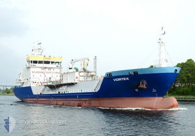
VORTEX
Lpg Tanker
Current Trip
ES GND
| Time Travelled | 14 h, 32 mins |
|---|---|
| Remaining Time | --- |
| Distance Travelled | 96.38 nm |
| Remaining Distance | --- |
| AVG Speed | 7.8 Knots |
| MAX Speed | 10.4 Knots |
| AVG Wind | 14.6 knots |
| MAX Wind | 22 knots |
| MIN Temp | 16.7°C / 62.06°F |
| MAX Temp | 18.1°C / 64.58°F |
| Draught | 6.1 m |
| Position Received | 1 h, 24 m ago |
Current Position
| Longitude | --- |
|---|---|
| Latitude | --- |
| Status | Moored |
| Speed | |
| Course | 218° |
| Area | North Atlantic Ocean |
| Station | T-AIS |
| Position Received | 1 h, 24 m ago |
Info
Information
The current position of VORTEX is in North Atlantic Ocean with coordinates 28.07044° / -16.48859° as reported on 2026-01-09 22:40 by AIS to our vessel tracker app. The vessel's current speed is 0 Knots
The vessel VORTEX (IMO: 9566289, MMSI: 255805640) is a Lpg Tanker that was built in 2014 ( 12 years old ). It's sailing under the flag of [PT] Portugal.
In this page you can find informations about the vessels current position, last detected port calls, and current voyage information. If the vessels is not in coverage by AIS you will find the latest position.
The current position of VORTEX is detected by our AIS receivers and we are not responsible for the reliability of the data. The last position was recorded while the vessel was in Coverage by the Ais receivers of our vessel tracking app.
The current draught of VORTEX as reported by AIS is 6.1 meters
Weather
| Temperature | 17.1°C / 62.78°F |
|---|---|
| Wind Speed | 17 knots |
| Direction | 31° NNE |
| Pressure | 1029.7 hPa |
| Humidity | 63.7 % |
| Cloud Coverage | --- |
Featured Company
Last Port Calls
| Port | Arrival | Departure | Time In Port |
|---|---|---|---|
| 2026-01-08 19:50 | 2026-01-09 09:32 | 13 h | |
| 2026-01-03 11:21 | 2026-01-04 17:17 | 1 d | |
| 2025-12-31 10:10 | 2026-01-01 11:58 | 1 d | |
| 2025-12-22 15:27 | 2025-12-24 10:09 | 1 d | |
| 2025-12-17 05:16 | 2025-12-21 10:01 | 4 d | |
| 2025-12-14 15:39 | 2025-12-15 17:03 | 1 d | |
| 2025-12-10 08:20 | 2025-12-10 23:49 | 15 h | |
| 2025-12-06 18:39 | 2025-12-07 02:43 | 8 h | |
| 2025-11-29 10:09 | 2025-11-30 10:49 | 1 d | |
| 2025-11-25 21:05 | 2025-11-26 14:09 | 17 h |
Most Visited Ports (Last year)
| Port | Arrivals | |
|---|---|---|
| 21 | ||
| 12 | ||
| 7 | ||
| 6 | ||
| 4 | ||
| 4 |
Last Trips
| Origin | Departure | Destination | Arrival | Distance | |
|---|---|---|---|---|---|
| 2026-01-04 17:17 | 2026-01-08 19:50 | 754.05 nm | |||
| 2026-01-01 11:58 | 2026-01-03 11:21 | 285.67 nm | |||
| 2025-12-24 10:09 | 2025-12-31 10:10 | 1477.04 nm | |||
| 2025-12-21 10:01 | 2025-12-22 15:27 | 122.41 nm | |||
| 2025-12-15 17:03 | 2025-12-17 05:16 | 242.66 nm | |||
| 2025-12-10 23:49 | 2025-12-14 15:39 | 430.87 nm | |||
| 2025-12-07 02:43 | 2025-12-10 08:20 | 7.65 nm | |||
| 2025-11-30 10:49 | 2025-12-06 18:39 | 766.33 nm | |||
| 2025-11-26 14:09 | 2025-11-29 10:09 | 456.45 nm | |||
| 2025-11-14 15:20 | 2025-11-25 21:05 | 346.05 nm |
Events
| Time | Event | Details | Position / Dest | Info |
|---|---|---|---|---|
| 2026-01-09 22:40 | OUT of Coverage |
28.07044 / -16.48859
North Atlantic Ocean
ES GND
|
Speed: Course: 199.9° |
|
| 2026-01-09 22:40 | Status Changed | Moored Default |
28.07044 / -16.48859
ES GND
|
Speed: Course: 218° |
| 2026-01-09 21:42 | Status Changed | Default Moored |
28.07047 / -16.48857
ES GND
|
Speed: Course: 218° |
| 2026-01-09 21:39 | Status Changed | Moored Default |
28.07047 / -16.48859
ES GND
|
Speed: Course: 218° |
| 2026-01-09 21:33 | Status Changed | Default Moored |
28.07047 / -16.48858
ES GND
|
Speed: Course: 218° |
| 2026-01-09 21:01 | Status Changed | Moored Under way using engine |
28.07047 / -16.48857
ES GND
|
Speed: Course: 218° |
| 2026-01-09 20:53 | STOP Moving | 7.24 nm, North East of PUERTO DE GUINCHO |
28.07056 / -16.48858
ES GND
|
Speed: 0.3 kn Course: 217° |
| 2026-01-09 14:53 | Status Changed | Under way using engine Default |
27.65943 / -15.80600
ES GND
|
Speed: 9 kn Course: 279° |
| 2026-01-09 14:50 | Status Changed | Default Under way using engine |
27.65821 / -15.79758
ES GND
|
Speed: 9 kn Course: 277.5° |
| 2026-01-09 14:27 | Status Changed | Under way using engine Default |
27.64966 / -15.73311
ES GND
|
Speed: 8.5 kn Course: 281° |