

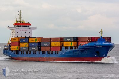
VOHBURG
Container Ship

Current Trip
| Time Travelled | 20 h, 10 mins |
|---|---|
| Remaining Time | --- |
| Distance Travelled | 288.45 nm |
| Remaining Distance | --- |
| AVG Speed | 13.3 Knots |
| MAX Speed | 17 Knots |
| AVG Wind | 17.2 knots |
| MAX Wind | 25 knots |
| MIN Temp | 1.4°C / 34.52°F |
| MAX Temp | 3.6°C / 38.48°F |
| Draught | 6.6 m |
| Position Received | 8 m ago |
Current Position
| Longitude | --- |
|---|---|
| Latitude | --- |
| Status | Under way using engine |
| Speed | 14.4 Knots |
| Course | 24.9° |
| Area | North Sea |
| Station | T-AIS |
| Position Received | 8 m ago |
Information
The current position of VOHBURG is in North Sea with coordinates 56.10997° / 6.70638° as reported on 2025-02-19 10:58 by AIS to our vessel tracker app. The vessel's current speed is 14.4 Knots
The vessel VOHBURG (IMO: 9287807, MMSI: 305773000) is a Container Ship that was built in 2005 ( 20 years old ). It's sailing under the flag of [AG] Antigua Barbuda.
In this page you can find informations about the vessels current position, last detected port calls, and current voyage information. If the vessels is not in coverage by AIS you will find the latest position.
The current position of VOHBURG is detected by our AIS receivers and we are not responsible for the reliability of the data. The last position was recorded while the vessel was in Coverage by the Ais receivers of our vessel tracking app.
The current draught of VOHBURG as reported by AIS is 6.6 meters
Weather
| Temperature | 2.6°C / 36.68°F |
|---|---|
| Wind Speed | 23 knots |
| Direction | 155° SSE |
| Pressure | 1027.5 hPa |
| Humidity | 60 % |
| Cloud Coverage | --- |


Featured Company
Last Port Calls
| Port | Arrival | Departure | Time In Port |
|---|---|---|---|
| 2025-02-17 17:10 | 2025-02-18 15:57 | 22 h | |
| 2025-02-16 07:15 | 2025-02-17 01:27 | 18 h | |
| 2025-02-12 11:41 | 2025-02-12 23:22 | 11 h | |
| 2025-02-11 13:54 | 2025-02-11 21:06 | 7 h | |
| 2025-02-09 09:45 | 2025-02-09 23:39 | 13 h | |
| 2025-02-08 12:07 | 2025-02-08 23:51 | 11 h | |
| 2025-02-06 15:47 | 2025-02-06 22:53 | 7 h | |
| 2025-02-06 04:37 | 2025-02-06 13:13 | 8 h | |
| 2025-02-04 14:51 | 2025-02-04 15:01 | 9 m | |
| 2025-02-03 15:38 | 2025-02-04 14:50 | 23 h |
Last Trips
| Origin | Departure | Destination | Arrival | Distance | |
|---|---|---|---|---|---|
| 2025-02-17 01:27 | 2025-02-17 17:10 | 202.68 nm | |||
| 2025-02-12 23:22 | 2025-02-16 07:15 | 419.50 nm | |||
| 2025-02-11 21:06 | 2025-02-12 11:41 | 164.30 nm | |||
| 2025-02-09 23:39 | 2025-02-11 13:54 | 594.83 nm | |||
| 2025-02-08 23:51 | 2025-02-09 09:45 | 131.12 nm | |||
| 2025-02-06 22:53 | 2025-02-08 12:07 | 523.78 nm | |||
| 2025-02-06 13:13 | 2025-02-06 15:47 | 35.97 nm | |||
| 2025-02-04 15:01 | 2025-02-06 04:37 | 566.09 nm | |||
| 2025-02-04 14:50 | 2025-02-04 14:51 | 0.03 nm | |||
| 2025-02-02 10:45 | 2025-02-03 15:38 | 206.50 nm |
Events
| Time | Event | Details | Position / Dest | Info |
|---|---|---|---|---|
| 2025-02-19 10:27 | Detected in Sea | Danish part of the North Sea |
55.99590 / 6.61399
North Sea
NOOSL
|
Speed: 14.6 kn Course: 24° |
| 2025-02-19 10:27 | Status Changed | Under way using engine Default |
55.99590 / 6.61399
NOOSL
|
Speed: 14.4 kn Course: 24° |
| 2025-02-19 10:18 | IN Coverage |
55.99590 / 6.61399
North Sea
NOOSL
|
Speed: 14.6 kn Course: 24° |
|
| 2025-02-18 23:14 | Status Changed | Default Under way using engine |
53.56226 / 4.80757
NOOSL
|
Speed: 14.5 kn Course: 18.7° |
| 2025-02-18 23:10 | OUT of Coverage |
53.54569 / 4.79883
North Sea
NOOSL
|
Speed: 14.5 kn Course: 18.7° |
|
| 2025-02-18 21:04 | Status Changed | Under way using engine Default |
53.06413 / 4.40224
NOOSL
|
Speed: 15.8 kn Course: 31° |
| 2025-02-18 20:39 | Status Changed | Default Under way using engine |
52.96944 / 4.31133
NOOSL
|
Speed: 16.1 kn Course: 27.9° |
| 2025-02-18 19:35 | Status Changed | Under way using engine Default |
52.71792 / 4.10189
NOOSL
|
Speed: 15.9 kn Course: 30° |
| 2025-02-18 19:17 | Status Changed | Default Under way using engine |
52.64747 / 4.03430
NOOSL
|
Speed: 16 kn Course: 30.9° |
| 2025-02-18 19:13 | Status Changed | Under way using engine Default |
52.63445 / 4.02160
NOOSL
|
Speed: 15.9 kn Course: 30° |